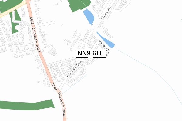
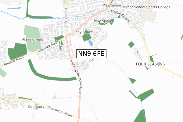
NN9 6FE is located in the Raunds electoral ward, within the unitary authority of North Northamptonshire and the English Parliamentary constituency of Corby. The Sub Integrated Care Board (ICB) Location is NHS Northamptonshire ICB - 78H and the police force is Northamptonshire. This postcode has been in use since April 2019.


GetTheData
Source: OS Open Zoomstack (Ordnance Survey)
Licence: Open Government Licence (requires attribution)
Attribution: Contains OS data © Crown copyright and database right 2024
Source: Open Postcode Geo
Licence: Open Government Licence (requires attribution)
Attribution: Contains OS data © Crown copyright and database right 2024; Contains Royal Mail data © Royal Mail copyright and database right 2024; Source: Office for National Statistics licensed under the Open Government Licence v.3.0
| Easting | 499443 |
| Northing | 271768 |
| Latitude | 52.335009 |
| Longitude | -0.541952 |
GetTheData
Source: Open Postcode Geo
Licence: Open Government Licence
| Country | England |
| Postcode District | NN9 |
| ➜ NN9 open data dashboard ➜ See where NN9 is on a map ➜ Where is Raunds? | |
GetTheData
Source: Land Registry Price Paid Data
Licence: Open Government Licence
| Ward | Raunds |
| Constituency | Corby |
GetTheData
Source: ONS Postcode Database
Licence: Open Government Licence
| June 2022 | Criminal damage and arson | On or near Chelveston Road | 294m |
| June 2022 | Anti-social behaviour | On or near Chelveston Road | 294m |
| June 2022 | Anti-social behaviour | On or near Weighbridge Way | 442m |
| ➜ Get more crime data in our Crime section | |||
GetTheData
Source: data.police.uk
Licence: Open Government Licence
| Red Lion Ph (Wellington Road) | Raunds | 466m |
| Red Lion Ph (Wellington Road) | Raunds | 481m |
| Cole Court (Grove Street) | Raunds | 569m |
| Cole Court (Grove Street) | Raunds | 602m |
| Francis Street (Stanwick Road) | Raunds | 675m |
GetTheData
Source: NaPTAN
Licence: Open Government Licence
| Percentage of properties with Next Generation Access | 33.3% |
| Percentage of properties with Superfast Broadband | 33.3% |
| Percentage of properties with Ultrafast Broadband | 33.3% |
| Percentage of properties with Full Fibre Broadband | 0.0% |
Superfast Broadband is between 30Mbps and 300Mbps
Ultrafast Broadband is > 300Mbps
| Percentage of properties unable to receive 2Mbps | 0.0% |
| Percentage of properties unable to receive 5Mbps | 0.0% |
| Percentage of properties unable to receive 10Mbps | 0.0% |
| Percentage of properties unable to receive 30Mbps | 66.7% |
GetTheData
Source: Ofcom
Licence: Ofcom Terms of Use (requires attribution)
GetTheData
Source: ONS Postcode Database
Licence: Open Government Licence


➜ Get more ratings from the Food Standards Agency
GetTheData
Source: Food Standards Agency
Licence: FSA terms & conditions
| Last Collection | |||
|---|---|---|---|
| Location | Mon-Fri | Sat | Distance |
| Marshalls Road | 16:15 | 08:00 | 1,243m |
| Mallows Drive | 16:45 | 08:30 | 1,709m |
| Chelveston Tso | 16:15 | 10:45 | 2,211m |
GetTheData
Source: Dracos
Licence: Creative Commons Attribution-ShareAlike
| Facility | Distance |
|---|---|
| Amos Lawrence Playing Field Stanwick Road, Raunds Grass Pitches | 820m |
| Raunds Cricket Club Marshalls Road, Raunds, Wellingborough Grass Pitches | 1km |
| Manor Sport And Leisure Ltd Mountbatten Way, Raunds, Wellingborough Sports Hall, Health and Fitness Gym, Artificial Grass Pitch, Grass Pitches, Studio, Outdoor Tennis Courts | 1.1km |
GetTheData
Source: Active Places
Licence: Open Government Licence
| School | Phase of Education | Distance |
|---|---|---|
| Raunds Park Infant School Park Street, Raunds, Wellingborough, NN9 6NB | Primary | 1.1km |
| Manor School Mountbatten Way, Raunds, Wellingborough, NN9 6PA | Secondary | 1.2km |
| St Peter's Church of England Academy Mountbatten Way, Raunds, Wellingborough, NN9 6PA | Primary | 1.2km |
GetTheData
Source: Edubase
Licence: Open Government Licence
The below table lists the International Territorial Level (ITL) codes (formerly Nomenclature of Territorial Units for Statistics (NUTS) codes) and Local Administrative Units (LAU) codes for NN9 6FE:
| ITL 1 Code | Name |
|---|---|
| TLF | East Midlands (England) |
| ITL 2 Code | Name |
| TLF2 | Leicestershire, Rutland and Northamptonshire |
| ITL 3 Code | Name |
| TLF25 | North Northamptonshire |
| LAU 1 Code | Name |
| E07000152 | East Northamptonshire |
GetTheData
Source: ONS Postcode Directory
Licence: Open Government Licence
The below table lists the Census Output Area (OA), Lower Layer Super Output Area (LSOA), and Middle Layer Super Output Area (MSOA) for NN9 6FE:
| Code | Name | |
|---|---|---|
| OA | E00137605 | |
| LSOA | E01027053 | East Northamptonshire 005C |
| MSOA | E02005633 | East Northamptonshire 005 |
GetTheData
Source: ONS Postcode Directory
Licence: Open Government Licence
| NN9 6DA | Chelveston Road | 272m |
| NN9 6TW | Whitney Close | 384m |
| NN9 6EE | The Paddock | 409m |
| NN9 6TT | Weighbridge Way | 453m |
| NN9 6DL | Wellington Road | 461m |
| NN9 6DZ | Antona Drive | 488m |
| NN9 6TU | Glovers Lane | 499m |
| NN9 6TX | Rushmere Close | 504m |
| NN9 6EB | Antona Gardens | 521m |
| NN9 6UE | Chamberlain Way | 532m |
GetTheData
Source: Open Postcode Geo; Land Registry Price Paid Data
Licence: Open Government Licence