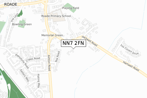
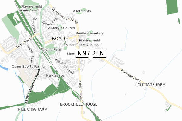
NN7 2FN is located in the Towcester and Roade electoral ward, within the unitary authority of West Northamptonshire and the English Parliamentary constituency of South Northamptonshire. The Sub Integrated Care Board (ICB) Location is NHS Northamptonshire ICB - 78H and the police force is Northamptonshire. This postcode has been in use since September 2019.


GetTheData
Source: OS Open Zoomstack (Ordnance Survey)
Licence: Open Government Licence (requires attribution)
Attribution: Contains OS data © Crown copyright and database right 2024
Source: Open Postcode Geo
Licence: Open Government Licence (requires attribution)
Attribution: Contains OS data © Crown copyright and database right 2024; Contains Royal Mail data © Royal Mail copyright and database right 2024; Source: Office for National Statistics licensed under the Open Government Licence v.3.0
| Easting | 476151 |
| Northing | 251409 |
| Latitude | 52.155731 |
| Longitude | -0.888294 |
GetTheData
Source: Open Postcode Geo
Licence: Open Government Licence
| Country | England |
| Postcode District | NN7 |
| ➜ NN7 open data dashboard ➜ See where NN7 is on a map ➜ Where is Roade? | |
GetTheData
Source: Land Registry Price Paid Data
Licence: Open Government Licence
| Ward | Towcester And Roade |
| Constituency | South Northamptonshire |
GetTheData
Source: ONS Postcode Database
Licence: Open Government Licence
4, BURMAN COURT, ROADE, NORTHAMPTON, NN7 2FN 2019 5 SEP £860,000 |
GetTheData
Source: HM Land Registry Price Paid Data
Licence: Contains HM Land Registry data © Crown copyright and database right 2024. This data is licensed under the Open Government Licence v3.0.
| June 2022 | Anti-social behaviour | On or near Parking Area | 115m |
| June 2022 | Anti-social behaviour | On or near Parking Area | 115m |
| June 2022 | Vehicle crime | On or near Parking Area | 115m |
| ➜ Get more crime data in our Crime section | |||
GetTheData
Source: data.police.uk
Licence: Open Government Licence
| Memorial Green (Hartwell Road) | Roade | 123m |
| Memorial Green (Ashton Road) | Roade | 154m |
| Memorial Green (Hartwell Road) | Roade | 169m |
| Fox Covert Drive (Hartwell Road) | Roade | 252m |
| Fox Covert Drive (Hartwell Road) | Roade | 256m |
GetTheData
Source: NaPTAN
Licence: Open Government Licence
GetTheData
Source: ONS Postcode Database
Licence: Open Government Licence


➜ Get more ratings from the Food Standards Agency
GetTheData
Source: Food Standards Agency
Licence: FSA terms & conditions
| Last Collection | |||
|---|---|---|---|
| Location | Mon-Fri | Sat | Distance |
| Upper End | 16:30 | 09:45 | 144m |
| Roade Tso | 16:45 | 09:45 | 472m |
| Station Road | 16:00 | 10:00 | 666m |
GetTheData
Source: Dracos
Licence: Creative Commons Attribution-ShareAlike
| Facility | Distance |
|---|---|
| Roade Recreation Ground London Road, Roade, Northampton Grass Pitches | 638m |
| Willison Sports Centre (Roade) Stratford Road, Roade, Northampton Sports Hall, Swimming Pool, Health and Fitness Gym, Artificial Grass Pitch, Grass Pitches, Studio, Outdoor Tennis Courts | 819m |
| Roade Football Club (Bailey Brooks Lane) Bailey Brooks Lane, Roade, Northampton Grass Pitches | 1km |
GetTheData
Source: Active Places
Licence: Open Government Licence
| School | Phase of Education | Distance |
|---|---|---|
| Roade Primary School Hartwell Road, Roade, Northampton, NN7 2NT | Primary | 278m |
| Ashton CofE Primary School Roade Hill, Ashton, Northampton, NN7 2JH | Primary | 1.5km |
| Stoke Bruerne Church of England Primary School Bridge Road, Stoke Bruerne, Towcester, NN12 7SD | Primary | 2.4km |
GetTheData
Source: Edubase
Licence: Open Government Licence
The below table lists the International Territorial Level (ITL) codes (formerly Nomenclature of Territorial Units for Statistics (NUTS) codes) and Local Administrative Units (LAU) codes for NN7 2FN:
| ITL 1 Code | Name |
|---|---|
| TLF | East Midlands (England) |
| ITL 2 Code | Name |
| TLF2 | Leicestershire, Rutland and Northamptonshire |
| ITL 3 Code | Name |
| TLF24 | West Northamptonshire |
| LAU 1 Code | Name |
| E07000155 | South Northamptonshire |
GetTheData
Source: ONS Postcode Directory
Licence: Open Government Licence
The below table lists the Census Output Area (OA), Lower Layer Super Output Area (LSOA), and Middle Layer Super Output Area (MSOA) for NN7 2FN:
| Code | Name | |
|---|---|---|
| OA | E00138770 | |
| LSOA | E01032985 | South Northamptonshire 003I |
| MSOA | E02005683 | South Northamptonshire 003 |
GetTheData
Source: ONS Postcode Directory
Licence: Open Government Licence
| NN7 2PB | The Grove | 110m |
| NN7 2NY | Memorial Green | 153m |
| NN7 2NU | Hartwell Road | 157m |
| NN7 2LF | Ashton Road | 170m |
| NN7 2NZ | Bretts Lane | 199m |
| NN7 2NT | Hartwell Road | 278m |
| NN7 2PE | Manor Close | 368m |
| NN7 2LL | Foxcovert Drive | 376m |
| NN7 2NS | South View | 415m |
| NN7 2PD | The Green | 419m |
GetTheData
Source: Open Postcode Geo; Land Registry Price Paid Data
Licence: Open Government Licence