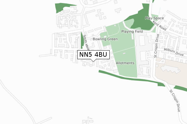
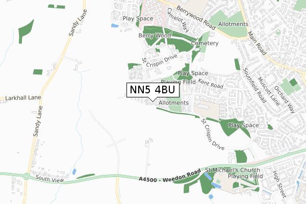
NN5 4BU is located in the Duston West and St. Crispin electoral ward, within the unitary authority of West Northamptonshire and the English Parliamentary constituency of South Northamptonshire. The Sub Integrated Care Board (ICB) Location is NHS Northamptonshire ICB - 78H and the police force is Northamptonshire. This postcode has been in use since July 2018.


GetTheData
Source: OS Open Zoomstack (Ordnance Survey)
Licence: Open Government Licence (requires attribution)
Attribution: Contains OS data © Crown copyright and database right 2024
Source: Open Postcode Geo
Licence: Open Government Licence (requires attribution)
Attribution: Contains OS data © Crown copyright and database right 2024; Contains Royal Mail data © Royal Mail copyright and database right 2024; Source: Office for National Statistics licensed under the Open Government Licence v.3.0
| Easting | 471099 |
| Northing | 260791 |
| Latitude | 52.240740 |
| Longitude | -0.960162 |
GetTheData
Source: Open Postcode Geo
Licence: Open Government Licence
| Country | England |
| Postcode District | NN5 |
| ➜ NN5 open data dashboard ➜ See where NN5 is on a map | |
GetTheData
Source: Land Registry Price Paid Data
Licence: Open Government Licence
| Ward | Duston West And St. Crispin |
| Constituency | South Northamptonshire |
GetTheData
Source: ONS Postcode Database
Licence: Open Government Licence
| January 2024 | Violence and sexual offences | On or near Berrywood Close | 460m |
| January 2024 | Public order | On or near Berrywood Close | 460m |
| December 2023 | Violence and sexual offences | On or near Berrywood Close | 460m |
| ➜ Get more crime data in our Crime section | |||
GetTheData
Source: data.police.uk
Licence: Open Government Licence
| Old Hospital (Berrywood Drive) | St Crispin | 311m |
| Old Hospital (Berrywood Drive) | St Crispin | 322m |
| St Crispin Village (Berrywood Drive) | St Crispin | 348m |
| St Crispin Village (Berrywood Drive) | St Crispin | 357m |
| St Crispin Drive (Kent Road) | St Crispin | 386m |
| Northampton Station | 3.7km |
GetTheData
Source: NaPTAN
Licence: Open Government Licence
GetTheData
Source: ONS Postcode Database
Licence: Open Government Licence


➜ Get more ratings from the Food Standards Agency
GetTheData
Source: Food Standards Agency
Licence: FSA terms & conditions
| Last Collection | |||
|---|---|---|---|
| Location | Mon-Fri | Sat | Distance |
| St Crispin Drive | 17:15 | 10:30 | 396m |
| Duston Tso | 17:30 | 11:45 | 1,038m |
| Southfield Road | 17:30 | 11:30 | 1,076m |
GetTheData
Source: Dracos
Licence: Creative Commons Attribution-ShareAlike
| Facility | Distance |
|---|---|
| St Crispins Park St. Crispin Drive, Northampton Grass Pitches | 479m |
| Quinton House School Upton Lane, Upton, Northampton Grass Pitches, Sports Hall | 806m |
| The Duston School Berrywood Road, Northampton Swimming Pool, Sports Hall, Artificial Grass Pitch, Grass Pitches | 883m |
GetTheData
Source: Active Places
Licence: Open Government Licence
| School | Phase of Education | Distance |
|---|---|---|
| St Luke's Church of England Primary School St Crispin Drive, Duston, Northampton, NN5 4UL | Primary | 389m |
| Quinton House School Upton Hall, Upton, Northampton, NN5 4UX | Not applicable | 805m |
| The Duston School Berrywood Road, Duston, Northampton, NN5 6XA | All-through | 897m |
GetTheData
Source: Edubase
Licence: Open Government Licence
The below table lists the International Territorial Level (ITL) codes (formerly Nomenclature of Territorial Units for Statistics (NUTS) codes) and Local Administrative Units (LAU) codes for NN5 4BU:
| ITL 1 Code | Name |
|---|---|
| TLF | East Midlands (England) |
| ITL 2 Code | Name |
| TLF2 | Leicestershire, Rutland and Northamptonshire |
| ITL 3 Code | Name |
| TLF24 | West Northamptonshire |
| LAU 1 Code | Name |
| E07000154 | Northampton |
GetTheData
Source: ONS Postcode Directory
Licence: Open Government Licence
The below table lists the Census Output Area (OA), Lower Layer Super Output Area (LSOA), and Middle Layer Super Output Area (MSOA) for NN5 4BU:
| Code | Name | |
|---|---|---|
| OA | E00169243 | |
| LSOA | E01032976 | Northampton 029F |
| MSOA | E02005678 | Northampton 029 |
GetTheData
Source: ONS Postcode Directory
Licence: Open Government Licence
| NN5 4BT | South Meadow View | 0m |
| NN5 4BQ | South Meadow Road | 81m |
| NN5 4BP | South Meadow Close | 84m |
| NN5 4AT | Betony Close | 94m |
| NN5 4AS | Meadowsweet Road | 148m |
| NN5 4BN | Bowling Green Lane | 176m |
| NN5 4AU | Teasle Close | 179m |
| NN5 4AR | Foxtail Way | 182m |
| NN5 4AQ | Charlock Road | 195m |
| NN5 4AW | Burdock Gardens | 222m |
GetTheData
Source: Open Postcode Geo; Land Registry Price Paid Data
Licence: Open Government Licence