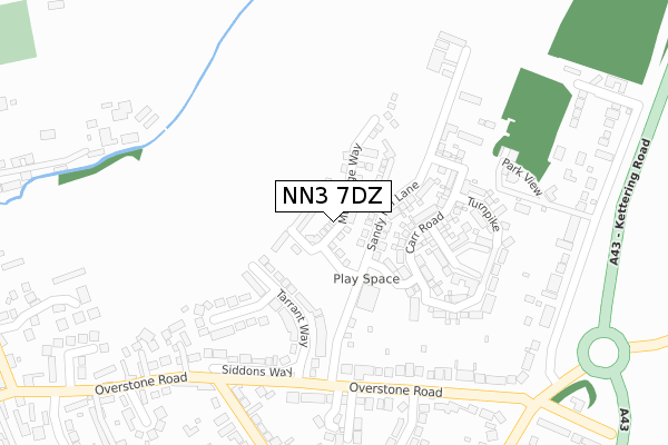
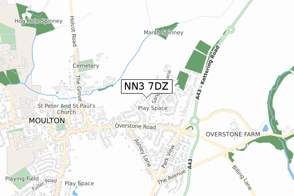
NN3 7DZ is located in the Moulton electoral ward, within the unitary authority of West Northamptonshire and the English Parliamentary constituency of Daventry. The Sub Integrated Care Board (ICB) Location is NHS Northamptonshire ICB - 78H and the police force is Northamptonshire. This postcode has been in use since July 2018.


GetTheData
Source: OS Open Zoomstack (Ordnance Survey)
Licence: Open Government Licence (requires attribution)
Attribution: Contains OS data © Crown copyright and database right 2024
Source: Open Postcode Geo
Licence: Open Government Licence (requires attribution)
Attribution: Contains OS data © Crown copyright and database right 2024; Contains Royal Mail data © Royal Mail copyright and database right 2024; Source: Office for National Statistics licensed under the Open Government Licence v.3.0
| Easting | 479041 |
| Northing | 266550 |
| Latitude | 52.291422 |
| Longitude | -0.842528 |
GetTheData
Source: Open Postcode Geo
Licence: Open Government Licence
| Country | England |
| Postcode District | NN3 |
| ➜ NN3 open data dashboard ➜ See where NN3 is on a map ➜ Where is Moulton? | |
GetTheData
Source: Land Registry Price Paid Data
Licence: Open Government Licence
| Ward | Moulton |
| Constituency | Daventry |
GetTheData
Source: ONS Postcode Database
Licence: Open Government Licence
2023 30 AUG £420,000 |
2021 11 JUN £345,000 |
2021 15 JAN £399,995 |
30, MULBRIDGE WAY, MOULTON, NORTHAMPTON, NN3 7DZ 2021 8 JAN £409,995 |
32, MULBRIDGE WAY, MOULTON, NORTHAMPTON, NN3 7DZ 2020 16 DEC £438,745 |
21, MULBRIDGE WAY, MOULTON, NORTHAMPTON, NN3 7DZ 2020 27 NOV £389,995 |
41, MULBRIDGE WAY, MOULTON, NORTHAMPTON, NN3 7DZ 2020 17 NOV £394,995 |
48, MULBRIDGE WAY, MOULTON, NORTHAMPTON, NN3 7DZ 2020 16 OCT £371,995 |
50, MULBRIDGE WAY, MOULTON, NORTHAMPTON, NN3 7DZ 2020 17 AUG £329,995 |
42, MULBRIDGE WAY, MOULTON, NORTHAMPTON, NN3 7DZ 2020 19 JUN £329,995 |
GetTheData
Source: HM Land Registry Price Paid Data
Licence: Contains HM Land Registry data © Crown copyright and database right 2024. This data is licensed under the Open Government Licence v3.0.
| June 2022 | Burglary | On or near Tarrant Way | 177m |
| June 2022 | Violence and sexual offences | On or near Park View | 349m |
| June 2022 | Possession of weapons | On or near Park View | 349m |
| ➜ Get more crime data in our Crime section | |||
GetTheData
Source: data.police.uk
Licence: Open Government Licence
| Wantage Close (Overstone Road) | Moulton | 287m |
| Wantage Close (Overstone Road) | Moulton | 290m |
| Overstone Road | Moulton | 363m |
| Overstone Road | Moulton | 390m |
| Overstone Road | Moulton | 395m |
GetTheData
Source: NaPTAN
Licence: Open Government Licence
| Percentage of properties with Next Generation Access | 100.0% |
| Percentage of properties with Superfast Broadband | 100.0% |
| Percentage of properties with Ultrafast Broadband | 100.0% |
| Percentage of properties with Full Fibre Broadband | 100.0% |
Superfast Broadband is between 30Mbps and 300Mbps
Ultrafast Broadband is > 300Mbps
| Percentage of properties unable to receive 2Mbps | 0.0% |
| Percentage of properties unable to receive 5Mbps | 0.0% |
| Percentage of properties unable to receive 10Mbps | 0.0% |
| Percentage of properties unable to receive 30Mbps | 0.0% |
GetTheData
Source: Ofcom
Licence: Ofcom Terms of Use (requires attribution)
GetTheData
Source: ONS Postcode Database
Licence: Open Government Licence


➜ Get more ratings from the Food Standards Agency
GetTheData
Source: Food Standards Agency
Licence: FSA terms & conditions
| Last Collection | |||
|---|---|---|---|
| Location | Mon-Fri | Sat | Distance |
| Overstone Road | 17:30 | 09:45 | 389m |
| Wantage Farm | 17:30 | 09:45 | 549m |
| Holcot Road | 17:30 | 09:30 | 660m |
GetTheData
Source: Dracos
Licence: Creative Commons Attribution-ShareAlike
| Facility | Distance |
|---|---|
| Moulton School And Science College Pound Lane, Moulton, Northampton Grass Pitches, Sports Hall, Health and Fitness Gym, Studio, Artificial Grass Pitch, Outdoor Tennis Courts | 1.1km |
| Moulton College (Holcot Centre) Pitsford Road, Moulton Sports Hall, Health and Fitness Gym, Artificial Grass Pitch, Grass Pitches, Studio, Outdoor Tennis Courts | 1.2km |
| Brunting Road (Moulton Fc) Brunting Road, Moulton, Northampton Grass Pitches, Artificial Grass Pitch | 1.2km |
GetTheData
Source: Active Places
Licence: Open Government Licence
| School | Phase of Education | Distance |
|---|---|---|
| Moulton Primary School Church Hill, Moulton, Moulton Primary School, Church Hill, Northampton, NN3 7SW | Primary | 846m |
| Moulton College West Street, Moulton, Northampton, NN3 7RR | 16 plus | 1.1km |
| Moulton School and Science College Pound Lane, Moulton, Northampton, NN3 7SD | Secondary | 1.1km |
GetTheData
Source: Edubase
Licence: Open Government Licence
The below table lists the International Territorial Level (ITL) codes (formerly Nomenclature of Territorial Units for Statistics (NUTS) codes) and Local Administrative Units (LAU) codes for NN3 7DZ:
| ITL 1 Code | Name |
|---|---|
| TLF | East Midlands (England) |
| ITL 2 Code | Name |
| TLF2 | Leicestershire, Rutland and Northamptonshire |
| ITL 3 Code | Name |
| TLF24 | West Northamptonshire |
| LAU 1 Code | Name |
| E07000151 | Daventry |
GetTheData
Source: ONS Postcode Directory
Licence: Open Government Licence
The below table lists the Census Output Area (OA), Lower Layer Super Output Area (LSOA), and Middle Layer Super Output Area (MSOA) for NN3 7DZ:
| Code | Name | |
|---|---|---|
| OA | E00137415 | |
| LSOA | E01027018 | Daventry 005B |
| MSOA | E02005623 | Daventry 005 |
GetTheData
Source: ONS Postcode Directory
Licence: Open Government Licence
| NN3 7AW | Sandy Hill Lane | 109m |
| NN3 7AX | Reedings | 130m |
| NN3 7AY | Druids Way | 135m |
| NN3 7US | Tarrant Way | 182m |
| NN3 7DH | Spinney Close | 187m |
| NN3 7DJ | Turnpike | 231m |
| NN3 7UT | Tarrant Close | 240m |
| NN3 7DA | The Furrows | 241m |
| NN3 7UR | Siddons Way | 271m |
| NN3 7UU | Overstone Road | 283m |
GetTheData
Source: Open Postcode Geo; Land Registry Price Paid Data
Licence: Open Government Licence