NN2 8FY maps, stats, and open data
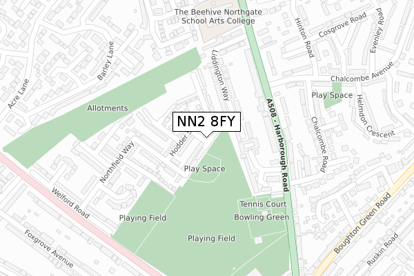
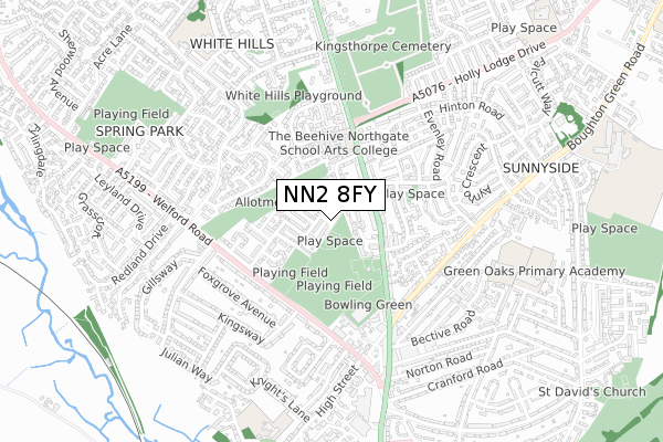
NN2 8FY is located in the Kingsthorpe North electoral ward, within the unitary authority of West Northamptonshire and the English Parliamentary constituency of Northampton North. The Sub Integrated Care Board (ICB) Location is NHS Northamptonshire ICB - 78H and the police force is Northamptonshire. This postcode has been in use since September 2018.
NN2 8FY maps


Licence: Open Government Licence (requires attribution)
Attribution: Contains OS data © Crown copyright and database right 2025
Source: Open Postcode Geo
Licence: Open Government Licence (requires attribution)
Attribution: Contains OS data © Crown copyright and database right 2025; Contains Royal Mail data © Royal Mail copyright and database right 2025; Source: Office for National Statistics licensed under the Open Government Licence v.3.0
NN2 8FY geodata
| Easting | 474960 |
| Northing | 263967 |
| Latitude | 52.268776 |
| Longitude | -0.902924 |
Where is NN2 8FY?
| Country | England |
| Postcode District | NN2 |
Politics
| Ward | Kingsthorpe North |
|---|---|
| Constituency | Northampton North |
House Prices
Sales of detached houses in NN2 8FY
2021 24 FEB £295,000 |
2020 21 FEB £271,000 |
8, HENARD CLOSE, NORTHAMPTON, NN2 8FY 2019 5 AUG £300,000 |
10, HENARD CLOSE, NORTHAMPTON, NN2 8FY 2019 28 JUN £309,950 |
12, HENARD CLOSE, NORTHAMPTON, NN2 8FY 2019 31 MAY £334,950 |
4, HENARD CLOSE, NORTHAMPTON, NN2 8FY 2019 30 APR £287,950 |
6, HENARD CLOSE, NORTHAMPTON, NN2 8FY 2019 26 APR £268,950 |
2019 29 MAR £286,950 |
7, HENARD CLOSE, NORTHAMPTON, NN2 8FY 2019 29 MAR £286,950 |
15, HENARD CLOSE, NORTHAMPTON, NN2 8FY 2019 29 MAR £289,950 |
Licence: Contains HM Land Registry data © Crown copyright and database right 2025. This data is licensed under the Open Government Licence v3.0.
Transport
Nearest bus stops to NN2 8FY
| Chalcombe Road (Harborough Road) | Kingsthorpe | 206m |
| 2 Chalcombe Avenue (Chalcombe Avenue) | Kingsthorpe | 216m |
| Greenfields School (Harborough Road) | Kingsthorpe | 224m |
| Chalcombe Road (Harborough Road) | Kingsthorpe | 250m |
| Greenfields School (Harborough Road) | Kingsthorpe | 325m |
Nearest railway stations to NN2 8FY
| Northampton Station | 3.5km |
Broadband
Broadband access in NN2 8FY (2020 data)
| Percentage of properties with Next Generation Access | 100.0% |
| Percentage of properties with Superfast Broadband | 100.0% |
| Percentage of properties with Ultrafast Broadband | 100.0% |
| Percentage of properties with Full Fibre Broadband | 100.0% |
Superfast Broadband is between 30Mbps and 300Mbps
Ultrafast Broadband is > 300Mbps
Broadband limitations in NN2 8FY (2020 data)
| Percentage of properties unable to receive 2Mbps | 0.0% |
| Percentage of properties unable to receive 5Mbps | 0.0% |
| Percentage of properties unable to receive 10Mbps | 0.0% |
| Percentage of properties unable to receive 30Mbps | 0.0% |
Deprivation
77.4% of English postcodes are less deprived than NN2 8FY:Food Standards Agency
Three nearest food hygiene ratings to NN2 8FY (metres)


➜ Get more ratings from the Food Standards Agency
Nearest post box to NN2 8FY
| Last Collection | |||
|---|---|---|---|
| Location | Mon-Fri | Sat | Distance |
| Harborough Road | 17:30 | 11:30 | 180m |
| Welford Road | 17:30 | 12:00 | 346m |
| Helmdon Road | 17:30 | 12:15 | 462m |
NN2 8FY ITL and NN2 8FY LAU
The below table lists the International Territorial Level (ITL) codes (formerly Nomenclature of Territorial Units for Statistics (NUTS) codes) and Local Administrative Units (LAU) codes for NN2 8FY:
| ITL 1 Code | Name |
|---|---|
| TLF | East Midlands (England) |
| ITL 2 Code | Name |
| TLF2 | Leicestershire, Rutland and Northamptonshire |
| ITL 3 Code | Name |
| TLF24 | West Northamptonshire |
| LAU 1 Code | Name |
| E07000154 | Northampton |
NN2 8FY census areas
The below table lists the Census Output Area (OA), Lower Layer Super Output Area (LSOA), and Middle Layer Super Output Area (MSOA) for NN2 8FY:
| Code | Name | |
|---|---|---|
| OA | E00138090 | |
| LSOA | E01027147 | Northampton 003D |
| MSOA | E02005652 | Northampton 003 |
Nearest postcodes to NN2 8FY
| NN2 8FD | Wallbeck Close | 83m |
| NN2 8BW | Wallbeck Close | 153m |
| NN2 8DJ | Harborough Road | 153m |
| NN2 8DR | Liddington Way | 156m |
| NN2 8AN | Northfield Way | 191m |
| NN2 8DP | Glan Y Mor Terrace | 196m |
| NN2 8DW | Harborough Road | 202m |
| NN2 8AW | Barnfield Close | 242m |
| NN2 8AP | Penfold Close | 246m |
| NN2 8JE | Chalcombe Road | 261m |