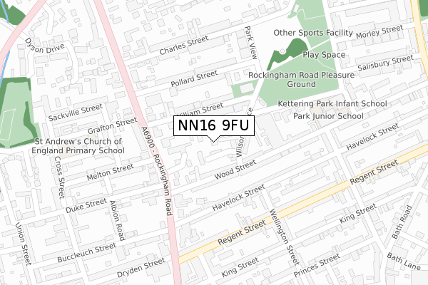
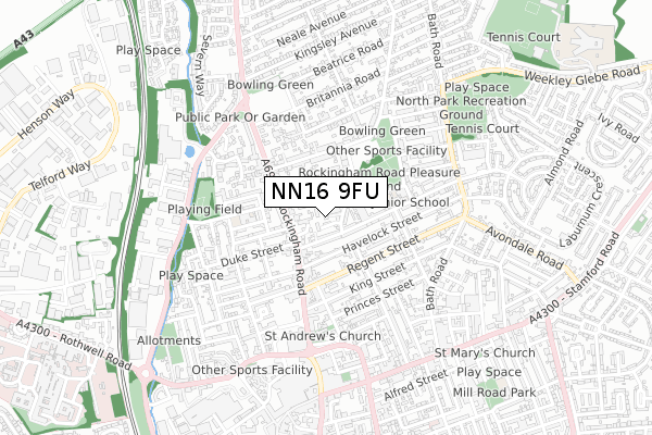
NN16 9FU is located in the Clover Hill electoral ward, within the unitary authority of North Northamptonshire and the English Parliamentary constituency of Kettering. The Sub Integrated Care Board (ICB) Location is NHS Northamptonshire ICB - 78H and the police force is Northamptonshire. This postcode has been in use since September 2018.


GetTheData
Source: OS Open Zoomstack (Ordnance Survey)
Licence: Open Government Licence (requires attribution)
Attribution: Contains OS data © Crown copyright and database right 2024
Source: Open Postcode Geo
Licence: Open Government Licence (requires attribution)
Attribution: Contains OS data © Crown copyright and database right 2024; Contains Royal Mail data © Royal Mail copyright and database right 2024; Source: Office for National Statistics licensed under the Open Government Licence v.3.0
| Easting | 486850 |
| Northing | 279555 |
| Latitude | 52.407133 |
| Longitude | -0.724705 |
GetTheData
Source: Open Postcode Geo
Licence: Open Government Licence
| Country | England |
| Postcode District | NN16 |
| ➜ NN16 open data dashboard ➜ See where NN16 is on a map ➜ Where is Kettering? | |
GetTheData
Source: Land Registry Price Paid Data
Licence: Open Government Licence
| Ward | Clover Hill |
| Constituency | Kettering |
GetTheData
Source: ONS Postcode Database
Licence: Open Government Licence
| October 2023 | Other theft | On or near Canon Street | 497m |
| July 2023 | Violence and sexual offences | On or near Canon Street | 497m |
| December 2022 | Burglary | On or near Canon Street | 497m |
| ➜ Get more crime data in our Crime section | |||
GetTheData
Source: data.police.uk
Licence: Open Government Licence
| Dryden Street (Rockingham Road) | Kettering | 263m |
| Charles Street (Rockingham Road) | Kettering | 277m |
| Charles Street (Rockingham Road) | Kettering | 367m |
| Dryden Street (Rockingham Road) | Kettering | 371m |
| Bonham Court (Bath Road) | Kettering | 437m |
| Kettering Station | 1.6km |
GetTheData
Source: NaPTAN
Licence: Open Government Licence
| Percentage of properties with Next Generation Access | 100.0% |
| Percentage of properties with Superfast Broadband | 100.0% |
| Percentage of properties with Ultrafast Broadband | 100.0% |
| Percentage of properties with Full Fibre Broadband | 0.0% |
Superfast Broadband is between 30Mbps and 300Mbps
Ultrafast Broadband is > 300Mbps
| Percentage of properties unable to receive 2Mbps | 0.0% |
| Percentage of properties unable to receive 5Mbps | 0.0% |
| Percentage of properties unable to receive 10Mbps | 0.0% |
| Percentage of properties unable to receive 30Mbps | 0.0% |
GetTheData
Source: Ofcom
Licence: Ofcom Terms of Use (requires attribution)
GetTheData
Source: ONS Postcode Database
Licence: Open Government Licence


➜ Get more ratings from the Food Standards Agency
GetTheData
Source: Food Standards Agency
Licence: FSA terms & conditions
| Last Collection | |||
|---|---|---|---|
| Location | Mon-Fri | Sat | Distance |
| Montague Street | 17:15 | 11:30 | 138m |
| Hallwood Road | 17:15 | 11:30 | 353m |
| Ivy Road | 17:15 | 12:00 | 454m |
GetTheData
Source: Dracos
Licence: Creative Commons Attribution-ShareAlike
| Facility | Distance |
|---|---|
| Ricochet Total Fitness (Closed) Regency House, Regent Street, Kettering Health and Fitness Gym, Studio | 281m |
| Energie Fitness (Kettering) Tanners Gate Retail Park, Northall Street, Kettering Health and Fitness Gym | 668m |
| Ladies First (Kettering) Montagu Street, Kettering Health and Fitness Gym, Studio | 683m |
GetTheData
Source: Active Places
Licence: Open Government Licence
| School | Phase of Education | Distance |
|---|---|---|
| Kettering Park Junior Academy Wood Street, Kettering, NN16 9SE | Primary | 225m |
| Youth Works Community College Keystone, 97 Rockingham Road, Kettering, Northamptonshire, NN16 9HX | Not applicable | 235m |
| Kettering Park Infant Academy Park Avenue, Kettering, NN16 9RU | Primary | 268m |
GetTheData
Source: Edubase
Licence: Open Government Licence
The below table lists the International Territorial Level (ITL) codes (formerly Nomenclature of Territorial Units for Statistics (NUTS) codes) and Local Administrative Units (LAU) codes for NN16 9FU:
| ITL 1 Code | Name |
|---|---|
| TLF | East Midlands (England) |
| ITL 2 Code | Name |
| TLF2 | Leicestershire, Rutland and Northamptonshire |
| ITL 3 Code | Name |
| TLF25 | North Northamptonshire |
| LAU 1 Code | Name |
| E07000153 | Kettering |
GetTheData
Source: ONS Postcode Directory
Licence: Open Government Licence
The below table lists the Census Output Area (OA), Lower Layer Super Output Area (LSOA), and Middle Layer Super Output Area (MSOA) for NN16 9FU:
| Code | Name | |
|---|---|---|
| OA | E00137751 | |
| LSOA | E01027079 | Kettering 004A |
| MSOA | E02005642 | Kettering 004 |
GetTheData
Source: ONS Postcode Directory
Licence: Open Government Licence
| NN16 9RT | Wilson Terrace | 34m |
| NN16 9RR | William Street | 72m |
| NN16 9SG | Wood Street | 98m |
| NN16 9SB | Wood Street | 116m |
| NN16 9SF | Wood Street | 126m |
| NN16 9SQ | Wood Street | 132m |
| NN16 9AP | Petherton Court | 139m |
| NN16 9RS | William Street | 141m |
| NN16 9QA | Havelock Street | 149m |
| NN16 9RP | Pollard Street | 153m |
GetTheData
Source: Open Postcode Geo; Land Registry Price Paid Data
Licence: Open Government Licence