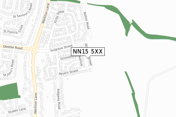
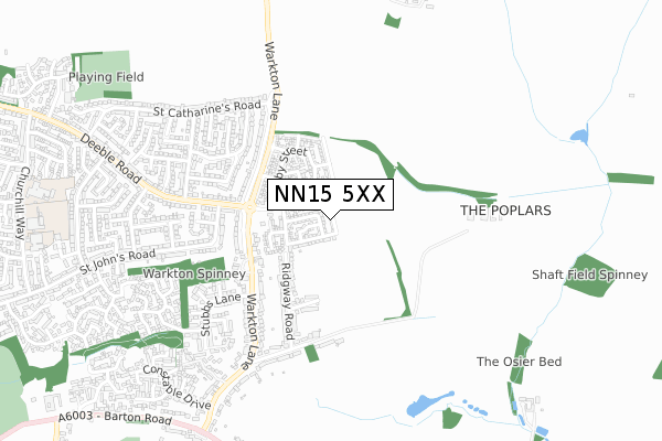
NN15 5XX is located in the Ise electoral ward, within the unitary authority of North Northamptonshire and the English Parliamentary constituency of Kettering. The Sub Integrated Care Board (ICB) Location is NHS Northamptonshire ICB - 78H and the police force is Northamptonshire. This postcode has been in use since September 2017.


GetTheData
Source: OS Open Zoomstack (Ordnance Survey)
Licence: Open Government Licence (requires attribution)
Attribution: Contains OS data © Crown copyright and database right 2024
Source: Open Postcode Geo
Licence: Open Government Licence (requires attribution)
Attribution: Contains OS data © Crown copyright and database right 2024; Contains Royal Mail data © Royal Mail copyright and database right 2024; Source: Office for National Statistics licensed under the Open Government Licence v.3.0
| Easting | 489804 |
| Northing | 278015 |
| Latitude | 52.392816 |
| Longitude | -0.681704 |
GetTheData
Source: Open Postcode Geo
Licence: Open Government Licence
| Country | England |
| Postcode District | NN15 |
| ➜ NN15 open data dashboard ➜ See where NN15 is on a map ➜ Where is Kettering? | |
GetTheData
Source: Land Registry Price Paid Data
Licence: Open Government Licence
| Ward | Ise |
| Constituency | Kettering |
GetTheData
Source: ONS Postcode Database
Licence: Open Government Licence
26, ABINGTON STREET, BARTON SEAGRAVE, KETTERING, NN15 5XX 2020 31 JAN £439,995 |
30, ABINGTON STREET, BARTON SEAGRAVE, KETTERING, NN15 5XX 2019 20 DEC £495,995 |
24, ABINGTON STREET, BARTON SEAGRAVE, KETTERING, NN15 5XX 2019 13 DEC £374,995 |
28, ABINGTON STREET, BARTON SEAGRAVE, KETTERING, NN15 5XX 2019 29 NOV £439,995 |
2, ABINGTON STREET, BARTON SEAGRAVE, KETTERING, NN15 5XX 2019 27 SEP £269,995 |
GetTheData
Source: HM Land Registry Price Paid Data
Licence: Contains HM Land Registry data © Crown copyright and database right 2024. This data is licensed under the Open Government Licence v3.0.
| June 2022 | Burglary | On or near Warkton Lane | 329m |
| June 2022 | Burglary | On or near Warkton Lane | 329m |
| June 2022 | Violence and sexual offences | On or near Warkton Lane | 329m |
| ➜ Get more crime data in our Crime section | |||
GetTheData
Source: data.police.uk
Licence: Open Government Licence
| St Stephens Road (Deeble Road) | Kettering | 501m |
| St Stephens Road (Deeble Road) | Kettering | 502m |
| St Lukes Close (St Johns Road) | Kettering | 546m |
| St Lukes Close (St Johns Road) | Kettering | 548m |
| The Leather Craftsman Ph (St Stephen's Rd) | Kettering | 566m |
| Kettering Station | 3.4km |
GetTheData
Source: NaPTAN
Licence: Open Government Licence
| Percentage of properties with Next Generation Access | 100.0% |
| Percentage of properties with Superfast Broadband | 100.0% |
| Percentage of properties with Ultrafast Broadband | 100.0% |
| Percentage of properties with Full Fibre Broadband | 100.0% |
Superfast Broadband is between 30Mbps and 300Mbps
Ultrafast Broadband is > 300Mbps
| Percentage of properties unable to receive 2Mbps | 0.0% |
| Percentage of properties unable to receive 5Mbps | 0.0% |
| Percentage of properties unable to receive 10Mbps | 0.0% |
| Percentage of properties unable to receive 30Mbps | 0.0% |
GetTheData
Source: Ofcom
Licence: Ofcom Terms of Use (requires attribution)
GetTheData
Source: ONS Postcode Database
Licence: Open Government Licence


➜ Get more ratings from the Food Standards Agency
GetTheData
Source: Food Standards Agency
Licence: FSA terms & conditions
| Last Collection | |||
|---|---|---|---|
| Location | Mon-Fri | Sat | Distance |
| St Johns Road | 17:15 | 11:30 | 716m |
| Barton Seagrave Tso | 17:30 | 11:00 | 1,374m |
| 17 Lower Street | 19:00 | 12:30 | 1,711m |
GetTheData
Source: Dracos
Licence: Creative Commons Attribution-ShareAlike
| Facility | Distance |
|---|---|
| Ise Lodge Community Centre St. Vincents Avenue, Kettering Grass Pitches | 1.1km |
| Barton Seagrave Cricket Club Barton Road, Barton Seagrave Grass Pitches | 1.1km |
| Latimer Arts College Castle Way, Barton Seagrave, Kettering Health and Fitness Gym, Grass Pitches, Sports Hall, Outdoor Tennis Courts, Artificial Grass Pitch | 1.5km |
GetTheData
Source: Active Places
Licence: Open Government Licence
| School | Phase of Education | Distance |
|---|---|---|
| Hayfield Cross CofE School Hayfield Crescent, Kettering, NN15 5FJ | Primary | 1.1km |
| Millbrook Infant School Churchill Way, Kettering, NN15 5BZ | Primary | 1.1km |
| Kingsley Special Academy Churchill Way, Kettering, NN15 5DP | Not applicable | 1.1km |
GetTheData
Source: Edubase
Licence: Open Government Licence
The below table lists the International Territorial Level (ITL) codes (formerly Nomenclature of Territorial Units for Statistics (NUTS) codes) and Local Administrative Units (LAU) codes for NN15 5XX:
| ITL 1 Code | Name |
|---|---|
| TLF | East Midlands (England) |
| ITL 2 Code | Name |
| TLF2 | Leicestershire, Rutland and Northamptonshire |
| ITL 3 Code | Name |
| TLF25 | North Northamptonshire |
| LAU 1 Code | Name |
| E07000153 | Kettering |
GetTheData
Source: ONS Postcode Directory
Licence: Open Government Licence
The below table lists the Census Output Area (OA), Lower Layer Super Output Area (LSOA), and Middle Layer Super Output Area (MSOA) for NN15 5XX:
| Code | Name | |
|---|---|---|
| OA | E00137967 | |
| LSOA | E01027121 | Kettering 010E |
| MSOA | E02005648 | Kettering 010 |
GetTheData
Source: ONS Postcode Directory
Licence: Open Government Licence
| NN15 5AH | Ridgway Road | 309m |
| NN15 5AJ | Westleigh Road | 311m |
| NN15 5AL | Westleigh Road | 347m |
| NN15 5AD | Warkton Lane | 353m |
| NN15 5AQ | Ridgway Road | 356m |
| NN15 5DX | St Simons Close | 409m |
| NN15 5AP | Warkton Lane | 412m |
| NN15 5EJ | St Saviours Road | 415m |
| NN15 5HJ | St Johns Road | 448m |
| NN15 5HN | Deeble Road | 448m |
GetTheData
Source: Open Postcode Geo; Land Registry Price Paid Data
Licence: Open Government Licence