Property/Postcode Data Search:
NN12 8WT maps, stats, and open data
NN12 8WT is located in the Silverstone electoral ward, within the unitary authority of West Northamptonshire and the English Parliamentary constituency of South Northamptonshire. The Sub Integrated Care Board (ICB) Location is NHS Northamptonshire ICB - 78H and the police force is Northamptonshire. This postcode has been in use since January 2019.
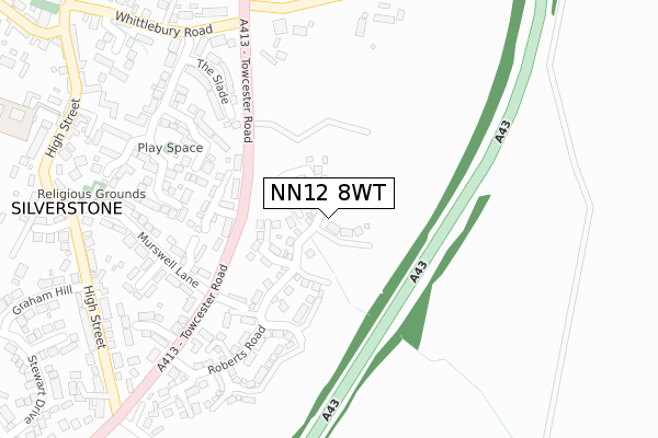
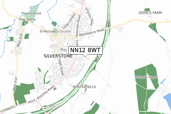
NN12 8WT maps


Source: OS Open Zoomstack (Ordnance Survey)
Licence: Open Government Licence (requires attribution)
Attribution: Contains OS data © Crown copyright and database right 2025
Source: Open Postcode Geo
Licence: Open Government Licence (requires attribution)
Attribution: Contains OS data © Crown copyright and database right 2025; Contains Royal Mail data © Royal Mail copyright and database right 2025; Source: Office for National Statistics licensed under the Open Government Licence v.3.0
Licence: Open Government Licence (requires attribution)
Attribution: Contains OS data © Crown copyright and database right 2025
Source: Open Postcode Geo
Licence: Open Government Licence (requires attribution)
Attribution: Contains OS data © Crown copyright and database right 2025; Contains Royal Mail data © Royal Mail copyright and database right 2025; Source: Office for National Statistics licensed under the Open Government Licence v.3.0
NN12 8WT geodata
| Easting | 467251 |
| Northing | 243894 |
| Latitude | 52.089330 |
| Longitude | -1.019845 |
Where is NN12 8WT?
| Country | England |
| Postcode District | NN12 |
Politics
| Ward | Silverstone |
|---|---|
| Constituency | South Northamptonshire |
House Prices
Sales of detached houses in NN12 8WT
3, BARN YARD, SILVERSTONE, TOWCESTER, NN12 8WT 2021 25 JUN £579,995 |
2, BARN YARD, SILVERSTONE, TOWCESTER, NN12 8WT 2021 25 JUN £564,995 |
4, BARN YARD, SILVERSTONE, TOWCESTER, NN12 8WT 2021 30 APR £464,995 |
6, BARN YARD, SILVERSTONE, TOWCESTER, NN12 8WT 2021 29 JAN £455,000 |
7, BARN YARD, SILVERSTONE, TOWCESTER, NN12 8WT 2020 17 DEC £549,995 |
5, BARN YARD, SILVERSTONE, TOWCESTER, NN12 8WT 2020 17 DEC £575,246 |
8, BARN YARD, SILVERSTONE, TOWCESTER, NN12 8WT 2020 16 DEC £399,995 |
Source: HM Land Registry Price Paid Data
Licence: Contains HM Land Registry data © Crown copyright and database right 2025. This data is licensed under the Open Government Licence v3.0.
Licence: Contains HM Land Registry data © Crown copyright and database right 2025. This data is licensed under the Open Government Licence v3.0.
Transport
Nearest bus stops to NN12 8WT
| Kingsley Road (Whittlebury Road) | Silverstone | 285m |
| Kingsley Road (Whittlebury Road) | Silverstone | 297m |
| Home Close (High Street) | Silverstone | 409m |
| Home Close (High Street) | Silverstone | 420m |
| High Street | Silverstone | 442m |
Deprivation
2.5% of English postcodes are less deprived than NN12 8WT:Food Standards Agency
Three nearest food hygiene ratings to NN12 8WT (metres)
ABM Catering Limited

Silverstone Ce Primary School
234m
KidsStop

Silverstone Ce Primary School
234m
Clare House Residential Home

Clare House
266m
➜ Get more ratings from the Food Standards Agency
Nearest post box to NN12 8WT
| Last Collection | |||
|---|---|---|---|
| Location | Mon-Fri | Sat | Distance |
| Silverstone Sub Office | 16:30 | 08:30 | 434m |
| Kingsley Road | 16:30 | 08:30 | 516m |
| Cattle End | 16:30 | 08:15 | 911m |
NN12 8WT ITL and NN12 8WT LAU
The below table lists the International Territorial Level (ITL) codes (formerly Nomenclature of Territorial Units for Statistics (NUTS) codes) and Local Administrative Units (LAU) codes for NN12 8WT:
| ITL 1 Code | Name |
|---|---|
| TLF | East Midlands (England) |
| ITL 2 Code | Name |
| TLF2 | Leicestershire, Rutland and Northamptonshire |
| ITL 3 Code | Name |
| TLF24 | West Northamptonshire |
| LAU 1 Code | Name |
| E07000155 | South Northamptonshire |
NN12 8WT census areas
The below table lists the Census Output Area (OA), Lower Layer Super Output Area (LSOA), and Middle Layer Super Output Area (MSOA) for NN12 8WT:
| Code | Name | |
|---|---|---|
| OA | E00138863 | |
| LSOA | E01027295 | South Northamptonshire 007B |
| MSOA | E02005687 | South Northamptonshire 007 |
Nearest postcodes to NN12 8WT
| NN12 8DG | Baines Close | 185m |
| NN12 8DQ | Acorn Way | 229m |
| NN12 8UH | The Slade | 278m |
| NN12 8UT | Murswell Lane | 282m |
| NN12 8DN | Old Oak Drive | 286m |
| NN12 8UD | Whittlebury Road | 323m |
| NN12 8UU | Murswell Close | 327m |
| NN12 8DW | Chapel Close | 345m |
| NN12 8FP | Lime Kiln Close | 364m |
| NN12 8DH | The Old Woodyard | 372m |