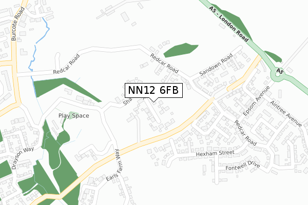
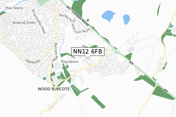
NN12 6FB is located in the Towcester and Roade electoral ward, within the unitary authority of West Northamptonshire and the English Parliamentary constituency of South Northamptonshire. The Sub Integrated Care Board (ICB) Location is NHS Northamptonshire ICB - 78H and the police force is Northamptonshire. This postcode has been in use since February 2018.


GetTheData
Source: OS Open Zoomstack (Ordnance Survey)
Licence: Open Government Licence (requires attribution)
Attribution: Contains OS data © Crown copyright and database right 2024
Source: Open Postcode Geo
Licence: Open Government Licence (requires attribution)
Attribution: Contains OS data © Crown copyright and database right 2024; Contains Royal Mail data © Royal Mail copyright and database right 2024; Source: Office for National Statistics licensed under the Open Government Licence v.3.0
| Easting | 469963 |
| Northing | 247486 |
| Latitude | 52.121284 |
| Longitude | -0.979533 |
GetTheData
Source: Open Postcode Geo
Licence: Open Government Licence
| Country | England |
| Postcode District | NN12 |
| ➜ NN12 open data dashboard ➜ See where NN12 is on a map ➜ Where is Towcester? | |
GetTheData
Source: Land Registry Price Paid Data
Licence: Open Government Licence
| Ward | Towcester And Roade |
| Constituency | South Northamptonshire |
GetTheData
Source: ONS Postcode Database
Licence: Open Government Licence
22, SHARPE STREET, TOWCESTER, NN12 6FB 2022 16 SEP £915,000 |
2020 28 OCT £725,000 |
17, SHARPE STREET, TOWCESTER, NN12 6FB 2019 28 AUG £879,950 |
18, SHARPE STREET, TOWCESTER, NN12 6FB 2019 27 JUN £914,950 |
16, SHARPE STREET, TOWCESTER, NN12 6FB 2019 29 MAR £914,950 |
15, SHARPE STREET, TOWCESTER, NN12 6FB 2019 15 MAR £829,950 |
14, SHARPE STREET, TOWCESTER, NN12 6FB 2019 8 MAR £899,950 |
2018 21 DEC £689,950 |
12, SHARPE STREET, TOWCESTER, NN12 6FB 2018 14 DEC £814,950 |
9, SHARPE STREET, TOWCESTER, NN12 6FB 2018 10 DEC £829,950 |
GetTheData
Source: HM Land Registry Price Paid Data
Licence: Contains HM Land Registry data © Crown copyright and database right 2024. This data is licensed under the Open Government Licence v3.0.
| June 2022 | Violence and sexual offences | On or near Jenkinson Road | 418m |
| June 2022 | Drugs | On or near Burcote Fields | 484m |
| June 2022 | Violence and sexual offences | On or near Burcote Fields | 484m |
| ➜ Get more crime data in our Crime section | |||
GetTheData
Source: data.police.uk
Licence: Open Government Licence
| Brick Kiln Close (Burcote Road) | Towcester | 504m |
| Brick Kiln Close (Burcote Road) | Towcester | 508m |
| Race Course (London Road) | Towcester | 586m |
| Oat Hill Road (South End) (Highfields) | Towcester | 592m |
| Jenkinson Road (Marlow Road) | Towcester | 610m |
GetTheData
Source: NaPTAN
Licence: Open Government Licence
| Percentage of properties with Next Generation Access | 100.0% |
| Percentage of properties with Superfast Broadband | 100.0% |
| Percentage of properties with Ultrafast Broadband | 100.0% |
| Percentage of properties with Full Fibre Broadband | 100.0% |
Superfast Broadband is between 30Mbps and 300Mbps
Ultrafast Broadband is > 300Mbps
| Percentage of properties unable to receive 2Mbps | 0.0% |
| Percentage of properties unable to receive 5Mbps | 0.0% |
| Percentage of properties unable to receive 10Mbps | 0.0% |
| Percentage of properties unable to receive 30Mbps | 0.0% |
GetTheData
Source: Ofcom
Licence: Ofcom Terms of Use (requires attribution)
GetTheData
Source: ONS Postcode Database
Licence: Open Government Licence


➜ Get more ratings from the Food Standards Agency
GetTheData
Source: Food Standards Agency
Licence: FSA terms & conditions
| Last Collection | |||
|---|---|---|---|
| Location | Mon-Fri | Sat | Distance |
| Marlow Road | 17:00 | 09:00 | 594m |
| Nightingale Drive | 17:00 | 08:00 | 608m |
| Wood Burcote | 16:45 | 07:00 | 753m |
GetTheData
Source: Dracos
Licence: Creative Commons Attribution-ShareAlike
| Facility | Distance |
|---|---|
| Marie Weller Primary School Redcar Road, Towcester Grass Pitches | 505m |
| Towcester Recreation Ground Islington Road, Towcester Grass Pitches, Sports Hall | 1.1km |
| Nicholas Hawksmoor Primary School Balmoral Close, Towcester Grass Pitches | 1.3km |
GetTheData
Source: Active Places
Licence: Open Government Licence
| School | Phase of Education | Distance |
|---|---|---|
| Marie Weller Primary School Redcar Road, Towcester, NN12 6LZ | Primary | 156m |
| Towcester Church of England Primary School Islington Road, Towcester, NN12 6AU | Primary | 930m |
| Nicholas Hawksmoor Primary School Balmoral Close, Towcester, NN12 6JA | Primary | 1.3km |
GetTheData
Source: Edubase
Licence: Open Government Licence
The below table lists the International Territorial Level (ITL) codes (formerly Nomenclature of Territorial Units for Statistics (NUTS) codes) and Local Administrative Units (LAU) codes for NN12 6FB:
| ITL 1 Code | Name |
|---|---|
| TLF | East Midlands (England) |
| ITL 2 Code | Name |
| TLF2 | Leicestershire, Rutland and Northamptonshire |
| ITL 3 Code | Name |
| TLF24 | West Northamptonshire |
| LAU 1 Code | Name |
| E07000155 | South Northamptonshire |
GetTheData
Source: ONS Postcode Directory
Licence: Open Government Licence
The below table lists the Census Output Area (OA), Lower Layer Super Output Area (LSOA), and Middle Layer Super Output Area (MSOA) for NN12 6FB:
| Code | Name | |
|---|---|---|
| OA | E00138887 | |
| LSOA | E01027298 | South Northamptonshire 005B |
| MSOA | E02005685 | South Northamptonshire 005 |
GetTheData
Source: ONS Postcode Directory
Licence: Open Government Licence
| NN12 6AW | Jenkinson Road | 404m |
| NN12 6AN | Jenkinson Road | 441m |
| NN12 6JW | Burcote Road | 445m |
| NN12 6LB | London Road | 484m |
| NN12 6TH | Burcote Fields | 489m |
| NN12 6AP | Blackwell Close | 499m |
| NN12 6AL | Park View Road | 515m |
| NN12 6RA | Nightingale Drive | 521m |
| NN12 6RE | Plover Close | 544m |
| NN12 6EY | Highfields | 553m |
GetTheData
Source: Open Postcode Geo; Land Registry Price Paid Data
Licence: Open Government Licence