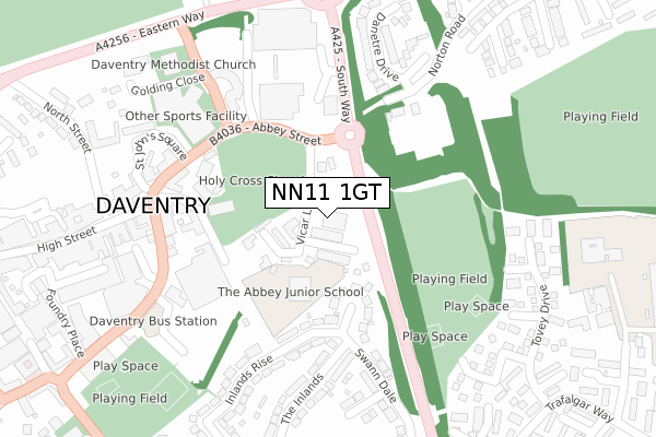
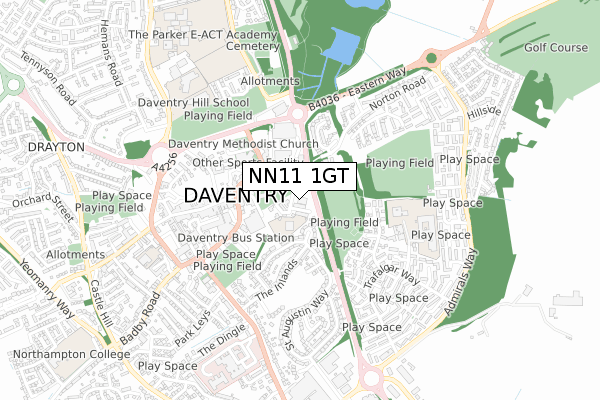
NN11 1GT is located in the Daventry East electoral ward, within the unitary authority of West Northamptonshire and the English Parliamentary constituency of Daventry. The Sub Integrated Care Board (ICB) Location is NHS Northamptonshire ICB - 78H and the police force is Northamptonshire. This postcode has been in use since January 2019.


GetTheData
Source: OS Open Zoomstack (Ordnance Survey)
Licence: Open Government Licence (requires attribution)
Attribution: Contains OS data © Crown copyright and database right 2024
Source: Open Postcode Geo
Licence: Open Government Licence (requires attribution)
Attribution: Contains OS data © Crown copyright and database right 2024; Contains Royal Mail data © Royal Mail copyright and database right 2024; Source: Office for National Statistics licensed under the Open Government Licence v.3.0
| Easting | 457672 |
| Northing | 262555 |
| Latitude | 52.258165 |
| Longitude | -1.156472 |
GetTheData
Source: Open Postcode Geo
Licence: Open Government Licence
| Country | England |
| Postcode District | NN11 |
| ➜ NN11 open data dashboard ➜ See where NN11 is on a map ➜ Where is Daventry? | |
GetTheData
Source: Land Registry Price Paid Data
Licence: Open Government Licence
| Ward | Daventry East |
| Constituency | Daventry |
GetTheData
Source: ONS Postcode Database
Licence: Open Government Licence
| January 2024 | Violence and sexual offences | On or near Parking Area | 304m |
| January 2024 | Vehicle crime | On or near Parking Area | 304m |
| January 2024 | Robbery | On or near Maritime Way | 385m |
| ➜ Get more crime data in our Crime section | |||
GetTheData
Source: data.police.uk
Licence: Open Government Licence
| Abbey School (Inlands Rise) | Daventry | 211m |
| Council Offices (Lodge Road) | Daventry | 250m |
| Council Offices (Lodge Road) | Daventry | 264m |
| Bus Station (New Street) | Daventry | 332m |
| Tovey Drive (Trafalgar Way) | Daventry | 437m |
| Long Buckby Station | 6.3km |
GetTheData
Source: NaPTAN
Licence: Open Government Licence
GetTheData
Source: ONS Postcode Database
Licence: Open Government Licence


➜ Get more ratings from the Food Standards Agency
GetTheData
Source: Food Standards Agency
Licence: FSA terms & conditions
| Last Collection | |||
|---|---|---|---|
| Location | Mon-Fri | Sat | Distance |
| Prospect Way | 18:30 | 1,924m | |
| Churchill Road | 16:00 | 09:30 | 3,196m |
| Kiln Lane | 16:00 | 09:00 | 3,270m |
GetTheData
Source: Dracos
Licence: Creative Commons Attribution-ShareAlike
| Facility | Distance |
|---|---|
| The Abbey Church Of England Academy Vicar Lane, Daventry Sports Hall, Grass Pitches | 117m |
| Fishponds Anson Close, Daventry Grass Pitches | 179m |
| Daventry Leisure Centre Lodge Road, Daventry Sports Hall, Swimming Pool, Health and Fitness Gym, Studio, Squash Courts | 277m |
GetTheData
Source: Active Places
Licence: Open Government Licence
| School | Phase of Education | Distance |
|---|---|---|
| Abbey CofE Academy Vicar Lane, Daventry, NN11 4GD | Primary | 117m |
| DSLV E-ACT Academy Hawke Road, Southbrook, Daventry, NN11 4LJ | All-through | 436m |
| Daventry Hill School Ashby Road, Daventry, NN11 0QE | Not applicable | 555m |
GetTheData
Source: Edubase
Licence: Open Government Licence
The below table lists the International Territorial Level (ITL) codes (formerly Nomenclature of Territorial Units for Statistics (NUTS) codes) and Local Administrative Units (LAU) codes for NN11 1GT:
| ITL 1 Code | Name |
|---|---|
| TLF | East Midlands (England) |
| ITL 2 Code | Name |
| TLF2 | Leicestershire, Rutland and Northamptonshire |
| ITL 3 Code | Name |
| TLF24 | West Northamptonshire |
| LAU 1 Code | Name |
| E07000151 | Daventry |
GetTheData
Source: ONS Postcode Directory
Licence: Open Government Licence
The below table lists the Census Output Area (OA), Lower Layer Super Output Area (LSOA), and Middle Layer Super Output Area (MSOA) for NN11 1GT:
| Code | Name | |
|---|---|---|
| OA | E00137275 | |
| LSOA | E01026991 | Daventry 007C |
| MSOA | E02005625 | Daventry 007 |
GetTheData
Source: ONS Postcode Directory
Licence: Open Government Licence
| NN11 4GB | Vicar Lane | 57m |
| NN11 4FJ | Station Close | 62m |
| NN11 4DG | Inlands Close | 136m |
| NN11 4BL | Church Walk | 197m |
| NN11 4BP | Thomas Webb Close | 205m |
| NN11 4BH | Market Square | 232m |
| NN11 4BE | Thomas Webb Close | 238m |
| NN11 4BT | New Street | 240m |
| NN11 4DF | Swann Dale | 256m |
| NN11 4DQ | Inlands Rise | 267m |
GetTheData
Source: Open Postcode Geo; Land Registry Price Paid Data
Licence: Open Government Licence