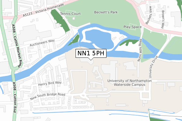
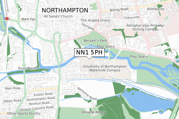
NN1 5PH is located in the Delapre and Rushmere electoral ward, within the unitary authority of West Northamptonshire and the English Parliamentary constituency of Northampton South. The Sub Integrated Care Board (ICB) Location is NHS Northamptonshire ICB - 78H and the police force is Northamptonshire. This postcode has been in use since July 2018.


GetTheData
Source: OS Open Zoomstack (Ordnance Survey)
Licence: Open Government Licence (requires attribution)
Attribution: Contains OS data © Crown copyright and database right 2024
Source: Open Postcode Geo
Licence: Open Government Licence (requires attribution)
Attribution: Contains OS data © Crown copyright and database right 2024; Contains Royal Mail data © Royal Mail copyright and database right 2024; Source: Office for National Statistics licensed under the Open Government Licence v.3.0
| Easting | 475893 |
| Northing | 259846 |
| Latitude | 52.231606 |
| Longitude | -0.890179 |
GetTheData
Source: Open Postcode Geo
Licence: Open Government Licence
| Country | England |
| Postcode District | NN1 |
| ➜ NN1 open data dashboard ➜ See where NN1 is on a map ➜ Where is Northampton? | |
GetTheData
Source: Land Registry Price Paid Data
Licence: Open Government Licence
| Ward | Delapre And Rushmere |
| Constituency | Northampton South |
GetTheData
Source: ONS Postcode Database
Licence: Open Government Licence
| January 2024 | Anti-social behaviour | On or near Swan Street | 464m |
| January 2024 | Bicycle theft | On or near Swan Street | 464m |
| January 2024 | Drugs | On or near Swan Street | 464m |
| ➜ Get more crime data in our Crime section | |||
GetTheData
Source: data.police.uk
Licence: Open Government Licence
| Browns Way (Bedford Road) | Northampton | 412m |
| Navigation Row (Cattle Market Road) | Far Cotton | 440m |
| Old Towcester Road (Cotton End) | Far Cotton | 446m |
| Navigation Row (Bridge Street) | Far Cotton | 483m |
| Browns Way (Bedford Road) | Northampton | 489m |
| Northampton Station | 1.3km |
GetTheData
Source: NaPTAN
Licence: Open Government Licence
| Percentage of properties with Next Generation Access | 0.0% |
| Percentage of properties with Superfast Broadband | 0.0% |
| Percentage of properties with Ultrafast Broadband | 0.0% |
| Percentage of properties with Full Fibre Broadband | 0.0% |
Superfast Broadband is between 30Mbps and 300Mbps
Ultrafast Broadband is > 300Mbps
| Percentage of properties unable to receive 2Mbps | 0.0% |
| Percentage of properties unable to receive 5Mbps | 0.0% |
| Percentage of properties unable to receive 10Mbps | 0.0% |
| Percentage of properties unable to receive 30Mbps | 0.0% |
GetTheData
Source: Ofcom
Licence: Ofcom Terms of Use (requires attribution)
GetTheData
Source: ONS Postcode Database
Licence: Open Government Licence


➜ Get more ratings from the Food Standards Agency
GetTheData
Source: Food Standards Agency
Licence: FSA terms & conditions
| Last Collection | |||
|---|---|---|---|
| Location | Mon-Fri | Sat | Distance |
| Derngate | 17:30 | 12:15 | 460m |
| Derngate | 17:30 | 12:15 | 600m |
| Bridge St | 17:30 | 11:30 | 620m |
GetTheData
Source: Dracos
Licence: Creative Commons Attribution-ShareAlike
| Facility | Distance |
|---|---|
| University Of Northampton (Waterside Campus) University Drive, Northampton Outdoor Tennis Courts, Artificial Grass Pitch, Sports Hall | 91m |
| Beckets Park Bedford Road, Northampton Grass Pitches, Outdoor Tennis Courts | 330m |
| Cripps Recreation Centre Cliftonville, Northampton Swimming Pool, Health and Fitness Gym, Sports Hall, Squash Courts, Artificial Grass Pitch, Studio | 414m |
GetTheData
Source: Active Places
Licence: Open Government Licence
| School | Phase of Education | Distance |
|---|---|---|
| Progress Schools - Northamptonshire 8 Notre Dame Mew, Northampton, NN1 2BG | Not applicable | 907m |
| Vernon Terrace Primary School Vernon Terrace, Northampton, NN1 5HE | Primary | 1.1km |
| New Horizons School 59-77 Sheep Street, Northampton, NN1 2NE | Not applicable | 1.2km |
GetTheData
Source: Edubase
Licence: Open Government Licence
The below table lists the International Territorial Level (ITL) codes (formerly Nomenclature of Territorial Units for Statistics (NUTS) codes) and Local Administrative Units (LAU) codes for NN1 5PH:
| ITL 1 Code | Name |
|---|---|
| TLF | East Midlands (England) |
| ITL 2 Code | Name |
| TLF2 | Leicestershire, Rutland and Northamptonshire |
| ITL 3 Code | Name |
| TLF24 | West Northamptonshire |
| LAU 1 Code | Name |
| E07000154 | Northampton |
GetTheData
Source: ONS Postcode Directory
Licence: Open Government Licence
The below table lists the Census Output Area (OA), Lower Layer Super Output Area (LSOA), and Middle Layer Super Output Area (MSOA) for NN1 5PH:
| Code | Name | |
|---|---|---|
| OA | E00169268 | |
| LSOA | E01032981 | Northampton 028F |
| MSOA | E02005677 | Northampton 028 |
GetTheData
Source: ONS Postcode Directory
Licence: Open Government Licence
| NN4 8GS | Lion Court | 153m |
| NN4 8GT | Lion Court | 169m |
| NN4 8GL | Henry Bird Way | 179m |
| NN1 1HF | Auctioneers Way | 180m |
| NN4 8GR | Lion Court | 199m |
| NN4 8GJ | Johnson Court | 226m |
| NN4 8GN | Trenery Way | 256m |
| NN4 8GA | Henry Bird Way | 292m |
| NN4 8GH | Smiths Court | 303m |
| NN4 8GG | Henry Bird Way | 309m |
GetTheData
Source: Open Postcode Geo; Land Registry Price Paid Data
Licence: Open Government Licence