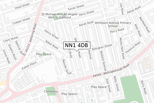
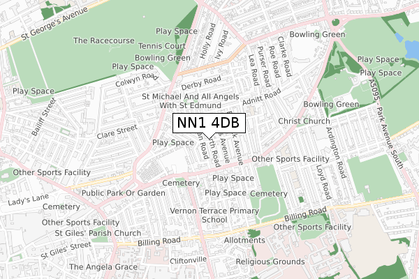
NN1 4DB is located in the Castle electoral ward, within the unitary authority of West Northamptonshire and the English Parliamentary constituency of Northampton South. The Sub Integrated Care Board (ICB) Location is NHS Northamptonshire ICB - 78H and the police force is Northamptonshire. This postcode has been in use since December 2017.


GetTheData
Source: OS Open Zoomstack (Ordnance Survey)
Licence: Open Government Licence (requires attribution)
Attribution: Contains OS data © Crown copyright and database right 2024
Source: Open Postcode Geo
Licence: Open Government Licence (requires attribution)
Attribution: Contains OS data © Crown copyright and database right 2024; Contains Royal Mail data © Royal Mail copyright and database right 2024; Source: Office for National Statistics licensed under the Open Government Licence v.3.0
| Easting | 476608 |
| Northing | 261157 |
| Latitude | 52.243291 |
| Longitude | -0.879415 |
GetTheData
Source: Open Postcode Geo
Licence: Open Government Licence
| Country | England |
| Postcode District | NN1 |
| ➜ NN1 open data dashboard ➜ See where NN1 is on a map ➜ Where is Northampton? | |
GetTheData
Source: Land Registry Price Paid Data
Licence: Open Government Licence
| Ward | Castle |
| Constituency | Northampton South |
GetTheData
Source: ONS Postcode Database
Licence: Open Government Licence
| January 2024 | Burglary | On or near Parking Area | 240m |
| January 2024 | Public order | On or near Parking Area | 240m |
| January 2024 | Anti-social behaviour | On or near Portland Place | 359m |
| ➜ Get more crime data in our Crime section | |||
GetTheData
Source: data.police.uk
Licence: Open Government Licence
| Melbourne Street (Wellingborough Road) | Abington | 201m |
| Melbourne Street (Wellingborough Road) | Abington | 214m |
| Billington Street (Stimpson Avenue) | Abington | 222m |
| St Edmund's Street (Wellingborough Road) | Northampton | 230m |
| Billington Street (Stimpson Avenue) | Abington | 236m |
| Northampton Station | 2km |
GetTheData
Source: NaPTAN
Licence: Open Government Licence
GetTheData
Source: ONS Postcode Database
Licence: Open Government Licence

➜ Get more ratings from the Food Standards Agency
GetTheData
Source: Food Standards Agency
Licence: FSA terms & conditions
| Last Collection | |||
|---|---|---|---|
| Location | Mon-Fri | Sat | Distance |
| Artizan Road | 17:30 | 11:30 | 50m |
| Wellingborough Road Tso | 17:30 | 12:00 | 177m |
| Whitworth Road | 17:30 | 11:30 | 200m |
GetTheData
Source: Dracos
Licence: Creative Commons Attribution-ShareAlike
| Facility | Distance |
|---|---|
| Barry Primary School Barry Road, Northampton Swimming Pool, Sports Hall | 439m |
| Abington Pdc Barry Road, Northampton Artificial Grass Pitch, Sports Hall, Grass Pitches | 536m |
| Northampton Borough Council Air Bubble (Closed) Kettering Road, Northampton Indoor Tennis Centre | 540m |
GetTheData
Source: Active Places
Licence: Open Government Licence
| School | Phase of Education | Distance |
|---|---|---|
| Stimpson Avenue Academy Stimpson Avenue, Northampton, NN1 4LR | Primary | 277m |
| Barry Primary School Barry Road, Northampton, NN1 5JS | Primary | 429m |
| Vernon Terrace Primary School Vernon Terrace, Northampton, NN1 5HE | Primary | 493m |
GetTheData
Source: Edubase
Licence: Open Government Licence
The below table lists the International Territorial Level (ITL) codes (formerly Nomenclature of Territorial Units for Statistics (NUTS) codes) and Local Administrative Units (LAU) codes for NN1 4DB:
| ITL 1 Code | Name |
|---|---|
| TLF | East Midlands (England) |
| ITL 2 Code | Name |
| TLF2 | Leicestershire, Rutland and Northamptonshire |
| ITL 3 Code | Name |
| TLF24 | West Northamptonshire |
| LAU 1 Code | Name |
| E07000154 | Northampton |
GetTheData
Source: ONS Postcode Directory
Licence: Open Government Licence
The below table lists the Census Output Area (OA), Lower Layer Super Output Area (LSOA), and Middle Layer Super Output Area (MSOA) for NN1 4DB:
| Code | Name | |
|---|---|---|
| OA | E00138494 | |
| LSOA | E01027226 | Northampton 025C |
| MSOA | E02005674 | Northampton 025 |
GetTheData
Source: ONS Postcode Directory
Licence: Open Government Licence
| NN1 4HG | Whitworth Road | 73m |
| NN1 4HJ | Whitworth Road | 82m |
| NN1 4HS | Artizan Road | 89m |
| NN1 4HU | Artizan Road | 94m |
| NN1 4HQ | Whitworth Road | 97m |
| NN1 4LH | Billington Street | 99m |
| NN1 4LJ | Adams Avenue | 101m |
| NN1 4LQ | Adams Avenue | 103m |
| NN1 4HX | Melville Street | 108m |
| NN1 4HR | Artizan Road | 121m |
GetTheData
Source: Open Postcode Geo; Land Registry Price Paid Data
Licence: Open Government Licence