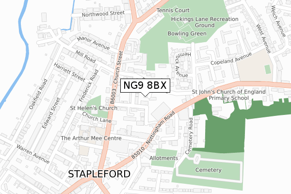
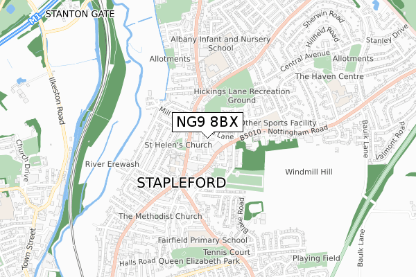
NG9 8BX is located in the Stapleford South East electoral ward, within the local authority district of Broxtowe and the English Parliamentary constituency of Broxtowe. The Sub Integrated Care Board (ICB) Location is NHS Nottingham and Nottinghamshire ICB - 52R and the police force is Nottinghamshire. This postcode has been in use since April 2020.


GetTheData
Source: OS Open Zoomstack (Ordnance Survey)
Licence: Open Government Licence (requires attribution)
Attribution: Contains OS data © Crown copyright and database right 2024
Source: Open Postcode Geo
Licence: Open Government Licence (requires attribution)
Attribution: Contains OS data © Crown copyright and database right 2024; Contains Royal Mail data © Royal Mail copyright and database right 2024; Source: Office for National Statistics licensed under the Open Government Licence v.3.0
| Easting | 449033 |
| Northing | 337411 |
| Latitude | 52.931890 |
| Longitude | -1.271973 |
GetTheData
Source: Open Postcode Geo
Licence: Open Government Licence
| Country | England |
| Postcode District | NG9 |
| ➜ NG9 open data dashboard ➜ See where NG9 is on a map ➜ Where is Stapleford? | |
GetTheData
Source: Land Registry Price Paid Data
Licence: Open Government Licence
| Ward | Stapleford South East |
| Constituency | Broxtowe |
GetTheData
Source: ONS Postcode Database
Licence: Open Government Licence
1, GLADWIN CLOSE, STAPLEFORD, NOTTINGHAM, NG9 8BX 2020 18 DEC £269,950 |
3, GLADWIN CLOSE, STAPLEFORD, NOTTINGHAM, NG9 8BX 2020 10 JUL £269,950 |
4, GLADWIN CLOSE, STAPLEFORD, NOTTINGHAM, NG9 8BX 2020 23 MAR £260,000 |
GetTheData
Source: HM Land Registry Price Paid Data
Licence: Contains HM Land Registry data © Crown copyright and database right 2024. This data is licensed under the Open Government Licence v3.0.
| June 2022 | Theft from the person | On or near Pinfold Lane | 51m |
| June 2022 | Violence and sexual offences | On or near Pinfold Lane | 51m |
| June 2022 | Shoplifting | On or near Shopping Area | 87m |
| ➜ Get more crime data in our Crime section | |||
GetTheData
Source: data.police.uk
Licence: Open Government Licence
| Arthur Mee Centre (Church Street) | Stapleford | 123m |
| Cemetery Road (Nottingham Road) | Stapleford | 127m |
| Mill Road (Church Street) | Stapleford | 143m |
| Albert Street (Nottingham Road) | Stapleford | 175m |
| Cemetery Road (Nottingham Road) | Stapleford | 197m |
| Toton Lane Tram Stop (Toton Lane) | Toton | 1,629m |
| Inham Road Tram Stop (Eskdale Drive) | Chilwell | 1,944m |
| Attenborough Station | 3.9km |
| Beeston Station | 4.5km |
GetTheData
Source: NaPTAN
Licence: Open Government Licence
GetTheData
Source: ONS Postcode Database
Licence: Open Government Licence


➜ Get more ratings from the Food Standards Agency
GetTheData
Source: Food Standards Agency
Licence: FSA terms & conditions
| Last Collection | |||
|---|---|---|---|
| Location | Mon-Fri | Sat | Distance |
| Mill Road | 17:15 | 12:00 | 139m |
| Copeland Avenue | 17:15 | 12:00 | 264m |
| Stapleford Post Office | 17:15 | 12:00 | 276m |
GetTheData
Source: Dracos
Licence: Creative Commons Attribution-ShareAlike
| Facility | Distance |
|---|---|
| Finbows Health & Fitness (Closed) Nottingham Road, Stapleford, Nottingham Health and Fitness Gym, Studio | 159m |
| Hickings Lane Recreation Ground (Stapleford Town Fc) Hickings Lane, Stapleford, Nottingham Grass Pitches | 298m |
| Fairfield Primary Academy Toton Lane, Stapleford, Nottingham Sports Hall, Grass Pitches | 612m |
GetTheData
Source: Active Places
Licence: Open Government Licence
| School | Phase of Education | Distance |
|---|---|---|
| St John's CofE Primary School 80 Nottingham Road, Stapleford, Nottingham, NG9 8AQ | Primary | 291m |
| Albany Junior School Pasture Road, Stapleford, Nottingham, NG9 8HR | Primary | 431m |
| Albany Infant and Nursery School Grenville Drive, Stapleford, Nottingham, NG9 8PD | Primary | 557m |
GetTheData
Source: Edubase
Licence: Open Government Licence
The below table lists the International Territorial Level (ITL) codes (formerly Nomenclature of Territorial Units for Statistics (NUTS) codes) and Local Administrative Units (LAU) codes for NG9 8BX:
| ITL 1 Code | Name |
|---|---|
| TLF | East Midlands (England) |
| ITL 2 Code | Name |
| TLF1 | Derbyshire and Nottinghamshire |
| ITL 3 Code | Name |
| TLF16 | South Nottinghamshire |
| LAU 1 Code | Name |
| E07000172 | Broxtowe |
GetTheData
Source: ONS Postcode Directory
Licence: Open Government Licence
The below table lists the Census Output Area (OA), Lower Layer Super Output Area (LSOA), and Middle Layer Super Output Area (MSOA) for NG9 8BX:
| Code | Name | |
|---|---|---|
| OA | E00143332 | |
| LSOA | E01028130 | Broxtowe 010C |
| MSOA | E02005859 | Broxtowe 010 |
GetTheData
Source: ONS Postcode Directory
Licence: Open Government Licence
| NG9 8DH | Lower Orchard Street | 49m |
| NG9 8DD | Middle Orchard Street | 55m |
| NG9 8DF | Upper Orchard Street | 74m |
| NG9 8DL | Pinfold Lane | 78m |
| NG9 8AD | Nottingham Road | 128m |
| NG9 8DJ | Church Street | 130m |
| NG9 8DA | Church Street | 141m |
| NG9 8DB | Albert Street | 148m |
| NG9 8AA | Nottingham Road | 169m |
| NG9 8DN | Hemlock Avenue | 170m |
GetTheData
Source: Open Postcode Geo; Land Registry Price Paid Data
Licence: Open Government Licence