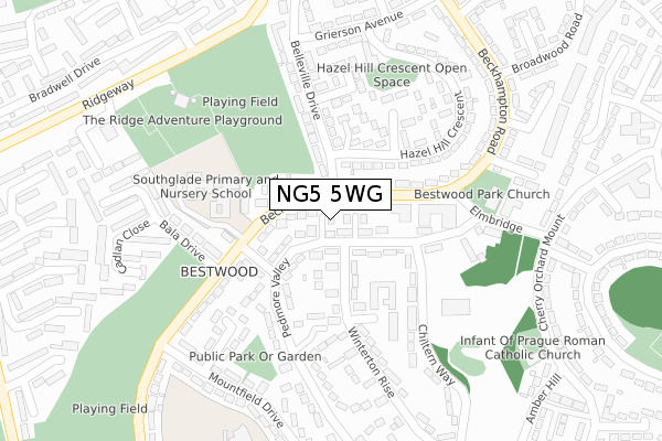
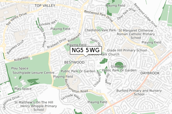
NG5 5WG is located in the Bestwood electoral ward, within the unitary authority of Nottingham and the English Parliamentary constituency of Nottingham North. The Sub Integrated Care Board (ICB) Location is NHS Nottingham and Nottinghamshire ICB - 52R and the police force is Nottinghamshire. This postcode has been in use since March 2018.


GetTheData
Source: OS Open Zoomstack (Ordnance Survey)
Licence: Open Government Licence (requires attribution)
Attribution: Contains OS data © Crown copyright and database right 2024
Source: Open Postcode Geo
Licence: Open Government Licence (requires attribution)
Attribution: Contains OS data © Crown copyright and database right 2024; Contains Royal Mail data © Royal Mail copyright and database right 2024; Source: Office for National Statistics licensed under the Open Government Licence v.3.0
| Easting | 456541 |
| Northing | 345371 |
| Latitude | 53.002701 |
| Longitude | -1.158902 |
GetTheData
Source: Open Postcode Geo
Licence: Open Government Licence
| Country | England |
| Postcode District | NG5 |
| ➜ NG5 open data dashboard ➜ See where NG5 is on a map ➜ Where is Nottingham? | |
GetTheData
Source: Land Registry Price Paid Data
Licence: Open Government Licence
| Ward | Bestwood |
| Constituency | Nottingham North |
GetTheData
Source: ONS Postcode Database
Licence: Open Government Licence
| January 2024 | Other theft | On or near Ranskill Gardens | 446m |
| December 2023 | Anti-social behaviour | On or near Ranskill Gardens | 446m |
| December 2023 | Other theft | On or near Ranskill Gardens | 446m |
| ➜ Get more crime data in our Crime section | |||
GetTheData
Source: data.police.uk
Licence: Open Government Licence
| Elmbridge Shops (Beckhampton Road) | Bestwood Park | 92m |
| Elmbridge Shops (Beckhampton Road) | Bestwood Park | 134m |
| Belsay Road (Beckhampton Road) | Bestwood Park | 166m |
| Belsay Road (Beckhampton Road) | Bestwood Park | 217m |
| Bradwell Drive East (Ridgeway) | Top Valley | 330m |
| Bulwell Station | 2.5km |
| Hucknall Station | 4.7km |
GetTheData
Source: NaPTAN
Licence: Open Government Licence
| Percentage of properties with Next Generation Access | 100.0% |
| Percentage of properties with Superfast Broadband | 100.0% |
| Percentage of properties with Ultrafast Broadband | 100.0% |
| Percentage of properties with Full Fibre Broadband | 0.0% |
Superfast Broadband is between 30Mbps and 300Mbps
Ultrafast Broadband is > 300Mbps
| Percentage of properties unable to receive 2Mbps | 0.0% |
| Percentage of properties unable to receive 5Mbps | 0.0% |
| Percentage of properties unable to receive 10Mbps | 0.0% |
| Percentage of properties unable to receive 30Mbps | 0.0% |
GetTheData
Source: Ofcom
Licence: Ofcom Terms of Use (requires attribution)
GetTheData
Source: ONS Postcode Database
Licence: Open Government Licence


➜ Get more ratings from the Food Standards Agency
GetTheData
Source: Food Standards Agency
Licence: FSA terms & conditions
| Last Collection | |||
|---|---|---|---|
| Location | Mon-Fri | Sat | Distance |
| Elmbridge Post Office | 17:00 | 11:30 | 103m |
| Beckhampton Road P O | 17:00 | 11:30 | 519m |
| Belleville Drive | 17:30 | 11:30 | 573m |
GetTheData
Source: Dracos
Licence: Creative Commons Attribution-ShareAlike
| Facility | Distance |
|---|---|
| Robin Hood Primary School Beckhampton Road, Nottingham Grass Pitches | 393m |
| Bestwood Country Park Woodchurch Road, Arnold, Nottingham Grass Pitches, Outdoor Tennis Courts | 895m |
| Southglade Leisure Centre Southglade Road, Nottingham Sports Hall, Swimming Pool, Health and Fitness Gym, Studio | 988m |
GetTheData
Source: Active Places
Licence: Open Government Licence
| School | Phase of Education | Distance |
|---|---|---|
| Southglade Primary and Nursery School Beckhampton Road, Nottingham, NG5 5NE | Primary | 217m |
| Robin Hood Primary School Beckhampton Road, Bestwood Park, Nottingham, NG5 5NA | Primary | 434m |
| Glade Hill Primary & Nursery School Chippenham Road, Bestwood Park, Nottingham, NG5 5TA | Primary | 594m |
GetTheData
Source: Edubase
Licence: Open Government Licence
The below table lists the International Territorial Level (ITL) codes (formerly Nomenclature of Territorial Units for Statistics (NUTS) codes) and Local Administrative Units (LAU) codes for NG5 5WG:
| ITL 1 Code | Name |
|---|---|
| TLF | East Midlands (England) |
| ITL 2 Code | Name |
| TLF1 | Derbyshire and Nottinghamshire |
| ITL 3 Code | Name |
| TLF14 | Nottingham |
| LAU 1 Code | Name |
| E06000018 | Nottingham |
GetTheData
Source: ONS Postcode Directory
Licence: Open Government Licence
The below table lists the Census Output Area (OA), Lower Layer Super Output Area (LSOA), and Middle Layer Super Output Area (MSOA) for NG5 5WG:
| Code | Name | |
|---|---|---|
| OA | E00069855 | |
| LSOA | E01013850 | Nottingham 038B |
| MSOA | E02006834 | Nottingham 038 |
GetTheData
Source: ONS Postcode Directory
Licence: Open Government Licence
| NG5 5NE | Beckhampton Road | 35m |
| NG5 5NX | Pedmore Valley | 89m |
| NG5 5NU | Winterton Rise | 109m |
| NG5 5NW | Blyton Walk | 138m |
| NG5 5NF | Beckhampton Road | 139m |
| NG5 5ND | Belsay Road | 143m |
| NG5 5NT | Walgrave Walk | 153m |
| NG5 5NN | Pedmore Valley | 160m |
| NG5 5PG | Belleville Drive | 182m |
| NG5 5NL | Eversley Walk | 183m |
GetTheData
Source: Open Postcode Geo; Land Registry Price Paid Data
Licence: Open Government Licence