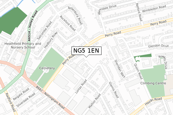
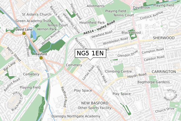
NG5 1EN is located in the Berridge electoral ward, within the unitary authority of Nottingham and the English Parliamentary constituency of Nottingham East. The Sub Integrated Care Board (ICB) Location is NHS Nottingham and Nottinghamshire ICB - 52R and the police force is Nottinghamshire. This postcode has been in use since January 2019.


GetTheData
Source: OS Open Zoomstack (Ordnance Survey)
Licence: Open Government Licence (requires attribution)
Attribution: Contains OS data © Crown copyright and database right 2024
Source: Open Postcode Geo
Licence: Open Government Licence (requires attribution)
Attribution: Contains OS data © Crown copyright and database right 2024; Contains Royal Mail data © Royal Mail copyright and database right 2024; Source: Office for National Statistics licensed under the Open Government Licence v.3.0
| Easting | 455952 |
| Northing | 342987 |
| Latitude | 52.981334 |
| Longitude | -1.168090 |
GetTheData
Source: Open Postcode Geo
Licence: Open Government Licence
| Country | England |
| Postcode District | NG5 |
| ➜ NG5 open data dashboard ➜ See where NG5 is on a map ➜ Where is Nottingham? | |
GetTheData
Source: Land Registry Price Paid Data
Licence: Open Government Licence
| Ward | Berridge |
| Constituency | Nottingham East |
GetTheData
Source: ONS Postcode Database
Licence: Open Government Licence
2023 27 OCT £425,000 |
25, WESTBURY MEWS, NOTTINGHAM, NG5 1EN 2021 18 NOV £315,000 |
26, WESTBURY MEWS, NOTTINGHAM, NG5 1EN 2021 31 AUG £295,000 |
24, WESTBURY MEWS, NOTTINGHAM, NG5 1EN 2021 27 JUL £250,000 |
23, WESTBURY MEWS, NOTTINGHAM, NG5 1EN 2021 26 MAR £250,000 |
22, WESTBURY MEWS, NOTTINGHAM, NG5 1EN 2021 26 FEB £285,000 |
21, WESTBURY MEWS, NOTTINGHAM, NG5 1EN 2021 4 FEB £295,000 |
2021 8 JAN £290,000 |
19, WESTBURY MEWS, NOTTINGHAM, NG5 1EN 2020 3 DEC £250,000 |
18, WESTBURY MEWS, NOTTINGHAM, NG5 1EN 2020 20 NOV £275,000 |
GetTheData
Source: HM Land Registry Price Paid Data
Licence: Contains HM Land Registry data © Crown copyright and database right 2024. This data is licensed under the Open Government Licence v3.0.
| January 2024 | Vehicle crime | On or near Scotland Road | 415m |
| January 2024 | Criminal damage and arson | On or near Scotland Road | 415m |
| January 2024 | Violence and sexual offences | On or near Zulu Road | 461m |
| ➜ Get more crime data in our Crime section | |||
GetTheData
Source: data.police.uk
Licence: Open Government Licence
| Westbury Road (Perry Road) | Basford | 80m |
| Rockford Road (Perry Road) | Basford | 111m |
| Rockford Road (Perry Road) | Basford | 147m |
| Westbury Road (Perry Road) | Basford | 156m |
| Nottingham Road (Perry Road) | Basford | 233m |
| Basford Tram Stop (Vernon Road) | Basford | 705m |
| David Lane Tram Stop (Vernon Road) | Basford | 1,024m |
| Shipstone Street Tram Stop (Shipstone Street) | Radford | 1,145m |
| Wilkinson Street Tram Stop (Wilkinson Street) | Basford | 1,236m |
| Beaconsfield Street Tram Stop (Noel Street) | Forest Fields | 1,246m |
| Bulwell Station | 2.8km |
| Nottingham Station | 4.1km |
GetTheData
Source: NaPTAN
Licence: Open Government Licence
| Percentage of properties with Next Generation Access | 100.0% |
| Percentage of properties with Superfast Broadband | 100.0% |
| Percentage of properties with Ultrafast Broadband | 100.0% |
| Percentage of properties with Full Fibre Broadband | 100.0% |
Superfast Broadband is between 30Mbps and 300Mbps
Ultrafast Broadband is > 300Mbps
| Percentage of properties unable to receive 2Mbps | 0.0% |
| Percentage of properties unable to receive 5Mbps | 0.0% |
| Percentage of properties unable to receive 10Mbps | 0.0% |
| Percentage of properties unable to receive 30Mbps | 0.0% |
GetTheData
Source: Ofcom
Licence: Ofcom Terms of Use (requires attribution)
GetTheData
Source: ONS Postcode Database
Licence: Open Government Licence


➜ Get more ratings from the Food Standards Agency
GetTheData
Source: Food Standards Agency
Licence: FSA terms & conditions
| Last Collection | |||
|---|---|---|---|
| Location | Mon-Fri | Sat | Distance |
| Westbury Road | 17:30 | 10:30 | 238m |
| Perry Road | 17:30 | 10:30 | 353m |
| Valley Road | 17:30 | 10:30 | 376m |
GetTheData
Source: Dracos
Licence: Creative Commons Attribution-ShareAlike
| Facility | Distance |
|---|---|
| Lady Of Leisure (Closed) Zulu Road, Nottingham Health and Fitness Gym, Studio | 378m |
| Puregym (Nottingham Basford) Nottingham Road, Nottingham Health and Fitness Gym, Studio | 418m |
| Djanogly City Academy Nottingham (Haydn Road Sports Ground) Haydn Road, Nottingham Grass Pitches, Artificial Grass Pitch | 466m |
GetTheData
Source: Active Places
Licence: Open Government Licence
| School | Phase of Education | Distance |
|---|---|---|
| Heathfield Primary and Nursery School Scotland Road, Basford, Nottingham, NG5 1JU | Primary | 398m |
| FUEL Unit 7, Ellesmere Business Park, Haydn Road, Nottingham, NG5 1DX | Not applicable | 588m |
| Nottingham Free School The Courtaulds Building, 290 Haydn Road, Nottingham, NG5 1EB | Secondary | 598m |
GetTheData
Source: Edubase
Licence: Open Government Licence
The below table lists the International Territorial Level (ITL) codes (formerly Nomenclature of Territorial Units for Statistics (NUTS) codes) and Local Administrative Units (LAU) codes for NG5 1EN:
| ITL 1 Code | Name |
|---|---|
| TLF | East Midlands (England) |
| ITL 2 Code | Name |
| TLF1 | Derbyshire and Nottinghamshire |
| ITL 3 Code | Name |
| TLF14 | Nottingham |
| LAU 1 Code | Name |
| E06000018 | Nottingham |
GetTheData
Source: ONS Postcode Directory
Licence: Open Government Licence
The below table lists the Census Output Area (OA), Lower Layer Super Output Area (LSOA), and Middle Layer Super Output Area (MSOA) for NG5 1EN:
| Code | Name | |
|---|---|---|
| OA | E00069839 | |
| LSOA | E01013838 | Nottingham 012B |
| MSOA | E02002879 | Nottingham 012 |
GetTheData
Source: ONS Postcode Directory
Licence: Open Government Licence
| NG5 1GQ | Perry Road | 40m |
| NG5 1GS | Perry Road | 77m |
| NG5 1EH | Lortas Road | 109m |
| NG5 1EJ | Westbury Road | 145m |
| NG5 1QH | Sheridan Way | 161m |
| NG5 1QJ | Sheridan Way | 170m |
| NG5 1GH | Vicarage Close | 174m |
| NG5 1QL | Minstrel Avenue | 202m |
| NG5 1EG | Malton Road | 204m |
| NG5 1JX | Rockford Road | 217m |
GetTheData
Source: Open Postcode Geo; Land Registry Price Paid Data
Licence: Open Government Licence