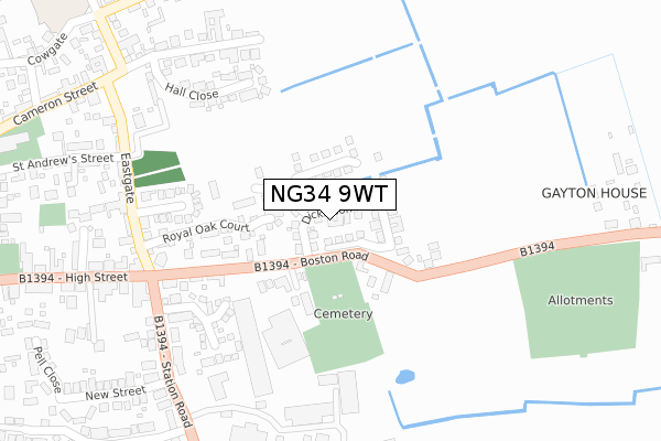
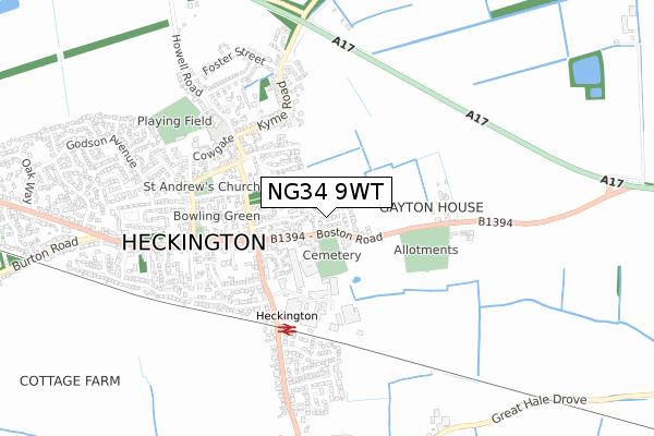
NG34 9WT is located in the Heckington Rural electoral ward, within the local authority district of North Kesteven and the English Parliamentary constituency of Sleaford and North Hykeham. The Sub Integrated Care Board (ICB) Location is NHS Lincolnshire ICB - 71E and the police force is Lincolnshire. This postcode has been in use since November 2018.


GetTheData
Source: OS Open Zoomstack (Ordnance Survey)
Licence: Open Government Licence (requires attribution)
Attribution: Contains OS data © Crown copyright and database right 2024
Source: Open Postcode Geo
Licence: Open Government Licence (requires attribution)
Attribution: Contains OS data © Crown copyright and database right 2024; Contains Royal Mail data © Royal Mail copyright and database right 2024; Source: Office for National Statistics licensed under the Open Government Licence v.3.0
| Easting | 514800 |
| Northing | 344003 |
| Latitude | 52.981108 |
| Longitude | -0.291554 |
GetTheData
Source: Open Postcode Geo
Licence: Open Government Licence
| Country | England |
| Postcode District | NG34 |
| ➜ NG34 open data dashboard ➜ See where NG34 is on a map ➜ Where is Heckington? | |
GetTheData
Source: Land Registry Price Paid Data
Licence: Open Government Licence
| Ward | Heckington Rural |
| Constituency | Sleaford And North Hykeham |
GetTheData
Source: ONS Postcode Database
Licence: Open Government Licence
2023 13 JAN £325,000 |
53, DICKINSON ROAD, HECKINGTON, SLEAFORD, NG34 9WT 2020 23 OCT £310,000 |
2020 9 OCT £290,000 |
47, DICKINSON ROAD, HECKINGTON, SLEAFORD, NG34 9WT 2020 2 OCT £315,000 |
28, DICKINSON ROAD, HECKINGTON, SLEAFORD, NG34 9WT 2020 15 SEP £285,013 |
35, DICKINSON ROAD, HECKINGTON, SLEAFORD, NG34 9WT 2020 24 JUL £282,000 |
25, DICKINSON ROAD, HECKINGTON, SLEAFORD, NG34 9WT 2020 8 JUN £280,000 |
45, DICKINSON ROAD, HECKINGTON, SLEAFORD, NG34 9WT 2020 24 MAR £314,000 |
18, DICKINSON ROAD, HECKINGTON, SLEAFORD, NG34 9WT 2020 13 MAR £275,000 |
23, DICKINSON ROAD, HECKINGTON, SLEAFORD, NG34 9WT 2020 12 MAR £290,000 |
GetTheData
Source: HM Land Registry Price Paid Data
Licence: Contains HM Land Registry data © Crown copyright and database right 2024. This data is licensed under the Open Government Licence v3.0.
| June 2022 | Violence and sexual offences | On or near Boston Road | 87m |
| June 2022 | Criminal damage and arson | On or near Boston Road | 87m |
| May 2022 | Criminal damage and arson | On or near Boston Road | 87m |
| ➜ Get more crime data in our Crime section | |||
GetTheData
Source: data.police.uk
Licence: Open Government Licence
| Eastgate (High Street) | Heckington | 278m |
| Eastgate (High Street) | Heckington | 278m |
| Village Hall (High Street) | Heckington | 385m |
| Old School (Cameron Street) | Heckington | 425m |
| Old School (Cameron Street) | Heckington | 433m |
| Heckington Station | 0.4km |
GetTheData
Source: NaPTAN
Licence: Open Government Licence
| Percentage of properties with Next Generation Access | 100.0% |
| Percentage of properties with Superfast Broadband | 100.0% |
| Percentage of properties with Ultrafast Broadband | 72.2% |
| Percentage of properties with Full Fibre Broadband | 72.2% |
Superfast Broadband is between 30Mbps and 300Mbps
Ultrafast Broadband is > 300Mbps
| Percentage of properties unable to receive 2Mbps | 0.0% |
| Percentage of properties unable to receive 5Mbps | 0.0% |
| Percentage of properties unable to receive 10Mbps | 0.0% |
| Percentage of properties unable to receive 30Mbps | 0.0% |
GetTheData
Source: Ofcom
Licence: Ofcom Terms of Use (requires attribution)
GetTheData
Source: ONS Postcode Database
Licence: Open Government Licence


➜ Get more ratings from the Food Standards Agency
GetTheData
Source: Food Standards Agency
Licence: FSA terms & conditions
| Last Collection | |||
|---|---|---|---|
| Location | Mon-Fri | Sat | Distance |
| Helpingham Post Office | 15:30 | 10:20 | 3,348m |
GetTheData
Source: Dracos
Licence: Creative Commons Attribution-ShareAlike
| Facility | Distance |
|---|---|
| Heckington Squash Club (Closed) High Street, Heckington, Sleaford Squash Courts, Health and Fitness Gym | 517m |
| Heckington St Andrews Ce Primary School Howell Road, Heckington, Sleaford Grass Pitches, Artificial Grass Pitch | 580m |
| Heckington Tennis Club Churchill Way, Churchill Way, Heckington, Sleaford Outdoor Tennis Courts | 605m |
GetTheData
Source: Active Places
Licence: Open Government Licence
| School | Phase of Education | Distance |
|---|---|---|
| Heckington St Andrew's Church of England School Heckington St. Andrew's C of E Primary School, Howell Road, Heckington, Sleaford, NG34 9RX | Primary | 610m |
| Helpringham School Highgate, Helpringham, Sleaford, NG34 0RD | Primary | 3.6km |
| The Kirkby-la-Thorpe Church of England Primary School Church Lane, Kirkby-la-Thorpe, Sleaford, NG34 9NU | Primary | 5.3km |
GetTheData
Source: Edubase
Licence: Open Government Licence
The below table lists the International Territorial Level (ITL) codes (formerly Nomenclature of Territorial Units for Statistics (NUTS) codes) and Local Administrative Units (LAU) codes for NG34 9WT:
| ITL 1 Code | Name |
|---|---|
| TLF | East Midlands (England) |
| ITL 2 Code | Name |
| TLF3 | Lincolnshire |
| ITL 3 Code | Name |
| TLF30 | Lincolnshire CC |
| LAU 1 Code | Name |
| E07000139 | North Kesteven |
GetTheData
Source: ONS Postcode Directory
Licence: Open Government Licence
The below table lists the Census Output Area (OA), Lower Layer Super Output Area (LSOA), and Middle Layer Super Output Area (MSOA) for NG34 9WT:
| Code | Name | |
|---|---|---|
| OA | E00133031 | |
| LSOA | E01026200 | North Kesteven 012A |
| MSOA | E02005464 | North Kesteven 012 |
GetTheData
Source: ONS Postcode Directory
Licence: Open Government Licence
| NG34 9JD | Boston Road | 142m |
| NG34 9JE | Boston Road | 147m |
| NG34 9QQ | Royal Oak Court | 201m |
| NG34 9GZ | Wellington Close | 256m |
| NG34 9SE | Cobham Close | 269m |
| NG34 9SF | Hall Close | 289m |
| NG34 9JH | Station Road | 322m |
| NG34 9JJ | Station Road | 323m |
| NG34 9RB | Eastgate | 330m |
| NG34 9RP | Cameron Street | 350m |
GetTheData
Source: Open Postcode Geo; Land Registry Price Paid Data
Licence: Open Government Licence