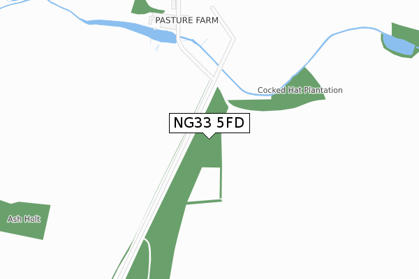
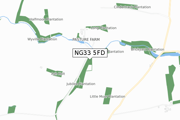
NG33 5FD is located in the Isaac Newton electoral ward, within the local authority district of South Kesteven and the English Parliamentary constituency of Grantham and Stamford. The Sub Integrated Care Board (ICB) Location is NHS Lincolnshire ICB - 71E and the police force is Lincolnshire. This postcode has been in use since September 2017.


GetTheData
Source: OS Open Zoomstack (Ordnance Survey)
Licence: Open Government Licence (requires attribution)
Attribution: Contains OS data © Crown copyright and database right 2024
Source: Open Postcode Geo
Licence: Open Government Licence (requires attribution)
Attribution: Contains OS data © Crown copyright and database right 2024; Contains Royal Mail data © Royal Mail copyright and database right 2024; Source: Office for National Statistics licensed under the Open Government Licence v.3.0
| Easting | 489991 |
| Northing | 328430 |
| Latitude | 52.845888 |
| Longitude | -0.665256 |
GetTheData
Source: Open Postcode Geo
Licence: Open Government Licence
| Country | England |
| Postcode District | NG33 |
| ➜ NG33 open data dashboard ➜ See where NG33 is on a map | |
GetTheData
Source: Land Registry Price Paid Data
Licence: Open Government Licence
| Ward | Isaac Newton |
| Constituency | Grantham And Stamford |
GetTheData
Source: ONS Postcode Database
Licence: Open Government Licence
| Red Cottages (Grantham Road) | Stoke Rochford | 921m |
| Demand Responsive Area | Stoke Rochford | 927m |
| Red Cottages (Grantham Road) | Stoke Rochford | 934m |
GetTheData
Source: NaPTAN
Licence: Open Government Licence
GetTheData
Source: ONS Postcode Database
Licence: Open Government Licence
➜ Get more ratings from the Food Standards Agency
GetTheData
Source: Food Standards Agency
Licence: FSA terms & conditions
| Last Collection | |||
|---|---|---|---|
| Location | Mon-Fri | Sat | Distance |
| Great Ponton Heath | 17:00 | 09:00 | 1,475m |
| Stoke Rochford Post Office | 16:30 | 10:30 | 2,499m |
| Hungerton | 17:00 | 09:00 | 3,384m |
GetTheData
Source: Dracos
Licence: Creative Commons Attribution-ShareAlike
| Facility | Distance |
|---|---|
| Stoke Rochford Leisure Club (Closed) Stoke Rochford, Grantham Swimming Pool, Health and Fitness Gym, Grass Pitches, Outdoor Tennis Courts | 1.9km |
| Stoke Rochford Golf Club Great North Road, Stoke Rochford Golf | 2.5km |
| Skillington Village Hall Grantham Road, Skillington, Grantham Grass Pitches | 2.5km |
GetTheData
Source: Active Places
Licence: Open Government Licence
| School | Phase of Education | Distance |
|---|---|---|
| Great Ponton Church of England School Mill Lane, Great Ponton, Grantham, NG33 5DT | Primary | 3.5km |
| The Harlaxton Church of England Primary School Swinehill, Harlaxton, Grantham, NG32 1HT | Primary | 4.2km |
| Denton CofE School Church Street, Denton, Grantham, NG32 1LG | Primary | 5.3km |
GetTheData
Source: Edubase
Licence: Open Government Licence
The below table lists the International Territorial Level (ITL) codes (formerly Nomenclature of Territorial Units for Statistics (NUTS) codes) and Local Administrative Units (LAU) codes for NG33 5FD:
| ITL 1 Code | Name |
|---|---|
| TLF | East Midlands (England) |
| ITL 2 Code | Name |
| TLF3 | Lincolnshire |
| ITL 3 Code | Name |
| TLF30 | Lincolnshire CC |
| LAU 1 Code | Name |
| E07000141 | South Kesteven |
GetTheData
Source: ONS Postcode Directory
Licence: Open Government Licence
The below table lists the Census Output Area (OA), Lower Layer Super Output Area (LSOA), and Middle Layer Super Output Area (MSOA) for NG33 5FD:
| Code | Name | |
|---|---|---|
| OA | E00169423 | |
| LSOA | E01026331 | South Kesteven 009B |
| MSOA | E02005484 | South Kesteven 009 |
GetTheData
Source: ONS Postcode Directory
Licence: Open Government Licence
| NG33 5EB | 2141m | |
| NG33 5EP | 2378m | |
| NG33 5HH | Park Lane | 2522m |
| NG33 5EW | 2527m | |
| NG33 5HG | Grantham Road | 2577m |
| NG33 5HQ | Church Street | 2579m |
| NG33 5HR | Sproxton Road | 2631m |
| NG33 5ER | Paddock View | 2669m |
| NG33 5ES | Fish Well Close | 2672m |
| NG33 5EA | Barn End | 2687m |
GetTheData
Source: Open Postcode Geo; Land Registry Price Paid Data
Licence: Open Government Licence