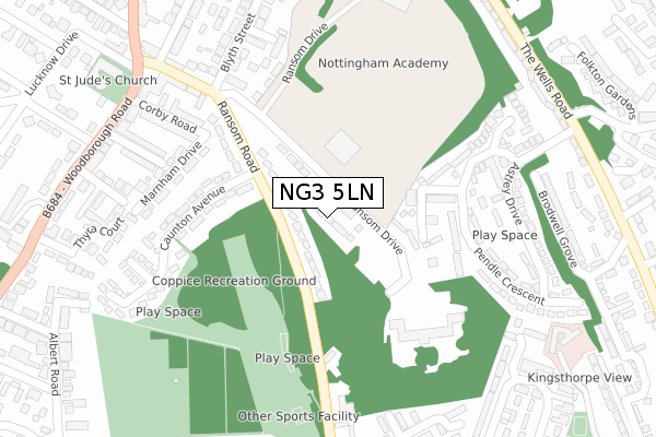
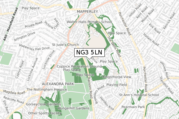
NG3 5LN is located in the Mapperley electoral ward, within the unitary authority of Nottingham and the English Parliamentary constituency of Nottingham East. The Sub Integrated Care Board (ICB) Location is NHS Nottingham and Nottinghamshire ICB - 52R and the police force is Nottinghamshire. This postcode has been in use since May 2019.


GetTheData
Source: OS Open Zoomstack (Ordnance Survey)
Licence: Open Government Licence (requires attribution)
Attribution: Contains OS data © Crown copyright and database right 2024
Source: Open Postcode Geo
Licence: Open Government Licence (requires attribution)
Attribution: Contains OS data © Crown copyright and database right 2024; Contains Royal Mail data © Royal Mail copyright and database right 2024; Source: Office for National Statistics licensed under the Open Government Licence v.3.0
| Easting | 458408 |
| Northing | 342219 |
| Latitude | 52.974170 |
| Longitude | -1.131654 |
GetTheData
Source: Open Postcode Geo
Licence: Open Government Licence
| Country | England |
| Postcode District | NG3 |
| ➜ NG3 open data dashboard ➜ See where NG3 is on a map ➜ Where is Nottingham? | |
GetTheData
Source: Land Registry Price Paid Data
Licence: Open Government Licence
| Ward | Mapperley |
| Constituency | Nottingham East |
GetTheData
Source: ONS Postcode Database
Licence: Open Government Licence
2022 14 OCT £225,000 |
2021 21 DEC £260,000 |
1, ELLIOTT DURHAM CRESCENT, NOTTINGHAM, NG3 5LN 2020 26 NOV £188,995 |
2020 6 MAR £205,995 |
8, ELLIOTT DURHAM CRESCENT, NOTTINGHAM, NG3 5LN 2020 7 FEB £170,995 |
12, ELLIOTT DURHAM CRESCENT, NOTTINGHAM, NG3 5LN 2019 20 DEC £170,995 |
10, ELLIOTT DURHAM CRESCENT, NOTTINGHAM, NG3 5LN 2019 20 DEC £163,995 |
21, ELLIOTT DURHAM CRESCENT, NOTTINGHAM, NG3 5LN 2019 30 APR £145,995 |
2018 21 DEC £155,995 |
GetTheData
Source: HM Land Registry Price Paid Data
Licence: Contains HM Land Registry data © Crown copyright and database right 2024. This data is licensed under the Open Government Licence v3.0.
| March 2023 | Other theft | On or near Malvern Road | 351m |
| June 2022 | Violence and sexual offences | On or near Ransom Road | 105m |
| June 2022 | Violence and sexual offences | On or near Ransom Road | 105m |
| ➜ Get more crime data in our Crime section | |||
GetTheData
Source: data.police.uk
Licence: Open Government Licence
| Ransom Road | St Anns | 150m |
| Boynton Drive (The Wells Road) | Mapperley | 388m |
| Malvern Road (Woodborough Road) | Mapperley Park | 391m |
| Brewsters Road Top (Brewsters Road) | Mapperley | 403m |
| Boynton Drive (The Wells Road) | Mapperley | 404m |
| Nottingham Station | 3.2km |
| Carlton Station | 3.7km |
| Netherfield Station | 3.8km |
GetTheData
Source: NaPTAN
Licence: Open Government Licence
| Percentage of properties with Next Generation Access | 100.0% |
| Percentage of properties with Superfast Broadband | 100.0% |
| Percentage of properties with Ultrafast Broadband | 83.3% |
| Percentage of properties with Full Fibre Broadband | 83.3% |
Superfast Broadband is between 30Mbps and 300Mbps
Ultrafast Broadband is > 300Mbps
| Percentage of properties unable to receive 2Mbps | 0.0% |
| Percentage of properties unable to receive 5Mbps | 0.0% |
| Percentage of properties unable to receive 10Mbps | 0.0% |
| Percentage of properties unable to receive 30Mbps | 0.0% |
GetTheData
Source: Ofcom
Licence: Ofcom Terms of Use (requires attribution)
GetTheData
Source: ONS Postcode Database
Licence: Open Government Licence


➜ Get more ratings from the Food Standards Agency
GetTheData
Source: Food Standards Agency
Licence: FSA terms & conditions
| Last Collection | |||
|---|---|---|---|
| Location | Mon-Fri | Sat | Distance |
| Wells Road | 17:30 | 12:00 | 402m |
| Brewsters Road | 17:30 | 12:00 | 405m |
| Thyra Grove | 17:30 | 12:30 | 457m |
GetTheData
Source: Dracos
Licence: Creative Commons Attribution-ShareAlike
| Facility | Distance |
|---|---|
| Coppice Park Ransom Road, Nottingham Grass Pitches | 88m |
| Mapperley Sports Village Ransom Drive, Nottingham Sports Hall, Health and Fitness Gym, Artificial Grass Pitch, Grass Pitches | 112m |
| The Wells Academy Ransom Drive, Nottingham Sports Hall, Grass Pitches | 354m |
GetTheData
Source: Active Places
Licence: Open Government Licence
| School | Phase of Education | Distance |
|---|---|---|
| The Wells Academy Ransom Drive, Nottingham, NG3 5LR | Secondary | 354m |
| Walter Halls Primary and Early Years School Querneby Road, Mapperley, Nottingham, NG3 5HS | Primary | 607m |
| Thorneywood Education Base The Wells Road, Nottingham, NG3 3AL | Not applicable | 849m |
GetTheData
Source: Edubase
Licence: Open Government Licence
The below table lists the International Territorial Level (ITL) codes (formerly Nomenclature of Territorial Units for Statistics (NUTS) codes) and Local Administrative Units (LAU) codes for NG3 5LN:
| ITL 1 Code | Name |
|---|---|
| TLF | East Midlands (England) |
| ITL 2 Code | Name |
| TLF1 | Derbyshire and Nottinghamshire |
| ITL 3 Code | Name |
| TLF14 | Nottingham |
| LAU 1 Code | Name |
| E06000018 | Nottingham |
GetTheData
Source: ONS Postcode Directory
Licence: Open Government Licence
The below table lists the Census Output Area (OA), Lower Layer Super Output Area (LSOA), and Middle Layer Super Output Area (MSOA) for NG3 5LN:
| Code | Name | |
|---|---|---|
| OA | E00070327 | |
| LSOA | E01013936 | Nottingham 016A |
| MSOA | E02002883 | Nottingham 016 |
GetTheData
Source: ONS Postcode Directory
Licence: Open Government Licence
| NG3 5HN | Ransom Road | 47m |
| NG3 5LR | Ransom Drive | 55m |
| NG3 3EY | Hazelbank Avenue | 155m |
| NG3 5HH | Caunton Avenue | 180m |
| NG3 5PD | Hine Hall | 192m |
| NG3 5PE | Hine Hall | 215m |
| NG3 5PF | Hine Hall | 219m |
| NG3 5PG | Hine Hall | 228m |
| NG3 5HG | Marnham Drive | 238m |
| NG3 5PH | Hine Hall | 238m |
GetTheData
Source: Open Postcode Geo; Land Registry Price Paid Data
Licence: Open Government Licence