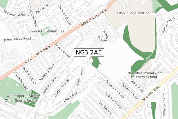
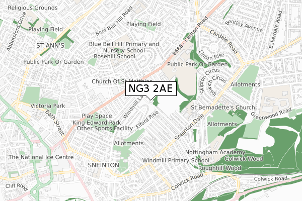
NG3 2AE is located in the St. Ann's electoral ward, within the unitary authority of Nottingham and the English Parliamentary constituency of Nottingham East. The Sub Integrated Care Board (ICB) Location is NHS Nottingham and Nottinghamshire ICB - 52R and the police force is Nottinghamshire. This postcode has been in use since September 2019.


GetTheData
Source: OS Open Zoomstack (Ordnance Survey)
Licence: Open Government Licence (requires attribution)
Attribution: Contains OS data © Crown copyright and database right 2024
Source: Open Postcode Geo
Licence: Open Government Licence (requires attribution)
Attribution: Contains OS data © Crown copyright and database right 2024; Contains Royal Mail data © Royal Mail copyright and database right 2024; Source: Office for National Statistics licensed under the Open Government Licence v.3.0
| Easting | 458802 |
| Northing | 340274 |
| Latitude | 52.956646 |
| Longitude | -1.126139 |
GetTheData
Source: Open Postcode Geo
Licence: Open Government Licence
| Country | England |
| Postcode District | NG3 |
| ➜ NG3 open data dashboard ➜ See where NG3 is on a map ➜ Where is Nottingham? | |
GetTheData
Source: Land Registry Price Paid Data
Licence: Open Government Licence
| Ward | St. Ann's |
| Constituency | Nottingham East |
GetTheData
Source: ONS Postcode Database
Licence: Open Government Licence
| June 2022 | Drugs | On or near Elford Rise | 137m |
| June 2022 | Other theft | On or near Elford Rise | 137m |
| June 2022 | Violence and sexual offences | On or near Chedworth Close | 152m |
| ➜ Get more crime data in our Crime section | |||
GetTheData
Source: data.police.uk
Licence: Open Government Licence
| Randolph Street (Carlton Road) | Sneinton | 193m |
| Randolph Street (Carlton Road) | Sneinton | 198m |
| Alma Road | Sneinton | 248m |
| St Matthias Road (Carlton Road) | Sneinton | 295m |
| Stonebridge Road (St Matthias Road) | St Anns | 297m |
| Lace Market Tram Stop (Fletcher Gate) | Nottingham | 1,351m |
| Nottingham Station Tram Stop (N/A) | Nottingham | 1,703m |
| Nottingham Station | 1.7km |
| Netherfield Station | 3.2km |
| Carlton Station | 3.3km |
GetTheData
Source: NaPTAN
Licence: Open Government Licence
GetTheData
Source: ONS Postcode Database
Licence: Open Government Licence


➜ Get more ratings from the Food Standards Agency
GetTheData
Source: Food Standards Agency
Licence: FSA terms & conditions
| Last Collection | |||
|---|---|---|---|
| Location | Mon-Fri | Sat | Distance |
| Sneinton Elements P O | 17:30 | 11:30 | 224m |
| Alma Road | 17:30 | 12:30 | 363m |
| Denstone Road | 17:30 | 12:30 | 378m |
GetTheData
Source: Dracos
Licence: Creative Commons Attribution-ShareAlike
| Facility | Distance |
|---|---|
| Castle College (Carlton Road Centre) (Closed) Carlton Road, Nottingham Sports Hall, Grass Pitches | 262m |
| King Edwards Park Carlton Road, Nottingham Grass Pitches | 430m |
| K.k Sports And Leisure Centre Carlton Road, Nottingham Health and Fitness Gym, Sports Hall, Artificial Grass Pitch | 506m |
GetTheData
Source: Active Places
Licence: Open Government Licence
| School | Phase of Education | Distance |
|---|---|---|
| Edale Rise Primary & Nursery School Edale Road, Sneinton Dale, Nottingham, NG2 4HT | Primary | 323m |
| Sneinton St Stephen's CofE Primary School Windmill Lane, Sneinton, Nottingham, NG2 4QB | Primary | 453m |
| Windmill L.E.A.D. Academy Sneinton Boulevard, Nottingham, NG2 4FZ | Primary | 515m |
GetTheData
Source: Edubase
Licence: Open Government Licence
The below table lists the International Territorial Level (ITL) codes (formerly Nomenclature of Territorial Units for Statistics (NUTS) codes) and Local Administrative Units (LAU) codes for NG3 2AE:
| ITL 1 Code | Name |
|---|---|
| TLF | East Midlands (England) |
| ITL 2 Code | Name |
| TLF1 | Derbyshire and Nottinghamshire |
| ITL 3 Code | Name |
| TLF14 | Nottingham |
| LAU 1 Code | Name |
| E06000018 | Nottingham |
GetTheData
Source: ONS Postcode Directory
Licence: Open Government Licence
The below table lists the Census Output Area (OA), Lower Layer Super Output Area (LSOA), and Middle Layer Super Output Area (MSOA) for NG3 2AE:
| Code | Name | |
|---|---|---|
| OA | E00173465 | |
| LSOA | E01013954 | Nottingham 021A |
| MSOA | E02002888 | Nottingham 021 |
GetTheData
Source: ONS Postcode Directory
Licence: Open Government Licence
| NG3 2BY | Anstey Rise | 96m |
| NG3 2BZ | Windmill Lane | 101m |
| NG3 2BG | Windmill Lane | 103m |
| NG3 2BX | Rothley Avenue | 118m |
| NG3 2NA | Chedworth Close | 136m |
| NG3 2BE | Devon Street | 149m |
| NG3 2NB | Carlton Road | 170m |
| NG3 2BQ | Anstey Rise | 173m |
| NG3 2BP | Elford Rise | 178m |
| NG3 2AY | Spalding Road | 200m |
GetTheData
Source: Open Postcode Geo; Land Registry Price Paid Data
Licence: Open Government Licence