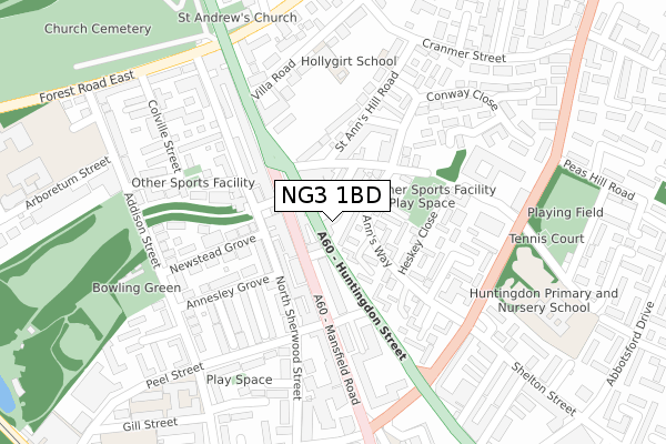
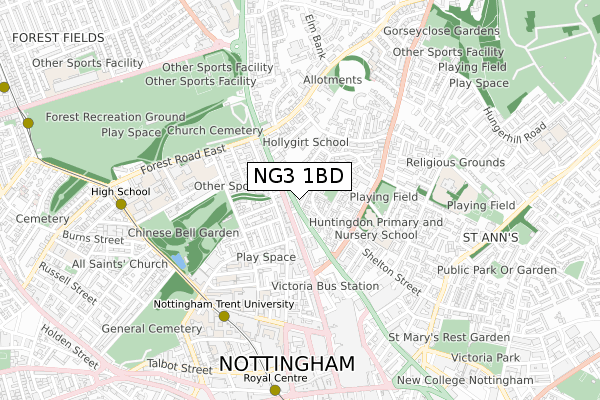
NG3 1BD is located in the St. Ann's electoral ward, within the unitary authority of Nottingham and the English Parliamentary constituency of Nottingham East. The Sub Integrated Care Board (ICB) Location is NHS Nottingham and Nottinghamshire ICB - 52R and the police force is Nottinghamshire. This postcode has been in use since November 2017.


GetTheData
Source: OS Open Zoomstack (Ordnance Survey)
Licence: Open Government Licence (requires attribution)
Attribution: Contains OS data © Crown copyright and database right 2024
Source: Open Postcode Geo
Licence: Open Government Licence (requires attribution)
Attribution: Contains OS data © Crown copyright and database right 2024; Contains Royal Mail data © Royal Mail copyright and database right 2024; Source: Office for National Statistics licensed under the Open Government Licence v.3.0
| Easting | 457173 |
| Northing | 340887 |
| Latitude | 52.962331 |
| Longitude | -1.150277 |
GetTheData
Source: Open Postcode Geo
Licence: Open Government Licence
| Country | England |
| Postcode District | NG3 |
| ➜ NG3 open data dashboard ➜ See where NG3 is on a map ➜ Where is Nottingham? | |
GetTheData
Source: Land Registry Price Paid Data
Licence: Open Government Licence
| Ward | St. Ann's |
| Constituency | Nottingham East |
GetTheData
Source: ONS Postcode Database
Licence: Open Government Licence
| January 2024 | Violence and sexual offences | On or near Parking Area | 392m |
| December 2023 | Violence and sexual offences | On or near Major Street | 392m |
| December 2023 | Violence and sexual offences | On or near Parking Area | 392m |
| ➜ Get more crime data in our Crime section | |||
GetTheData
Source: data.police.uk
Licence: Open Government Licence
| Huntingdon Street (Mansfield Road) | Nottingham | 55m |
| Huntingdon Street (Mansfield Road) | Nottingham | 102m |
| Frogmore Street (Mansfield Road) | Nottingham | 107m |
| Huntingdon Street (Mansfield Road) | Nottingham | 112m |
| Woodborough Road (Mansfield Road) | Nottingham | 194m |
| Ntu Tram Stop (Goldsmith Street) | Nottingham Trent University In City Centre | 578m |
| High School Tram Stop (Waverley Street) | Arboretum | 778m |
| Royal Centre Tram Stop (Wollaton Street) | Nottingham | 798m |
| Old Market Square Tram Stop (South Parade) | Nottingham | 1,032m |
| Lace Market Tram Stop (Fletcher Gate) | Nottingham | 1,076m |
| Nottingham Station | 1.7km |
| Netherfield Station | 4.7km |
| Carlton Station | 4.8km |
GetTheData
Source: NaPTAN
Licence: Open Government Licence
➜ Broadband speed and availability dashboard for NG3 1BD
| Percentage of properties with Next Generation Access | 100.0% |
| Percentage of properties with Superfast Broadband | 100.0% |
| Percentage of properties with Ultrafast Broadband | 100.0% |
| Percentage of properties with Full Fibre Broadband | 0.0% |
Superfast Broadband is between 30Mbps and 300Mbps
Ultrafast Broadband is > 300Mbps
| Median download speed | 100.0Mbps |
| Average download speed | 125.0Mbps |
| Maximum download speed | 350.00Mbps |
Ofcom does not currently provide upload speed data for NG3 1BD. This is because there are less than four broadband connections in this postcode.
| Percentage of properties unable to receive 2Mbps | 0.0% |
| Percentage of properties unable to receive 5Mbps | 0.0% |
| Percentage of properties unable to receive 10Mbps | 0.0% |
| Percentage of properties unable to receive 30Mbps | 0.0% |
➜ Broadband speed and availability dashboard for NG3 1BD
GetTheData
Source: Ofcom
Licence: Ofcom Terms of Use (requires attribution)
GetTheData
Source: ONS Postcode Database
Licence: Open Government Licence


➜ Get more ratings from the Food Standards Agency
GetTheData
Source: Food Standards Agency
Licence: FSA terms & conditions
| Last Collection | |||
|---|---|---|---|
| Location | Mon-Fri | Sat | Distance |
| Mansfield Road P O | 18:30 | 12:00 | 66m |
| Peel Street | 18:30 | 12:30 | 293m |
| Arboretum Street | 18:30 | 12:30 | 299m |
GetTheData
Source: Dracos
Licence: Creative Commons Attribution-ShareAlike
| Facility | Distance |
|---|---|
| Nottingham Girls High School Arboretum Street, Nottingham Sports Hall, Health and Fitness Gym | 412m |
| H2 Fitness (Closed) Victoria Centre, Nottingham Swimming Pool, Health and Fitness Gym, Studio | 459m |
| Nottingham Trent University (City Campus Byron Sports Hall) (Closed) Shakespeare Street, Nottingham Sports Hall, Squash Courts | 517m |
GetTheData
Source: Active Places
Licence: Open Government Licence
| School | Phase of Education | Distance |
|---|---|---|
| Hollygirt School Elm Avenue, Nottingham, NG3 4GF | Not applicable | 255m |
| Huntingdon Academy Alfred Street Central, St Ann's, Nottingham, NG3 4AY | Primary | 367m |
| Nottingham Girls' High School 9 Arboretum Street, Nottingham, NG1 4JB | Not applicable | 412m |
GetTheData
Source: Edubase
Licence: Open Government Licence
The below table lists the International Territorial Level (ITL) codes (formerly Nomenclature of Territorial Units for Statistics (NUTS) codes) and Local Administrative Units (LAU) codes for NG3 1BD:
| ITL 1 Code | Name |
|---|---|
| TLF | East Midlands (England) |
| ITL 2 Code | Name |
| TLF1 | Derbyshire and Nottinghamshire |
| ITL 3 Code | Name |
| TLF14 | Nottingham |
| LAU 1 Code | Name |
| E06000018 | Nottingham |
GetTheData
Source: ONS Postcode Directory
Licence: Open Government Licence
The below table lists the Census Output Area (OA), Lower Layer Super Output Area (LSOA), and Middle Layer Super Output Area (MSOA) for NG3 1BD:
| Code | Name | |
|---|---|---|
| OA | E00070437 | |
| LSOA | E01013961 | Nottingham 023D |
| MSOA | E02002890 | Nottingham 023 |
GetTheData
Source: ONS Postcode Directory
Licence: Open Government Licence
| NG1 3JH | Huntingdon Street | 10m |
| NG3 1AJ | Sherwin Walk | 44m |
| NG3 1BS | Kilbourn Street | 50m |
| NG1 3HW | Mansfield Road | 51m |
| NG3 1BQ | Kilbourn Street | 56m |
| NG1 3FR | Mansfield Road | 72m |
| NG3 1AL | Welbeck Walk | 91m |
| NG1 3HL | Mansfield Road | 93m |
| NG3 1AA | Alfred Street North | 100m |
| NG1 4EF | North Sherwood Street | 116m |
GetTheData
Source: Open Postcode Geo; Land Registry Price Paid Data
Licence: Open Government Licence