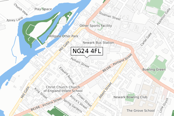
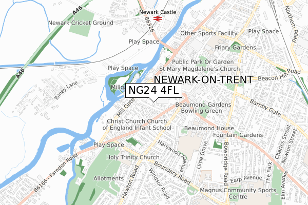
NG24 4FL is located in the Castle electoral ward, within the local authority district of Newark and Sherwood and the English Parliamentary constituency of Newark. The Sub Integrated Care Board (ICB) Location is NHS Nottingham and Nottinghamshire ICB - 52R and the police force is Nottinghamshire. This postcode has been in use since September 2019.


GetTheData
Source: OS Open Zoomstack (Ordnance Survey)
Licence: Open Government Licence (requires attribution)
Attribution: Contains OS data © Crown copyright and database right 2024
Source: Open Postcode Geo
Licence: Open Government Licence (requires attribution)
Attribution: Contains OS data © Crown copyright and database right 2024; Contains Royal Mail data © Royal Mail copyright and database right 2024; Source: Office for National Statistics licensed under the Open Government Licence v.3.0
| Easting | 479570 |
| Northing | 353653 |
| Latitude | 53.074212 |
| Longitude | -0.813764 |
GetTheData
Source: Open Postcode Geo
Licence: Open Government Licence
| Country | England |
| Postcode District | NG24 |
| ➜ NG24 open data dashboard ➜ See where NG24 is on a map ➜ Where is Newark-on-Trent? | |
GetTheData
Source: Land Registry Price Paid Data
Licence: Open Government Licence
| Ward | Castle |
| Constituency | Newark |
GetTheData
Source: ONS Postcode Database
Licence: Open Government Licence
| June 2022 | Violence and sexual offences | On or near Bus/Coach Station | 8m |
| June 2022 | Violence and sexual offences | On or near Bus/Coach Station | 8m |
| June 2022 | Vehicle crime | On or near Pelham Street | 51m |
| ➜ Get more crime data in our Crime section | |||
GetTheData
Source: data.police.uk
Licence: Open Government Licence
| Albert Street (Portland Street) | Newark | 151m |
| Portland Street (Albert Street) | Newark | 202m |
| Albert Street (Portland Street) | Newark | 208m |
| Portland Street (Albert Street) | Newark | 209m |
| Chatham Court (Albert Street) | Newark | 212m |
| Newark Castle Station | 0.6km |
| Newark North Gate Station | 1.3km |
GetTheData
Source: NaPTAN
Licence: Open Government Licence
GetTheData
Source: ONS Postcode Database
Licence: Open Government Licence


➜ Get more ratings from the Food Standards Agency
GetTheData
Source: Food Standards Agency
Licence: FSA terms & conditions
| Last Collection | |||
|---|---|---|---|
| Location | Mon-Fri | Sat | Distance |
| Pelham Street | 18:30 | 12:30 | 47m |
| Castlegate | 18:30 | 11:30 | 269m |
| Millgate | 17:30 | 11:30 | 278m |
GetTheData
Source: Dracos
Licence: Creative Commons Attribution-ShareAlike
| Facility | Distance |
|---|---|
| Anytime Fitness (Newark On Trent) (Closed) Castle Gate, Castle Gate, Newark Health and Fitness Gym | 245m |
| Newark Academy (Closed) London Road, Newark Sports Hall, Artificial Grass Pitch, Grass Pitches | 442m |
| Newark Tennis Club London Road, Newark Outdoor Tennis Courts | 510m |
GetTheData
Source: Active Places
Licence: Open Government Licence
| School | Phase of Education | Distance |
|---|---|---|
| Christ Church C of E Primary School Flaxley Lane, Middlebeck, Newark-on-Trent, NG24 3XB | Primary | 216m |
| Holy Trinity Catholic Voluntary Academy Boundary Road, Newark, NG24 4AU | Primary | 474m |
| Mount CofE Primary School Kings Road, Newark, NG24 1EW | Primary | 593m |
GetTheData
Source: Edubase
Licence: Open Government Licence
The below table lists the International Territorial Level (ITL) codes (formerly Nomenclature of Territorial Units for Statistics (NUTS) codes) and Local Administrative Units (LAU) codes for NG24 4FL:
| ITL 1 Code | Name |
|---|---|
| TLF | East Midlands (England) |
| ITL 2 Code | Name |
| TLF1 | Derbyshire and Nottinghamshire |
| ITL 3 Code | Name |
| TLF15 | North Nottinghamshire |
| LAU 1 Code | Name |
| E07000175 | Newark and Sherwood |
GetTheData
Source: ONS Postcode Directory
Licence: Open Government Licence
The below table lists the Census Output Area (OA), Lower Layer Super Output Area (LSOA), and Middle Layer Super Output Area (MSOA) for NG24 4FL:
| Code | Name | |
|---|---|---|
| OA | E00144241 | |
| LSOA | E01028311 | Newark and Sherwood 007G |
| MSOA | E02005899 | Newark and Sherwood 007 |
GetTheData
Source: ONS Postcode Directory
Licence: Open Government Licence
| NG24 4XD | Pelham Street | 37m |
| NG24 4XR | Pelham Gardens | 78m |
| NG24 4XL | Pelham Close | 98m |
| NG24 4XA | Victoria Terrace | 100m |
| NG24 4TR | Mill Gate | 137m |
| NG24 4XG | Portland Street | 139m |
| NG24 1XG | Lombard Street | 148m |
| NG24 4XF | Portland Street | 152m |
| NG24 4UZ | Edward Avenue | 156m |
| NG24 4UT | Victoria Street | 161m |
GetTheData
Source: Open Postcode Geo; Land Registry Price Paid Data
Licence: Open Government Licence