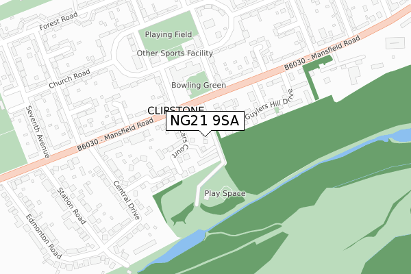
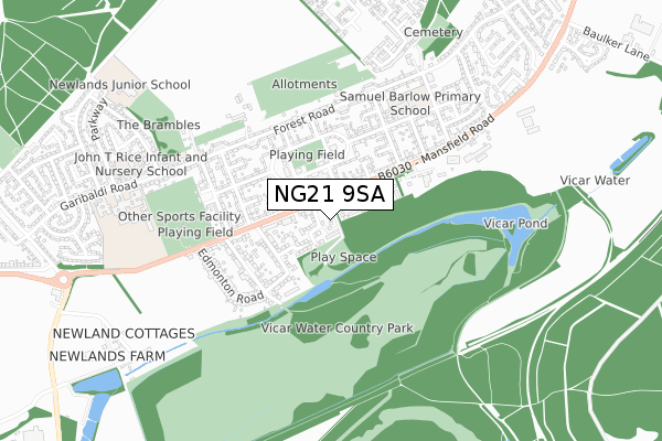
NG21 9SA is located in the Edwinstowe & Clipstone electoral ward, within the local authority district of Newark and Sherwood and the English Parliamentary constituency of Sherwood. The Sub Integrated Care Board (ICB) Location is NHS Nottingham and Nottinghamshire ICB - 52R and the police force is Nottinghamshire. This postcode has been in use since April 2019.


GetTheData
Source: OS Open Zoomstack (Ordnance Survey)
Licence: Open Government Licence (requires attribution)
Attribution: Contains OS data © Crown copyright and database right 2024
Source: Open Postcode Geo
Licence: Open Government Licence (requires attribution)
Attribution: Contains OS data © Crown copyright and database right 2024; Contains Royal Mail data © Royal Mail copyright and database right 2024; Source: Office for National Statistics licensed under the Open Government Licence v.3.0
| Easting | 458780 |
| Northing | 362887 |
| Latitude | 53.159893 |
| Longitude | -1.122348 |
GetTheData
Source: Open Postcode Geo
Licence: Open Government Licence
| Country | England |
| Postcode District | NG21 |
| ➜ NG21 open data dashboard ➜ See where NG21 is on a map ➜ Where is Clipstone? | |
GetTheData
Source: Land Registry Price Paid Data
Licence: Open Government Licence
| Ward | Edwinstowe & Clipstone |
| Constituency | Sherwood |
GetTheData
Source: ONS Postcode Database
Licence: Open Government Licence
| November 2023 | Criminal damage and arson | On or near Fifth Avenue | 201m |
| November 2023 | Anti-social behaviour | On or near Fourth Avenue | 209m |
| November 2023 | Criminal damage and arson | On or near Fourth Avenue | 209m |
| ➜ Get more crime data in our Crime section | |||
GetTheData
Source: data.police.uk
Licence: Open Government Licence
| Fifth Avenue (Mansfield Road) | Clipstone | 95m |
| Fifth Avenue (Mansfield Road) | Clipstone | 139m |
| Central Drive (Mansfield Road) | Clipstone | 249m |
| Third Avenue (Mansfield Road) | Clipstone | 304m |
| Sixth Avenue | Clipstone | 346m |
GetTheData
Source: NaPTAN
Licence: Open Government Licence
| Percentage of properties with Next Generation Access | 100.0% |
| Percentage of properties with Superfast Broadband | 100.0% |
| Percentage of properties with Ultrafast Broadband | 0.0% |
| Percentage of properties with Full Fibre Broadband | 0.0% |
Superfast Broadband is between 30Mbps and 300Mbps
Ultrafast Broadband is > 300Mbps
| Percentage of properties unable to receive 2Mbps | 0.0% |
| Percentage of properties unable to receive 5Mbps | 0.0% |
| Percentage of properties unable to receive 10Mbps | 0.0% |
| Percentage of properties unable to receive 30Mbps | 0.0% |
GetTheData
Source: Ofcom
Licence: Ofcom Terms of Use (requires attribution)
GetTheData
Source: ONS Postcode Database
Licence: Open Government Licence


➜ Get more ratings from the Food Standards Agency
GetTheData
Source: Food Standards Agency
Licence: FSA terms & conditions
| Last Collection | |||
|---|---|---|---|
| Location | Mon-Fri | Sat | Distance |
| Clipstone Post Office | 17:15 | 11:00 | 90m |
| Forest Road | 17:00 | 11:00 | 397m |
| Main Road | 16:15 | 11:00 | 687m |
GetTheData
Source: Dracos
Licence: Creative Commons Attribution-ShareAlike
| Facility | Distance |
|---|---|
| Clipstone Miners Welfare (Church Road Site) Church Road, Clipstone Village, Mansfield Grass Pitches | 266m |
| Samuel Barlow Primary Academy Church Road, Clipstone Village, Mansfield Grass Pitches | 501m |
| Clipstone Miners Welfare (The Lido Ground) Clipstone Road East, Clipstone Village, Mansfield Grass Pitches | 511m |
GetTheData
Source: Active Places
Licence: Open Government Licence
| School | Phase of Education | Distance |
|---|---|---|
| Samuel Barlow Primary Academy Church Road, Clipstone, Mansfield, NG21 9DF | Primary | 511m |
| The Garibaldi School Forest Town, Mansfield, NG19 0JX | Secondary | 750m |
| John T Rice Infant and Nursery School Braemar Road, Forest Town, Mansfield, NG19 0LL | Primary | 778m |
GetTheData
Source: Edubase
Licence: Open Government Licence
The below table lists the International Territorial Level (ITL) codes (formerly Nomenclature of Territorial Units for Statistics (NUTS) codes) and Local Administrative Units (LAU) codes for NG21 9SA:
| ITL 1 Code | Name |
|---|---|
| TLF | East Midlands (England) |
| ITL 2 Code | Name |
| TLF1 | Derbyshire and Nottinghamshire |
| ITL 3 Code | Name |
| TLF15 | North Nottinghamshire |
| LAU 1 Code | Name |
| E07000175 | Newark and Sherwood |
GetTheData
Source: ONS Postcode Directory
Licence: Open Government Licence
The below table lists the Census Output Area (OA), Lower Layer Super Output Area (LSOA), and Middle Layer Super Output Area (MSOA) for NG21 9SA:
| Code | Name | |
|---|---|---|
| OA | E00144259 | |
| LSOA | E01028314 | Newark and Sherwood 002B |
| MSOA | E02005894 | Newark and Sherwood 002 |
GetTheData
Source: ONS Postcode Directory
Licence: Open Government Licence
| NG21 9AA | Mansfield Road | 67m |
| NG21 9AL | Mansfield Road | 168m |
| NG21 9RU | Osberne Way | 174m |
| NG21 9RT | Guylers Hill Drive | 184m |
| NG21 9AG | Central Drive | 260m |
| NG21 9AE | Mansfield Road | 289m |
| NG21 9DL | Church Road | 307m |
| NG21 9DJ | Church Road | 332m |
| NG21 9DF | Church Road | 335m |
| NG21 9DH | Fifth Avenue | 338m |
GetTheData
Source: Open Postcode Geo; Land Registry Price Paid Data
Licence: Open Government Licence