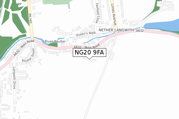
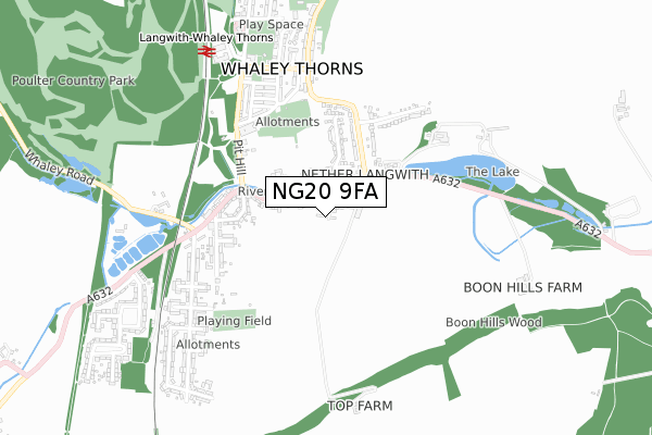
NG20 9FA is located in the Welbeck electoral ward, within the local authority district of Bassetlaw and the English Parliamentary constituency of Bassetlaw. The Sub Integrated Care Board (ICB) Location is NHS Nottingham and Nottinghamshire ICB - 02Q and the police force is Nottinghamshire. This postcode has been in use since August 2019.


GetTheData
Source: OS Open Zoomstack (Ordnance Survey)
Licence: Open Government Licence (requires attribution)
Attribution: Contains OS data © Crown copyright and database right 2024
Source: Open Postcode Geo
Licence: Open Government Licence (requires attribution)
Attribution: Contains OS data © Crown copyright and database right 2024; Contains Royal Mail data © Royal Mail copyright and database right 2024; Source: Office for National Statistics licensed under the Open Government Licence v.3.0
| Easting | 453335 |
| Northing | 370290 |
| Latitude | 53.227004 |
| Longitude | -1.202541 |
GetTheData
Source: Open Postcode Geo
Licence: Open Government Licence
| Country | England |
| Postcode District | NG20 |
| ➜ NG20 open data dashboard ➜ See where NG20 is on a map ➜ Where is Langwith? | |
GetTheData
Source: Land Registry Price Paid Data
Licence: Open Government Licence
| Ward | Welbeck |
| Constituency | Bassetlaw |
GetTheData
Source: ONS Postcode Database
Licence: Open Government Licence
1, STONE GROVE, NETHER LANGWITH, MANSFIELD, NG20 9FA 2019 8 AUG £320,000 |
GetTheData
Source: HM Land Registry Price Paid Data
Licence: Contains HM Land Registry data © Crown copyright and database right 2024. This data is licensed under the Open Government Licence v3.0.
| June 2022 | Violence and sexual offences | On or near Fairfield Close | 271m |
| June 2022 | Criminal damage and arson | On or near Fairfield Close | 271m |
| June 2022 | Violence and sexual offences | On or near Limes Avenue | 282m |
| ➜ Get more crime data in our Crime section | |||
GetTheData
Source: data.police.uk
Licence: Open Government Licence
| Queens Walk (Main Road) | Langwith | 62m |
| Queens Walk (Main Road) | Langwith | 101m |
| Limes Avenue (Main Road) | Langwith | 219m |
| Limes Avenue (Main Road) | Langwith | 221m |
| Welfitt Grove (Limes Avenue) | Langwith | 299m |
| Langwith - Whaley Thorns Station | 0.7km |
| Shirebrook Station | 2.5km |
| Creswell (Derbys) Station | 4.2km |
GetTheData
Source: NaPTAN
Licence: Open Government Licence
GetTheData
Source: ONS Postcode Database
Licence: Open Government Licence


➜ Get more ratings from the Food Standards Agency
GetTheData
Source: Food Standards Agency
Licence: FSA terms & conditions
| Last Collection | |||
|---|---|---|---|
| Location | Mon-Fri | Sat | Distance |
| Nether Langwith | 16:30 | 10:30 | 120m |
| Langwith Post Office | 17:00 | 11:00 | 435m |
| Whaley Thorns Post Office | 16:45 | 09:30 | 584m |
GetTheData
Source: Dracos
Licence: Creative Commons Attribution-ShareAlike
| Facility | Distance |
|---|---|
| Devonshire Drive Recreation Ground Main Road, Nether Langwith Grass Pitches | 526m |
| Whaley Thorns Cricket Ground Main Street, Whaley Thorns Grass Pitches | 659m |
| Langwith Recreation Ground Cockshut Lane, Langwith, Mansfield Grass Pitches | 1.1km |
GetTheData
Source: Active Places
Licence: Open Government Licence
| School | Phase of Education | Distance |
|---|---|---|
| Whaley Thorns Primary School Portland Road, Langwith, Mansfield, NG20 9HB | Primary | 909m |
| Langwith Bassett Junior Academy Bassett Hill, Upper Langwith, Mansfield, NG20 9RD | Primary | 1.5km |
| Brookfield Primary School Burlington Avenue, Langwith Junction, Mansfield, NG20 9AD | Primary | 1.9km |
GetTheData
Source: Edubase
Licence: Open Government Licence
The below table lists the International Territorial Level (ITL) codes (formerly Nomenclature of Territorial Units for Statistics (NUTS) codes) and Local Administrative Units (LAU) codes for NG20 9FA:
| ITL 1 Code | Name |
|---|---|
| TLF | East Midlands (England) |
| ITL 2 Code | Name |
| TLF1 | Derbyshire and Nottinghamshire |
| ITL 3 Code | Name |
| TLF15 | North Nottinghamshire |
| LAU 1 Code | Name |
| E07000171 | Bassetlaw |
GetTheData
Source: ONS Postcode Directory
Licence: Open Government Licence
The below table lists the Census Output Area (OA), Lower Layer Super Output Area (LSOA), and Middle Layer Super Output Area (MSOA) for NG20 9FA:
| Code | Name | |
|---|---|---|
| OA | E00142879 | |
| LSOA | E01028041 | Bassetlaw 014B |
| MSOA | E02005848 | Bassetlaw 014 |
GetTheData
Source: ONS Postcode Directory
Licence: Open Government Licence
| NG20 9EN | Main Road | 84m |
| NG20 9EW | Queens Walk | 127m |
| NG20 9EA | Farm Court | 218m |
| NG20 9EL | Poulter Street | 282m |
| NG20 9ER | Langwith Lodge Drive | 313m |
| NG20 9EP | Fairfield Close | 326m |
| NG20 9ET | Limes Avenue | 329m |
| NG20 9DH | Poulter Street | 343m |
| NG20 9EU | Limes Avenue | 350m |
| NG20 9DL | Boundary Walk | 374m |
GetTheData
Source: Open Postcode Geo; Land Registry Price Paid Data
Licence: Open Government Licence