NG2 7YX maps, stats, and open data
NG2 7YX is located in the Compton Acres electoral ward, within the local authority district of Rushcliffe and the English Parliamentary constituency of Rushcliffe. The Sub Integrated Care Board (ICB) Location is NHS Nottingham and Nottinghamshire ICB - 52R and the police force is Nottinghamshire. This postcode has been in use since December 2018.
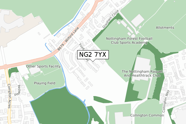
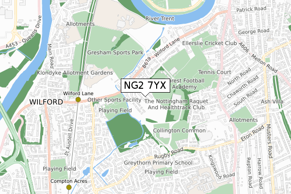
NG2 7YX maps


Licence: Open Government Licence (requires attribution)
Attribution: Contains OS data © Crown copyright and database right 2025
Source: Open Postcode Geo
Licence: Open Government Licence (requires attribution)
Attribution: Contains OS data © Crown copyright and database right 2025; Contains Royal Mail data © Royal Mail copyright and database right 2025; Source: Office for National Statistics licensed under the Open Government Licence v.3.0
NG2 7YX geodata
| Easting | 457433 |
| Northing | 336871 |
| Latitude | 52.926206 |
| Longitude | -1.147116 |
Where is NG2 7YX?
| Country | England |
| Postcode District | NG2 |
Politics
| Ward | Compton Acres |
|---|---|
| Constituency | Rushcliffe |
House Prices
Sales of detached houses in NG2 7YX
2, WOODPECKER CLOSE, WEST BRIDGFORD, NOTTINGHAM, NG2 7YX 2019 22 NOV £391,000 |
1, WOODPECKER CLOSE, WEST BRIDGFORD, NOTTINGHAM, NG2 7YX 2019 21 MAR £320,000 |
4, WOODPECKER CLOSE, WEST BRIDGFORD, NOTTINGHAM, NG2 7YX 2019 28 FEB £320,000 |
Licence: Contains HM Land Registry data © Crown copyright and database right 2025. This data is licensed under the Open Government Licence v3.0.
Transport
Nearest bus stops to NG2 7YX
| Wilford Lane | West Bridgford | 189m |
| Wilford Lane | West Bridgford | 194m |
| Gresham Close (Wilford Lane) | West Bridgford | 372m |
| Gresham Close (Wilford Lane) | West Bridgford | 377m |
| Roko (Wilford Lane) | Wilford | 378m |
Nearest underground/metro/tram to NG2 7YX
| Wilford Lane Tram Stop (Wilford Lane) | Wilford | 609m |
| Compton Acres Tram Stop (N/A) | Compton Acres | 1,056m |
| Wilford Village Tram Stop (Main Road) | Wilford | 1,207m |
| Ruddington Lane Tram Stop (Ruddington Lane) | Compton Acres | 1,485m |
| Meadows Embankment Tram Stop (Queens Walk) | Meadows | 1,499m |
Nearest railway stations to NG2 7YX
| Nottingham Station | 2.3km |
| Beeston Station | 4.1km |
| Netherfield Station | 6km |
Broadband
Broadband access in NG2 7YX (2020 data)
| Percentage of properties with Next Generation Access | 100.0% |
| Percentage of properties with Superfast Broadband | 100.0% |
| Percentage of properties with Ultrafast Broadband | 46.2% |
| Percentage of properties with Full Fibre Broadband | 46.2% |
Superfast Broadband is between 30Mbps and 300Mbps
Ultrafast Broadband is > 300Mbps
Broadband limitations in NG2 7YX (2020 data)
| Percentage of properties unable to receive 2Mbps | 0.0% |
| Percentage of properties unable to receive 5Mbps | 0.0% |
| Percentage of properties unable to receive 10Mbps | 0.0% |
| Percentage of properties unable to receive 30Mbps | 0.0% |
Deprivation
2.2% of English postcodes are less deprived than NG2 7YX:Food Standards Agency
Three nearest food hygiene ratings to NG2 7YX (metres)


➜ Get more ratings from the Food Standards Agency
Nearest post box to NG2 7YX
| Last Collection | |||
|---|---|---|---|
| Location | Mon-Fri | Sat | Distance |
| The Chateau | 17:00 | 09:30 | 314m |
| Collington Way | 16:30 | 11:30 | 447m |
| Stowe Avenue | 16:30 | 11:30 | 702m |
Environment
| Risk of NG2 7YX flooding from rivers and sea | Low |
NG2 7YX ITL and NG2 7YX LAU
The below table lists the International Territorial Level (ITL) codes (formerly Nomenclature of Territorial Units for Statistics (NUTS) codes) and Local Administrative Units (LAU) codes for NG2 7YX:
| ITL 1 Code | Name |
|---|---|
| TLF | East Midlands (England) |
| ITL 2 Code | Name |
| TLF1 | Derbyshire and Nottinghamshire |
| ITL 3 Code | Name |
| TLF16 | South Nottinghamshire |
| LAU 1 Code | Name |
| E07000176 | Rushcliffe |
NG2 7YX census areas
The below table lists the Census Output Area (OA), Lower Layer Super Output Area (LSOA), and Middle Layer Super Output Area (MSOA) for NG2 7YX:
| Code | Name | |
|---|---|---|
| OA | E00144521 | |
| LSOA | E01028365 | Rushcliffe 007C |
| MSOA | E02005912 | Rushcliffe 007 |
Nearest postcodes to NG2 7YX
| NG2 7RQ | Gresham Close | 195m |
| NG2 7RL | Wilford Lane | 238m |
| NG2 7RP | Bede Ling | 265m |
| NG2 7RN | Wilford Lane | 345m |
| NG2 7SR | Gresham Gardens | 384m |
| NG2 7RW | Castle View | 401m |
| NG2 7LQ | Northwold Avenue | 403m |
| NG2 7LR | Collington Way | 437m |
| NG2 7QN | East View | 449m |
| NG2 7ER | Syon Park Close | 461m |