Property/Postcode Data Search:
NG2 3UN maps, stats, and open data
NG2 3UN is located in the Meadows electoral ward, within the unitary authority of Nottingham and the English Parliamentary constituency of Nottingham South. The Sub Integrated Care Board (ICB) Location is NHS Nottingham and Nottinghamshire ICB - 52R and the police force is Nottinghamshire. This postcode has been in use since September 2019.
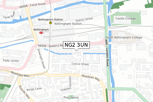
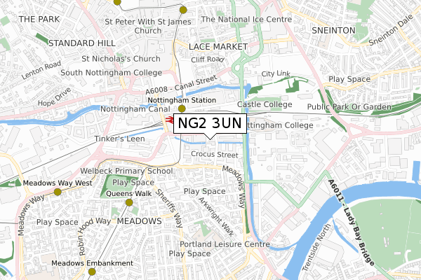
NG2 3UN maps


Source: OS Open Zoomstack (Ordnance Survey)
Licence: Open Government Licence (requires attribution)
Attribution: Contains OS data © Crown copyright and database right 2025
Source: Open Postcode Geo
Licence: Open Government Licence (requires attribution)
Attribution: Contains OS data © Crown copyright and database right 2025; Contains Royal Mail data © Royal Mail copyright and database right 2025; Source: Office for National Statistics licensed under the Open Government Licence v.3.0
Licence: Open Government Licence (requires attribution)
Attribution: Contains OS data © Crown copyright and database right 2025
Source: Open Postcode Geo
Licence: Open Government Licence (requires attribution)
Attribution: Contains OS data © Crown copyright and database right 2025; Contains Royal Mail data © Royal Mail copyright and database right 2025; Source: Office for National Statistics licensed under the Open Government Licence v.3.0
NG2 3UN geodata
| Easting | 457677 |
| Northing | 339085 |
| Latitude | 52.946080 |
| Longitude | -1.143095 |
Where is NG2 3UN?
| Country | England |
| Postcode District | NG2 |
Politics
| Ward | Meadows |
|---|---|
| Constituency | Nottingham South |
Transport
Nearest bus stops to NG2 3UN
| Lammas Gardens (Meadows Way) | Meadows | 153m |
| London Road Temporary (Meadows Way) | Nottingham | 169m |
| Lammas Gardens (Meadows Way) | Meadows | 178m |
| Ticket Office (Station Street) | Meadows | 189m |
| Cycle Facility (Station Street) | Meadows | 202m |
Nearest underground/metro/tram to NG2 3UN
| Nottingham Station Tram Stop (N/A) | Nottingham | 193m |
| Queens Walk Tram Stop (Queens Walk) | Meadows | 613m |
| Lace Market Tram Stop (Fletcher Gate) | Nottingham | 798m |
| Old Market Square Tram Stop (South Parade) | Nottingham | 930m |
| Meadows Way West Tram Stop (Meadows Way) | Meadows | 961m |
Nearest railway stations to NG2 3UN
| Nottingham Station | 0.2km |
| Netherfield Station | 4.6km |
| Carlton Station | 4.8km |
Deprivation
79.4% of English postcodes are less deprived than NG2 3UN:Food Standards Agency
Three nearest food hygiene ratings to NG2 3UN (metres)
Hooters

Block 4 The Hicking Building
75m
Lexington Catering

Holmes Place
169m
Tasty Bites & Biryani Station

1b Arkwright Street
233m
➜ Get more ratings from the Food Standards Agency
Nearest post box to NG2 3UN
| Last Collection | |||
|---|---|---|---|
| Location | Mon-Fri | Sat | Distance |
| Carrington Street | 18:45 | 12:30 | 307m |
| The Meadows Post Office | 17:00 | 12:00 | 347m |
| Eugene Gardens | 18:30 | 12:30 | 349m |
Environment
| Risk of NG2 3UN flooding from rivers and sea | Low |
NG2 3UN ITL and NG2 3UN LAU
The below table lists the International Territorial Level (ITL) codes (formerly Nomenclature of Territorial Units for Statistics (NUTS) codes) and Local Administrative Units (LAU) codes for NG2 3UN:
| ITL 1 Code | Name |
|---|---|
| TLF | East Midlands (England) |
| ITL 2 Code | Name |
| TLF1 | Derbyshire and Nottinghamshire |
| ITL 3 Code | Name |
| TLF14 | Nottingham |
| LAU 1 Code | Name |
| E06000018 | Nottingham |
NG2 3UN census areas
The below table lists the Census Output Area (OA), Lower Layer Super Output Area (LSOA), and Middle Layer Super Output Area (MSOA) for NG2 3UN:
| Code | Name | |
|---|---|---|
| OA | E00173481 | |
| LSOA | E01033400 | Nottingham 039B |
| MSOA | E02006904 | Nottingham 039 |
Nearest postcodes to NG2 3UN
| NG2 3AN | Queens Road | 59m |
| NG2 3AT | Queens Road | 59m |
| NG2 3AS | Queens Road | 66m |
| NG2 3BU | Queens Road | 113m |
| NG2 3BX | Queens Road | 128m |
| NG2 3DT | Queens Road | 136m |
| NG2 3DU | Queens Road | 143m |
| NG2 3BE | Queens Road | 174m |
| NG2 3LB | Lammas Gardens | 224m |
| NG2 3LD | Uppingham Gardens | 228m |