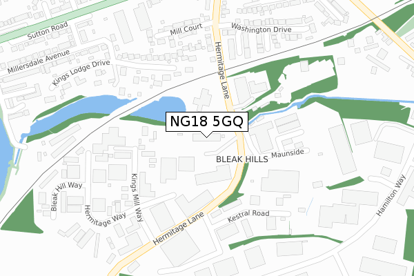
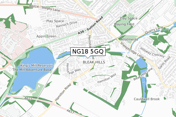
NG18 5GQ is located in the Grange Farm electoral ward, within the local authority district of Mansfield and the English Parliamentary constituency of Mansfield. The Sub Integrated Care Board (ICB) Location is NHS Nottingham and Nottinghamshire ICB - 52R and the police force is Nottinghamshire. This postcode has been in use since January 2018.


GetTheData
Source: OS Open Zoomstack (Ordnance Survey)
Licence: Open Government Licence (requires attribution)
Attribution: Contains OS data © Crown copyright and database right 2024
Source: Open Postcode Geo
Licence: Open Government Licence (requires attribution)
Attribution: Contains OS data © Crown copyright and database right 2024; Contains Royal Mail data © Royal Mail copyright and database right 2024; Source: Office for National Statistics licensed under the Open Government Licence v.3.0
| Easting | 452411 |
| Northing | 359789 |
| Latitude | 53.132711 |
| Longitude | -1.218097 |
GetTheData
Source: Open Postcode Geo
Licence: Open Government Licence
| Country | England |
| Postcode District | NG18 |
| ➜ NG18 open data dashboard ➜ See where NG18 is on a map ➜ Where is Mansfield? | |
GetTheData
Source: Land Registry Price Paid Data
Licence: Open Government Licence
| Ward | Grange Farm |
| Constituency | Mansfield |
GetTheData
Source: ONS Postcode Database
Licence: Open Government Licence
| January 2024 | Burglary | On or near Hermitage Way | 238m |
| January 2024 | Burglary | On or near Hermitage Way | 238m |
| December 2023 | Drugs | On or near Bleak Hill Way | 398m |
| ➜ Get more crime data in our Crime section | |||
GetTheData
Source: data.police.uk
Licence: Open Government Licence
| Bathwood Drive (Sutton Road) | Mansfield | 424m |
| Bathwood Drive (Sutton Road) | Mansfield | 459m |
| Rainbow International (Lower Oakham Way) | Oakham Business Park | 482m |
| Hermitage Lane (Sutton Road) | Mansfield | 490m |
| Hermitage Lane (Sutton Road) | Mansfield | 534m |
| Mansfield Station | 1.7km |
| Sutton Parkway Station | 2.8km |
| Mansfield Woodhouse Station | 3.6km |
GetTheData
Source: NaPTAN
Licence: Open Government Licence
GetTheData
Source: ONS Postcode Database
Licence: Open Government Licence


➜ Get more ratings from the Food Standards Agency
GetTheData
Source: Food Standards Agency
Licence: FSA terms & conditions
| Last Collection | |||
|---|---|---|---|
| Location | Mon-Fri | Sat | Distance |
| Sheepbridge Lane | 17:15 | 11:00 | 721m |
| Kings Mill Hospital | 17:00 | 11:00 | 921m |
| Moor Lane | 17:30 | 11:00 | 934m |
GetTheData
Source: Dracos
Licence: Creative Commons Attribution-ShareAlike
| Facility | Distance |
|---|---|
| Sutton Road Primary And Nursery School Moor Lane, Mansfield Grass Pitches | 1km |
| Dw Fitness First (Mansfield) (Closed) Midland Way, Mansfield Health and Fitness Gym, Swimming Pool, Studio | 1.1km |
| World Physiques Gym Botany Commercial Centre, Botany Avenue, Mansfield Health and Fitness Gym | 1.2km |
GetTheData
Source: Active Places
Licence: Open Government Licence
| School | Phase of Education | Distance |
|---|---|---|
| Sutton Road Primary School Moor Lane, Mansfield, NG18 5SF | Primary | 950m |
| APTCOO - A Place to Call Our Own Unit 15, Botany Commercial Park, Botany Avenue, Mansfield, NG18 5NF | Not applicable | 1.2km |
| Intake Farm Primary School Armstrong Road, Mansfield, NG19 6JA | Primary | 1.3km |
GetTheData
Source: Edubase
Licence: Open Government Licence
The below table lists the International Territorial Level (ITL) codes (formerly Nomenclature of Territorial Units for Statistics (NUTS) codes) and Local Administrative Units (LAU) codes for NG18 5GQ:
| ITL 1 Code | Name |
|---|---|
| TLF | East Midlands (England) |
| ITL 2 Code | Name |
| TLF1 | Derbyshire and Nottinghamshire |
| ITL 3 Code | Name |
| TLF15 | North Nottinghamshire |
| LAU 1 Code | Name |
| E07000174 | Mansfield |
GetTheData
Source: ONS Postcode Directory
Licence: Open Government Licence
The below table lists the Census Output Area (OA), Lower Layer Super Output Area (LSOA), and Middle Layer Super Output Area (MSOA) for NG18 5GQ:
| Code | Name | |
|---|---|---|
| OA | E00144038 | |
| LSOA | E01028270 | Mansfield 013F |
| MSOA | E02005892 | Mansfield 013 |
GetTheData
Source: ONS Postcode Directory
Licence: Open Government Licence
| NG18 5ER | Kings Mill Way | 149m |
| NG18 5FT | Kestral Road | 230m |
| NG18 5GR | Worsbrough Close | 244m |
| NG18 5GN | Mill Court | 254m |
| NG18 5GZ | Kings Lodge Drive | 260m |
| NG18 5GS | Wellcroft Close | 265m |
| NG18 5HG | The Hermitage | 267m |
| NG18 5HA | Hermitage Lane | 291m |
| NG18 5HB | Hermitage Lane | 299m |
| NG18 5ES | Hermitage Way | 301m |
GetTheData
Source: Open Postcode Geo; Land Registry Price Paid Data
Licence: Open Government Licence