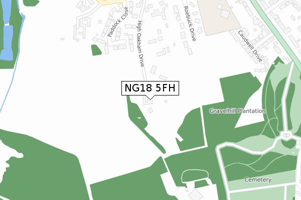
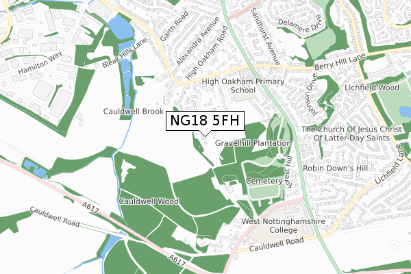
NG18 5FH is located in the Lindhurst electoral ward, within the local authority district of Mansfield and the English Parliamentary constituency of Mansfield. The Sub Integrated Care Board (ICB) Location is NHS Nottingham and Nottinghamshire ICB - 52R and the police force is Nottinghamshire. This postcode has been in use since July 2019.


GetTheData
Source: OS Open Zoomstack (Ordnance Survey)
Licence: Open Government Licence (requires attribution)
Attribution: Contains OS data © Crown copyright and database right 2024
Source: Open Postcode Geo
Licence: Open Government Licence (requires attribution)
Attribution: Contains OS data © Crown copyright and database right 2024; Contains Royal Mail data © Royal Mail copyright and database right 2024; Source: Office for National Statistics licensed under the Open Government Licence v.3.0
| Easting | 453684 |
| Northing | 359046 |
| Latitude | 53.125906 |
| Longitude | -1.199196 |
GetTheData
Source: Open Postcode Geo
Licence: Open Government Licence
| Country | England |
| Postcode District | NG18 |
| ➜ NG18 open data dashboard ➜ See where NG18 is on a map ➜ Where is Mansfield? | |
GetTheData
Source: Land Registry Price Paid Data
Licence: Open Government Licence
| Ward | Lindhurst |
| Constituency | Mansfield |
GetTheData
Source: ONS Postcode Database
Licence: Open Government Licence
GREYSTONE, HIGH OAKHAM PARK, MANSFIELD, NG18 5FH 2021 15 JUN £276,000 |
THE MANOR, HIGH OAKHAM PARK, MANSFIELD, NG18 5FH 2020 11 DEC £397,500 |
THE GATE HOUSE, HIGH OAKHAM PARK, MANSFIELD, NG18 5FH 2019 6 DEC £550,000 |
THE COTTAGE, HIGH OAKHAM PARK, MANSFIELD, NG18 5FH 2019 22 NOV £425,000 |
THE LODGE, HIGH OAKHAM PARK, MANSFIELD, NG18 5FH 2019 27 SEP £423,000 |
GetTheData
Source: HM Land Registry Price Paid Data
Licence: Contains HM Land Registry data © Crown copyright and database right 2024. This data is licensed under the Open Government Licence v3.0.
| June 2022 | Violence and sexual offences | On or near Paddock Close | 286m |
| June 2022 | Burglary | On or near Nottingham Road | 476m |
| April 2022 | Anti-social behaviour | On or near Paddock Close | 286m |
| ➜ Get more crime data in our Crime section | |||
GetTheData
Source: data.police.uk
Licence: Open Government Licence
| Harlow Avenue (Nottingham Road) | High Oakham | 471m |
| Atkin Lane (Nottingham Road) | High Oakham | 509m |
| Harlow Avenue (Nottingham Road) | High Oakham | 517m |
| Forest Hill (Nottingham Road) | Berry Hill | 550m |
| Forest Hill (Nottingham Road) | Berry Hill | 564m |
| Mansfield Station | 1.8km |
| Sutton Parkway Station | 3.4km |
| Mansfield Woodhouse Station | 4.2km |
GetTheData
Source: NaPTAN
Licence: Open Government Licence
| Percentage of properties with Next Generation Access | 100.0% |
| Percentage of properties with Superfast Broadband | 100.0% |
| Percentage of properties with Ultrafast Broadband | 100.0% |
| Percentage of properties with Full Fibre Broadband | 100.0% |
Superfast Broadband is between 30Mbps and 300Mbps
Ultrafast Broadband is > 300Mbps
| Percentage of properties unable to receive 2Mbps | 0.0% |
| Percentage of properties unable to receive 5Mbps | 0.0% |
| Percentage of properties unable to receive 10Mbps | 0.0% |
| Percentage of properties unable to receive 30Mbps | 0.0% |
GetTheData
Source: Ofcom
Licence: Ofcom Terms of Use (requires attribution)
GetTheData
Source: ONS Postcode Database
Licence: Open Government Licence


➜ Get more ratings from the Food Standards Agency
GetTheData
Source: Food Standards Agency
Licence: FSA terms & conditions
| Last Collection | |||
|---|---|---|---|
| Location | Mon-Fri | Sat | Distance |
| Sandhurst Avenue | 17:15 | 11:00 | 925m |
| Sheepbridge Lane | 17:15 | 11:00 | 983m |
| Moor Lane | 17:30 | 11:00 | 1,773m |
GetTheData
Source: Dracos
Licence: Creative Commons Attribution-ShareAlike
| Facility | Distance |
|---|---|
| High Oakham Primary School Nottingham Road, Mansfield Grass Pitches | 469m |
| Vision West Nottinghamshire College Derby Road, Mansfield Sports Hall, Grass Pitches, Artificial Grass Pitch, Outdoor Tennis Courts | 698m |
| Anytime Fitness (Mansfield) Nottingham Road, Mansfield Health and Fitness Gym, Studio | 998m |
GetTheData
Source: Active Places
Licence: Open Government Licence
| School | Phase of Education | Distance |
|---|---|---|
| High Oakham Primary School Nottingham Road, Mansfield, NG18 4SH | Primary | 484m |
| West Nottinghamshire College Derby Road, Mansfield, NG18 5BH | 16 plus | 666m |
| King Edward Primary School & Nursery St Andrew Street, Littleworth, Mansfield, NG18 2RG | Primary | 1.5km |
GetTheData
Source: Edubase
Licence: Open Government Licence
The below table lists the International Territorial Level (ITL) codes (formerly Nomenclature of Territorial Units for Statistics (NUTS) codes) and Local Administrative Units (LAU) codes for NG18 5FH:
| ITL 1 Code | Name |
|---|---|
| TLF | East Midlands (England) |
| ITL 2 Code | Name |
| TLF1 | Derbyshire and Nottinghamshire |
| ITL 3 Code | Name |
| TLF15 | North Nottinghamshire |
| LAU 1 Code | Name |
| E07000174 | Mansfield |
GetTheData
Source: ONS Postcode Directory
Licence: Open Government Licence
The below table lists the Census Output Area (OA), Lower Layer Super Output Area (LSOA), and Middle Layer Super Output Area (MSOA) for NG18 5FH:
| Code | Name | |
|---|---|---|
| OA | E00143785 | |
| LSOA | E01028222 | Mansfield 013D |
| MSOA | E02005892 | Mansfield 013 |
GetTheData
Source: ONS Postcode Directory
Licence: Open Government Licence
| NG18 5AL | High Oakham Drive | 171m |
| NG18 5AY | Mayflower Court | 205m |
| NG18 5AS | Paddock Close | 265m |
| NG18 5AW | Roebuck Drive | 275m |
| NG18 5AR | High Oakham Grange | 329m |
| NG18 4SL | Caudwell Drive | 368m |
| NG18 4SJ | Harlow Avenue | 418m |
| NG18 5AN | Atkin Lane | 436m |
| NG18 4SH | Nottingham Road | 448m |
| NG18 4SE | Nottingham Road | 501m |
GetTheData
Source: Open Postcode Geo; Land Registry Price Paid Data
Licence: Open Government Licence