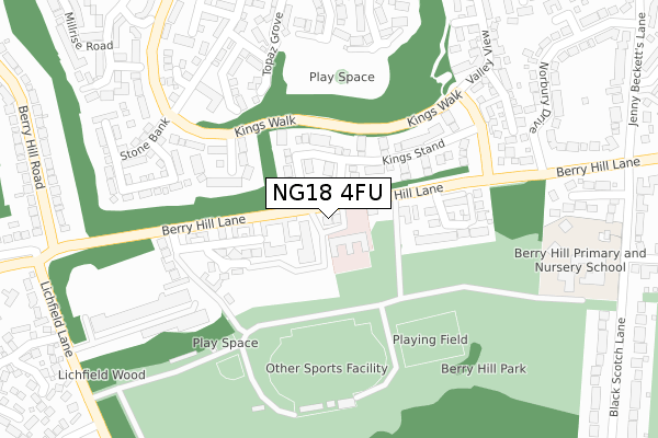
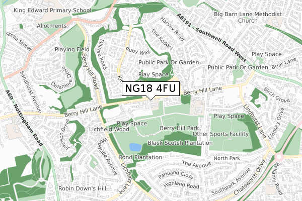
NG18 4FU is located in the Berry Hill electoral ward, within the local authority district of Mansfield and the English Parliamentary constituency of Mansfield. The Sub Integrated Care Board (ICB) Location is NHS Nottingham and Nottinghamshire ICB - 52R and the police force is Nottinghamshire. This postcode has been in use since November 2017.


GetTheData
Source: OS Open Zoomstack (Ordnance Survey)
Licence: Open Government Licence (requires attribution)
Attribution: Contains OS data © Crown copyright and database right 2024
Source: Open Postcode Geo
Licence: Open Government Licence (requires attribution)
Attribution: Contains OS data © Crown copyright and database right 2024; Contains Royal Mail data © Royal Mail copyright and database right 2024; Source: Office for National Statistics licensed under the Open Government Licence v.3.0
| Easting | 455045 |
| Northing | 359595 |
| Latitude | 53.130702 |
| Longitude | -1.178766 |
GetTheData
Source: Open Postcode Geo
Licence: Open Government Licence
| Country | England |
| Postcode District | NG18 |
| ➜ NG18 open data dashboard ➜ See where NG18 is on a map ➜ Where is Mansfield? | |
GetTheData
Source: Land Registry Price Paid Data
Licence: Open Government Licence
| Ward | Berry Hill |
| Constituency | Mansfield |
GetTheData
Source: ONS Postcode Database
Licence: Open Government Licence
| January 2024 | Vehicle crime | On or near Quartz Avenue | 352m |
| April 2023 | Anti-social behaviour | On or near Quartz Avenue | 352m |
| October 2022 | Anti-social behaviour | On or near Quartz Avenue | 352m |
| ➜ Get more crime data in our Crime section | |||
GetTheData
Source: data.police.uk
Licence: Open Government Licence
| Care Home (Berry Hill Lane) | Berry Hill | 16m |
| Care Home (Berry Hill Lane) | Berry Hill | 26m |
| Kings Walk | Berry Hill Quarry | 216m |
| Berry Hill Mews (Berry Hill Lane) | Berry Hill | 266m |
| Berry Hill Mews (Berry Hill Lane) | Berry Hill | 267m |
| Mansfield Station | 1.8km |
| Mansfield Woodhouse Station | 4km |
| Sutton Parkway Station | 4.8km |
GetTheData
Source: NaPTAN
Licence: Open Government Licence
GetTheData
Source: ONS Postcode Database
Licence: Open Government Licence


➜ Get more ratings from the Food Standards Agency
GetTheData
Source: Food Standards Agency
Licence: FSA terms & conditions
| Last Collection | |||
|---|---|---|---|
| Location | Mon-Fri | Sat | Distance |
| Leeming Street | 19:00 | 11:00 | 1,061m |
| Lindhurst Lane | 17:00 | 11:00 | 1,062m |
| Sandhurst Avenue | 17:15 | 11:00 | 1,100m |
GetTheData
Source: Dracos
Licence: Creative Commons Attribution-ShareAlike
| Facility | Distance |
|---|---|
| Berry Hill Park Athletic Track Lichfield Lane, Mansfield Athletics, Grass Pitches | 208m |
| King George V Park Golf Course & Recreation Ground Black Scotch Lane, Mansfield Golf, Grass Pitches | 739m |
| Bannatyne Health Club (Mansfield) Briar Lane, Mansfield Swimming Pool, Health and Fitness Gym, Studio | 936m |
GetTheData
Source: Active Places
Licence: Open Government Licence
| School | Phase of Education | Distance |
|---|---|---|
| Berry Hill Primary School Black Scotch Lane, Mansfield, NG18 4JW | Primary | 473m |
| High Oakham Primary School Nottingham Road, Mansfield, NG18 4SH | Primary | 1.1km |
| St Peter's CofE Primary Academy, Mansfield Bellamy Road, Mansfield, NG18 4LN | Primary | 1.2km |
GetTheData
Source: Edubase
Licence: Open Government Licence
The below table lists the International Territorial Level (ITL) codes (formerly Nomenclature of Territorial Units for Statistics (NUTS) codes) and Local Administrative Units (LAU) codes for NG18 4FU:
| ITL 1 Code | Name |
|---|---|
| TLF | East Midlands (England) |
| ITL 2 Code | Name |
| TLF1 | Derbyshire and Nottinghamshire |
| ITL 3 Code | Name |
| TLF15 | North Nottinghamshire |
| LAU 1 Code | Name |
| E07000174 | Mansfield |
GetTheData
Source: ONS Postcode Directory
Licence: Open Government Licence
The below table lists the Census Output Area (OA), Lower Layer Super Output Area (LSOA), and Middle Layer Super Output Area (MSOA) for NG18 4FU:
| Code | Name | |
|---|---|---|
| OA | E00143782 | |
| LSOA | E01028219 | Mansfield 013A |
| MSOA | E02005892 | Mansfield 013 |
GetTheData
Source: ONS Postcode Directory
Licence: Open Government Licence
| NG18 4FH | Berry Hill Lane | 47m |
| NG18 4FJ | Berry Hill Lane | 68m |
| NG18 4FT | Berry Hill Lane | 90m |
| NG18 4FZ | Berry Hill Lane | 103m |
| NG18 4AY | Kings Stand | 111m |
| NG18 4GY | Berry Hill Mews | 169m |
| NG18 4XY | Bloomsbury Gardens | 185m |
| NG18 4AT | Quarry Bank | 187m |
| NG18 4XF | Amethyst Gardens | 257m |
| NG18 4QG | Bank End Close | 258m |
GetTheData
Source: Open Postcode Geo; Land Registry Price Paid Data
Licence: Open Government Licence