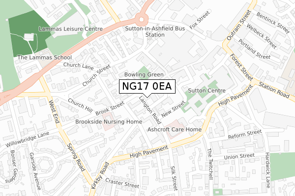
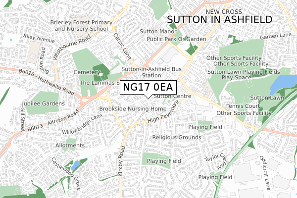
NG17 0EA is located in the Sutton Central & New Cross electoral ward, within the local authority district of Ashfield and the English Parliamentary constituency of Ashfield. The Sub Integrated Care Board (ICB) Location is NHS Nottingham and Nottinghamshire ICB - 52R and the police force is Nottinghamshire. This postcode has been in use since October 2017.


GetTheData
Source: OS Open Zoomstack (Ordnance Survey)
Licence: Open Government Licence (requires attribution)
Attribution: Contains OS data © Crown copyright and database right 2024
Source: Open Postcode Geo
Licence: Open Government Licence (requires attribution)
Attribution: Contains OS data © Crown copyright and database right 2024; Contains Royal Mail data © Royal Mail copyright and database right 2024; Source: Office for National Statistics licensed under the Open Government Licence v.3.0
| Easting | 449345 |
| Northing | 358750 |
| Latitude | 53.123664 |
| Longitude | -1.264078 |
GetTheData
Source: Open Postcode Geo
Licence: Open Government Licence
| Country | England |
| Postcode District | NG17 |
| ➜ NG17 open data dashboard ➜ See where NG17 is on a map ➜ Where is Sutton in Ashfield? | |
GetTheData
Source: Land Registry Price Paid Data
Licence: Open Government Licence
| Ward | Sutton Central & New Cross |
| Constituency | Ashfield |
GetTheData
Source: ONS Postcode Database
Licence: Open Government Licence
| January 2024 | Violence and sexual offences | On or near Parking Area | 326m |
| January 2024 | Violence and sexual offences | On or near Parking Area | 326m |
| December 2023 | Other theft | On or near Parking Area | 326m |
| ➜ Get more crime data in our Crime section | |||
GetTheData
Source: data.police.uk
Licence: Open Government Licence
| Silk Street (High Pavement) | Sutton In Ashfield | 183m |
| Silk Street (High Pavement) | Sutton In Ashfield | 198m |
| Church Hill (Brook Street) | Sutton In Ashfield | 213m |
| High Pavement | Sutton In Ashfield | 230m |
| Lammas Road | Sutton In Ashfield | 266m |
| Sutton Parkway Station | 1.6km |
| Kirkby in Ashfield Station | 2.7km |
| Mansfield Station | 4.8km |
GetTheData
Source: NaPTAN
Licence: Open Government Licence
GetTheData
Source: ONS Postcode Database
Licence: Open Government Licence


➜ Get more ratings from the Food Standards Agency
GetTheData
Source: Food Standards Agency
Licence: FSA terms & conditions
| Last Collection | |||
|---|---|---|---|
| Location | Mon-Fri | Sat | Distance |
| Langton Road Delivery Office | 18:30 | 11:00 | 11m |
| Sutton In Ashfield D O | 14m | ||
| Portland Square | 18:30 | 11:00 | 276m |
GetTheData
Source: Dracos
Licence: Creative Commons Attribution-ShareAlike
| Facility | Distance |
|---|---|
| Sutton Community Academy Sutton Centre, High Pavement, Sutton-in-ashfield Sports Hall, Squash Courts, Health and Fitness Gym, Studio | 187m |
| Sutton Pools Complex (Closed) Brook Street, Sutton-in-ashfield Swimming Pool, Health and Fitness Gym | 201m |
| Lammas Leisure Centre Lammas Road, Sutton-in-ashfield Swimming Pool, Sports Hall, Ice Rinks, Indoor Bowls, Health and Fitness Gym, Squash Courts, Studio | 357m |
GetTheData
Source: Active Places
Licence: Open Government Licence
| School | Phase of Education | Distance |
|---|---|---|
| Sutton Community Academy High Pavement, Sutton-in-Ashfield, NG17 1EE | Secondary | 233m |
| Croft Primary School Station Road, Sutton-in-Ashfield, NG17 5FJ | Primary | 521m |
| Priestsic Primary and Nursery School Park Street, Sutton-in-Ashfield, NG17 4BB | Primary | 644m |
GetTheData
Source: Edubase
Licence: Open Government Licence
The below table lists the International Territorial Level (ITL) codes (formerly Nomenclature of Territorial Units for Statistics (NUTS) codes) and Local Administrative Units (LAU) codes for NG17 0EA:
| ITL 1 Code | Name |
|---|---|
| TLF | East Midlands (England) |
| ITL 2 Code | Name |
| TLF1 | Derbyshire and Nottinghamshire |
| ITL 3 Code | Name |
| TLF15 | North Nottinghamshire |
| LAU 1 Code | Name |
| E07000170 | Ashfield |
GetTheData
Source: ONS Postcode Directory
Licence: Open Government Licence
The below table lists the Census Output Area (OA), Lower Layer Super Output Area (LSOA), and Middle Layer Super Output Area (MSOA) for NG17 0EA:
| Code | Name | |
|---|---|---|
| OA | E00142547 | |
| LSOA | E01027976 | Ashfield 005E |
| MSOA | E02005823 | Ashfield 005 |
GetTheData
Source: ONS Postcode Directory
Licence: Open Government Licence
| NG17 1AL | Brook Street | 42m |
| NG17 1AQ | Market Place | 45m |
| NG17 1EP | Brookhill Court | 61m |
| NG17 1BW | New Street | 73m |
| NG17 1EQ | Langton Court | 76m |
| NG17 1AN | Morven Avenue | 85m |
| NG17 1EJ | Kensington Close | 119m |
| NG17 1EU | Titchfield Avenue | 132m |
| NG17 1AE | Church Street | 141m |
| NG17 1AB | Mill Street | 145m |
GetTheData
Source: Open Postcode Geo; Land Registry Price Paid Data
Licence: Open Government Licence