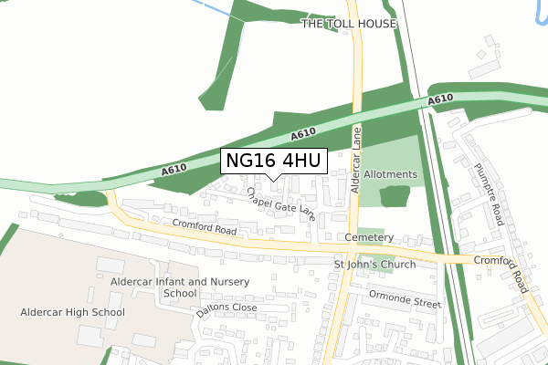
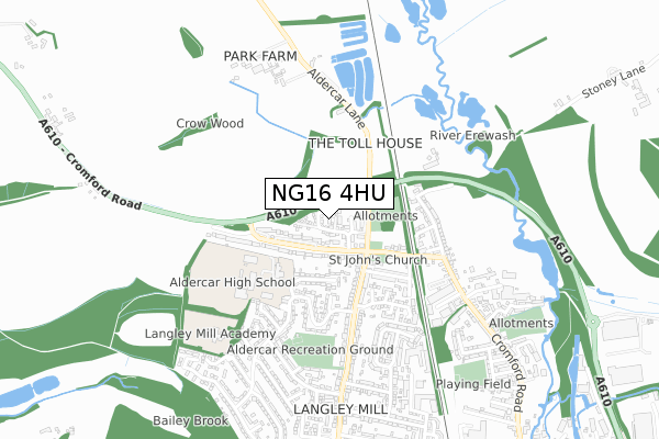
NG16 4HU is located in the Codnor, Langley Mill & Aldercar electoral ward, within the local authority district of Amber Valley and the English Parliamentary constituency of Amber Valley. The Sub Integrated Care Board (ICB) Location is NHS Derby and Derbyshire ICB - 15M and the police force is Derbyshire. This postcode has been in use since April 2019.


GetTheData
Source: OS Open Zoomstack (Ordnance Survey)
Licence: Open Government Licence (requires attribution)
Attribution: Contains OS data © Crown copyright and database right 2024
Source: Open Postcode Geo
Licence: Open Government Licence (requires attribution)
Attribution: Contains OS data © Crown copyright and database right 2024; Contains Royal Mail data © Royal Mail copyright and database right 2024; Source: Office for National Statistics licensed under the Open Government Licence v.3.0
| Easting | 444492 |
| Northing | 348057 |
| Latitude | 53.027977 |
| Longitude | -1.338066 |
GetTheData
Source: Open Postcode Geo
Licence: Open Government Licence
| Country | England |
| Postcode District | NG16 |
| ➜ NG16 open data dashboard ➜ See where NG16 is on a map ➜ Where is Heanor? | |
GetTheData
Source: Land Registry Price Paid Data
Licence: Open Government Licence
| Ward | Codnor, Langley Mill & Aldercar |
| Constituency | Amber Valley |
GetTheData
Source: ONS Postcode Database
Licence: Open Government Licence
2023 3 MAR £370,000 |
4, OAKES CLOSE, LANGLEY MILL, NOTTINGHAM, NG16 4HU 2020 28 AUG £288,950 |
5, OAKES CLOSE, LANGLEY MILL, NOTTINGHAM, NG16 4HU 2020 10 JUL £254,950 |
6, OAKES CLOSE, LANGLEY MILL, NOTTINGHAM, NG16 4HU 2020 22 MAY £254,950 |
2020 6 MAR £304,950 |
2, OAKES CLOSE, LANGLEY MILL, NOTTINGHAM, NG16 4HU 2020 28 FEB £290,000 |
3, OAKES CLOSE, LANGLEY MILL, NOTTINGHAM, NG16 4HU 2020 31 JAN £274,950 |
1, OAKES CLOSE, LANGLEY MILL, NOTTINGHAM, NG16 4HU 2019 26 APR £234,950 |
GetTheData
Source: HM Land Registry Price Paid Data
Licence: Contains HM Land Registry data © Crown copyright and database right 2024. This data is licensed under the Open Government Licence v3.0.
| June 2022 | Violence and sexual offences | On or near Daltons Close | 252m |
| June 2022 | Violence and sexual offences | On or near Daltons Close | 252m |
| June 2022 | Anti-social behaviour | On or near Ormonde Street | 295m |
| ➜ Get more crime data in our Crime section | |||
GetTheData
Source: data.police.uk
Licence: Open Government Licence
| Church (Upper Dunstead Road) | Aldercar | 207m |
| Church (Upper Dunstead Road) | Aldercar | 211m |
| Homestead (Godkin Drive) | Aldercar | 355m |
| College (Gregory Avenue) | Aldercar | 365m |
| Godkin Drive (Upper Dunstead Road) | Aldercar | 372m |
| Langley Mill Station | 1.2km |
GetTheData
Source: NaPTAN
Licence: Open Government Licence
| Percentage of properties with Next Generation Access | 100.0% |
| Percentage of properties with Superfast Broadband | 100.0% |
| Percentage of properties with Ultrafast Broadband | 100.0% |
| Percentage of properties with Full Fibre Broadband | 100.0% |
Superfast Broadband is between 30Mbps and 300Mbps
Ultrafast Broadband is > 300Mbps
| Percentage of properties unable to receive 2Mbps | 0.0% |
| Percentage of properties unable to receive 5Mbps | 0.0% |
| Percentage of properties unable to receive 10Mbps | 0.0% |
| Percentage of properties unable to receive 30Mbps | 0.0% |
GetTheData
Source: Ofcom
Licence: Ofcom Terms of Use (requires attribution)
GetTheData
Source: ONS Postcode Database
Licence: Open Government Licence


➜ Get more ratings from the Food Standards Agency
GetTheData
Source: Food Standards Agency
Licence: FSA terms & conditions
| Last Collection | |||
|---|---|---|---|
| Location | Mon-Fri | Sat | Distance |
| Cromford Road | 17:30 | 11:30 | 520m |
| Dunstead Road | 17:30 | 11:45 | 578m |
| Gregory Avenue | 17:30 | 11:45 | 759m |
GetTheData
Source: Dracos
Licence: Creative Commons Attribution-ShareAlike
| Facility | Distance |
|---|---|
| Aldercar High School Daltons Close, Langley Mill, Nottingham Sports Hall, Grass Pitches, Artificial Grass Pitch, Health and Fitness Gym | 372m |
| Aldercar Recreation Ground Andrews Drive, Langley Mill, Nottingham Grass Pitches | 522m |
| Langley Mill Academy Bailey Brook Crescent, Langley Mill, Nottingham Grass Pitches | 634m |
GetTheData
Source: Active Places
Licence: Open Government Licence
| School | Phase of Education | Distance |
|---|---|---|
| Aldercar Infant School Godkin Drive, Langley Mill, Nottingham, NG16 4GL | Primary | 302m |
| Aldercar High School Daltons Close, Langley Mill, Nottingham, NG16 4HL | Secondary | 381m |
| Langley Mill Academy Bailey Brook Crescent, Langley Mill, Nottingham, NG16 4FZ | Primary | 634m |
GetTheData
Source: Edubase
Licence: Open Government Licence
The below table lists the International Territorial Level (ITL) codes (formerly Nomenclature of Territorial Units for Statistics (NUTS) codes) and Local Administrative Units (LAU) codes for NG16 4HU:
| ITL 1 Code | Name |
|---|---|
| TLF | East Midlands (England) |
| ITL 2 Code | Name |
| TLF1 | Derbyshire and Nottinghamshire |
| ITL 3 Code | Name |
| TLF13 | South and West Derbyshire |
| LAU 1 Code | Name |
| E07000032 | Amber Valley |
GetTheData
Source: ONS Postcode Directory
Licence: Open Government Licence
The below table lists the Census Output Area (OA), Lower Layer Super Output Area (LSOA), and Middle Layer Super Output Area (MSOA) for NG16 4HU:
| Code | Name | |
|---|---|---|
| OA | E00098378 | |
| LSOA | E01019451 | Amber Valley 012D |
| MSOA | E02004040 | Amber Valley 012 |
GetTheData
Source: ONS Postcode Directory
Licence: Open Government Licence
| NG16 4HB | Cromford Road | 153m |
| NG16 4HA | Cromford Road | 203m |
| NG16 4GP | Daltons Close | 233m |
| NG16 4FD | Cromford Road | 266m |
| NG16 4GQ | Upper Dunstead Road | 280m |
| NG16 4FE | Cromford Road | 291m |
| NG16 4FH | Upper Dunstead Road | 292m |
| NG16 4FF | Ormonde Street | 316m |
| NG16 4GN | Homestead | 321m |
| NG16 4GW | Julius Close | 334m |
GetTheData
Source: Open Postcode Geo; Land Registry Price Paid Data
Licence: Open Government Licence