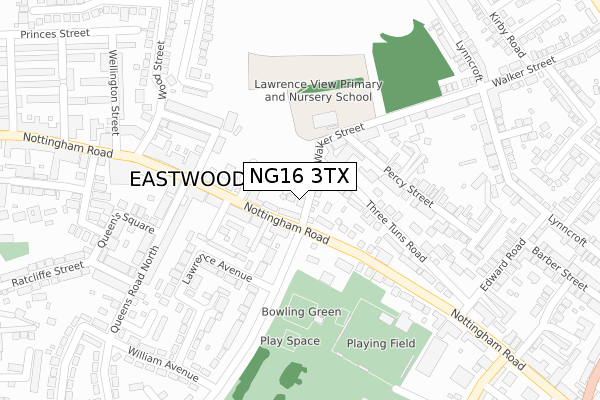
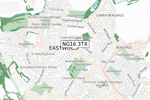
NG16 3TX is located in the Eastwood Hilltop electoral ward, within the local authority district of Broxtowe and the English Parliamentary constituency of Ashfield. The Sub Integrated Care Board (ICB) Location is NHS Nottingham and Nottinghamshire ICB - 52R and the police force is Nottinghamshire. This postcode has been in use since August 2018.


GetTheData
Source: OS Open Zoomstack (Ordnance Survey)
Licence: Open Government Licence (requires attribution)
Attribution: Contains OS data © Crown copyright and database right 2024
Source: Open Postcode Geo
Licence: Open Government Licence (requires attribution)
Attribution: Contains OS data © Crown copyright and database right 2024; Contains Royal Mail data © Royal Mail copyright and database right 2024; Source: Office for National Statistics licensed under the Open Government Licence v.3.0
| Easting | 447070 |
| Northing | 346866 |
| Latitude | 53.017052 |
| Longitude | -1.299805 |
GetTheData
Source: Open Postcode Geo
Licence: Open Government Licence
| Country | England |
| Postcode District | NG16 |
| ➜ NG16 open data dashboard ➜ See where NG16 is on a map ➜ Where is Eastwood? | |
GetTheData
Source: Land Registry Price Paid Data
Licence: Open Government Licence
| Ward | Eastwood Hilltop |
| Constituency | Ashfield |
GetTheData
Source: ONS Postcode Database
Licence: Open Government Licence
| January 2024 | Vehicle crime | On or near Parking Area | 166m |
| January 2024 | Violence and sexual offences | On or near King Street | 175m |
| January 2024 | Shoplifting | On or near Parking Area | 335m |
| ➜ Get more crime data in our Crime section | |||
GetTheData
Source: data.police.uk
Licence: Open Government Licence
| Library (Nottingham Road) | Eastwood | 124m |
| Lawrence Avenue (Plumptre Way) | Eastwood | 124m |
| Lawrence Avenue (Plumptre Way) | Eastwood | 126m |
| Library (Nottingham Road) | Eastwood | 147m |
| Edwards Road (Nottingham Road) | Eastwood | 226m |
| Langley Mill Station | 2.1km |
| Ilkeston Station | 4.2km |
GetTheData
Source: NaPTAN
Licence: Open Government Licence
➜ Broadband speed and availability dashboard for NG16 3TX
| Percentage of properties with Next Generation Access | 100.0% |
| Percentage of properties with Superfast Broadband | 100.0% |
| Percentage of properties with Ultrafast Broadband | 0.0% |
| Percentage of properties with Full Fibre Broadband | 0.0% |
Superfast Broadband is between 30Mbps and 300Mbps
Ultrafast Broadband is > 300Mbps
| Median download speed | 39.5Mbps |
| Average download speed | 35.0Mbps |
| Maximum download speed | 67.54Mbps |
| Median upload speed | 9.9Mbps |
| Average upload speed | 8.4Mbps |
| Maximum upload speed | 19.53Mbps |
| Percentage of properties unable to receive 2Mbps | 0.0% |
| Percentage of properties unable to receive 5Mbps | 0.0% |
| Percentage of properties unable to receive 10Mbps | 0.0% |
| Percentage of properties unable to receive 30Mbps | 0.0% |
➜ Broadband speed and availability dashboard for NG16 3TX
GetTheData
Source: Ofcom
Licence: Ofcom Terms of Use (requires attribution)
GetTheData
Source: ONS Postcode Database
Licence: Open Government Licence


➜ Get more ratings from the Food Standards Agency
GetTheData
Source: Food Standards Agency
Licence: FSA terms & conditions
| Last Collection | |||
|---|---|---|---|
| Location | Mon-Fri | Sat | Distance |
| Eastwood Post Office | 17:30 | 12:30 | 200m |
| Eastwood Post Office | 17:30 | 12:30 | 200m |
| Lynncroft | 17:30 | 11:30 | 370m |
GetTheData
Source: Dracos
Licence: Creative Commons Attribution-ShareAlike
| Facility | Distance |
|---|---|
| Halbrooke Stadium Chewton Street, Eastwood Artificial Grass Pitch | 272m |
| Coronation Park (Eastwood) Plumptre Way, Eastwood Grass Pitches | 328m |
| The Florence Nightingale School Chewton Street, Eastwood, Nottingham Grass Pitches | 446m |
GetTheData
Source: Active Places
Licence: Open Government Licence
| School | Phase of Education | Distance |
|---|---|---|
| Lawrence View Primary and Nursery School Walker Street, Eastwood, Nottingham, NG16 3FP | Primary | 184m |
| The Florence Nightingale Academy Chewton Street, Eastwood, Nottingham, NG16 3HB | Primary | 514m |
| The Priory Catholic Voluntary Academy Raglan Street, Hill Top, Eastwood, Nottingham, NG16 3GT | Primary | 595m |
GetTheData
Source: Edubase
Licence: Open Government Licence
The below table lists the International Territorial Level (ITL) codes (formerly Nomenclature of Territorial Units for Statistics (NUTS) codes) and Local Administrative Units (LAU) codes for NG16 3TX:
| ITL 1 Code | Name |
|---|---|
| TLF | East Midlands (England) |
| ITL 2 Code | Name |
| TLF1 | Derbyshire and Nottinghamshire |
| ITL 3 Code | Name |
| TLF16 | South Nottinghamshire |
| LAU 1 Code | Name |
| E07000172 | Broxtowe |
GetTheData
Source: ONS Postcode Directory
Licence: Open Government Licence
The below table lists the Census Output Area (OA), Lower Layer Super Output Area (LSOA), and Middle Layer Super Output Area (MSOA) for NG16 3TX:
| Code | Name | |
|---|---|---|
| OA | E00143251 | |
| LSOA | E01028112 | Broxtowe 002C |
| MSOA | E02005851 | Broxtowe 002 |
GetTheData
Source: ONS Postcode Directory
Licence: Open Government Licence
| NG16 3GH | Nottingham Road | 44m |
| NG16 3GG | Nottingham Road | 66m |
| NG16 3EH | Walker Street | 88m |
| NG16 3EJ | Three Tuns Road | 160m |
| NG16 3GD | Nottingham Road | 163m |
| NG16 3DA | King Street | 168m |
| NG16 3GJ | Nottingham Road | 169m |
| NG16 3LQ | Plumptre Way | 206m |
| NG16 3EP | Percy Street | 206m |
| NG16 3LD | Lawrence Avenue | 220m |
GetTheData
Source: Open Postcode Geo; Land Registry Price Paid Data
Licence: Open Government Licence