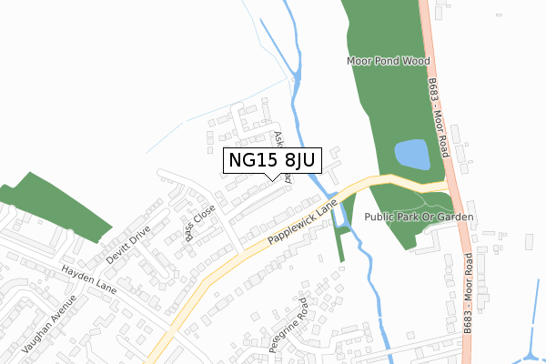
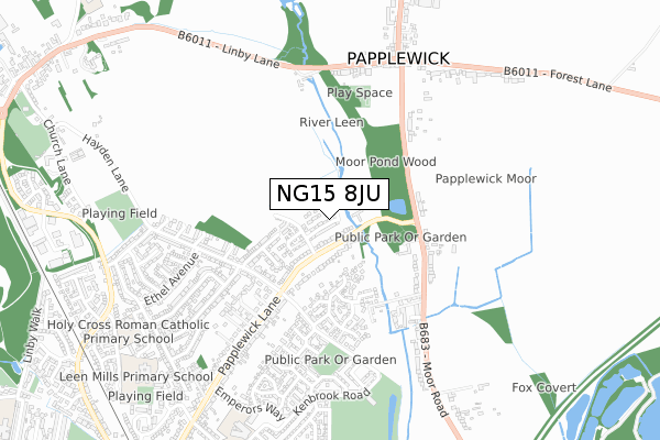
NG15 8JU is located in the Newstead Abbey electoral ward, within the local authority district of Gedling and the English Parliamentary constituency of Sherwood. The Sub Integrated Care Board (ICB) Location is NHS Nottingham and Nottinghamshire ICB - 52R and the police force is Nottinghamshire. This postcode has been in use since January 2019.


GetTheData
Source: OS Open Zoomstack (Ordnance Survey)
Licence: Open Government Licence (requires attribution)
Attribution: Contains OS data © Crown copyright and database right 2024
Source: Open Postcode Geo
Licence: Open Government Licence (requires attribution)
Attribution: Contains OS data © Crown copyright and database right 2024; Contains Royal Mail data © Royal Mail copyright and database right 2024; Source: Office for National Statistics licensed under the Open Government Licence v.3.0
| Easting | 454589 |
| Northing | 350463 |
| Latitude | 53.048670 |
| Longitude | -1.187127 |
GetTheData
Source: Open Postcode Geo
Licence: Open Government Licence
| Country | England |
| Postcode District | NG15 |
| ➜ NG15 open data dashboard ➜ See where NG15 is on a map ➜ Where is Hucknall? | |
GetTheData
Source: Land Registry Price Paid Data
Licence: Open Government Licence
| Ward | Newstead Abbey |
| Constituency | Sherwood |
GetTheData
Source: ONS Postcode Database
Licence: Open Government Licence
2022 13 MAY £365,000 |
74, ASKEW ROAD, LINBY, NOTTINGHAM, NG15 8JU 2020 18 DEC £350,000 |
57, ASKEW ROAD, LINBY, NOTTINGHAM, NG15 8JU 2020 7 DEC £349,500 |
86, ASKEW ROAD, LINBY, NOTTINGHAM, NG15 8JU 2020 1 DEC £358,500 |
63, ASKEW ROAD, LINBY, NOTTINGHAM, NG15 8JU 2020 27 NOV £350,000 |
82, ASKEW ROAD, LINBY, NOTTINGHAM, NG15 8JU 2020 30 OCT £365,000 |
61, ASKEW ROAD, LINBY, NOTTINGHAM, NG15 8JU 2020 23 OCT £327,500 |
80, ASKEW ROAD, LINBY, NOTTINGHAM, NG15 8JU 2020 12 OCT £365,000 |
84, ASKEW ROAD, LINBY, NOTTINGHAM, NG15 8JU 2020 2 OCT £402,500 |
2020 18 SEP £325,000 |
GetTheData
Source: HM Land Registry Price Paid Data
Licence: Contains HM Land Registry data © Crown copyright and database right 2024. This data is licensed under the Open Government Licence v3.0.
| June 2022 | Violence and sexual offences | On or near Falcon Way | 363m |
| May 2022 | Other theft | On or near Papplewick Lane | 172m |
| May 2022 | Public order | On or near Peregrine Road | 352m |
| ➜ Get more crime data in our Crime section | |||
GetTheData
Source: data.police.uk
Licence: Open Government Licence
| Papplewick Lane | Vaughan Estate | 91m |
| Papplewick Lane | Vaughan Estate | 100m |
| Papplewick Lane | Vaughan Estate | 258m |
| Papplewick Lane | Vaughan Estate | 269m |
| Hayden Lane | Vaughan Estate | 310m |
| Hucknall Tram Stop (Station Road) | Hucknall | 1,292m |
| Hucknall Station | 1.3km |
| Newstead Station | 3.3km |
GetTheData
Source: NaPTAN
Licence: Open Government Licence
| Percentage of properties with Next Generation Access | 100.0% |
| Percentage of properties with Superfast Broadband | 100.0% |
| Percentage of properties with Ultrafast Broadband | 100.0% |
| Percentage of properties with Full Fibre Broadband | 100.0% |
Superfast Broadband is between 30Mbps and 300Mbps
Ultrafast Broadband is > 300Mbps
| Percentage of properties unable to receive 2Mbps | 0.0% |
| Percentage of properties unable to receive 5Mbps | 0.0% |
| Percentage of properties unable to receive 10Mbps | 0.0% |
| Percentage of properties unable to receive 30Mbps | 0.0% |
GetTheData
Source: Ofcom
Licence: Ofcom Terms of Use (requires attribution)
GetTheData
Source: ONS Postcode Database
Licence: Open Government Licence

➜ Get more ratings from the Food Standards Agency
GetTheData
Source: Food Standards Agency
Licence: FSA terms & conditions
| Last Collection | |||
|---|---|---|---|
| Location | Mon-Fri | Sat | Distance |
| Moor Road | 17:00 | 12:00 | 318m |
| Hayden Lane Post Office | 17:00 | 12:15 | 472m |
| Main Street | 17:00 | 12:00 | 706m |
GetTheData
Source: Dracos
Licence: Creative Commons Attribution-ShareAlike
| Facility | Distance |
|---|---|
| Leen Pavilion And Playing Fields Kenbrook Road, Kenbrook Road, Hucknall Grass Pitches | 699m |
| Hucknall Cricket Club Hayden Lane, Hucknall Grass Pitches | 774m |
| Holy Cross Catholic Primary School Leen Mills Lane, Hucknall, Nottingham Grass Pitches | 834m |
GetTheData
Source: Active Places
Licence: Open Government Licence
| School | Phase of Education | Distance |
|---|---|---|
| Holy Cross Primary Catholic Voluntary Academy Leen Mills Lane, Hucknall, Nottingham, NG15 8BZ | Primary | 848m |
| Beardall Fields Primary and Nursery School Kenbrook Road, Hucknall, Nottingham, NG15 8HY | Primary | 855m |
| Leen Mills Primary School Leen Mills Lane, Vaughan Estate, Hucknall, Nottingham, NG15 8BZ | Primary | 876m |
GetTheData
Source: Edubase
Licence: Open Government Licence
The below table lists the International Territorial Level (ITL) codes (formerly Nomenclature of Territorial Units for Statistics (NUTS) codes) and Local Administrative Units (LAU) codes for NG15 8JU:
| ITL 1 Code | Name |
|---|---|
| TLF | East Midlands (England) |
| ITL 2 Code | Name |
| TLF1 | Derbyshire and Nottinghamshire |
| ITL 3 Code | Name |
| TLF16 | South Nottinghamshire |
| LAU 1 Code | Name |
| E07000173 | Gedling |
GetTheData
Source: ONS Postcode Directory
Licence: Open Government Licence
The below table lists the Census Output Area (OA), Lower Layer Super Output Area (LSOA), and Middle Layer Super Output Area (MSOA) for NG15 8JU:
| Code | Name | |
|---|---|---|
| OA | E00143626 | |
| LSOA | E01028189 | Gedling 001A |
| MSOA | E02005865 | Gedling 001 |
GetTheData
Source: ONS Postcode Directory
Licence: Open Government Licence
| NG15 8EJ | Papplewick Lane | 108m |
| NG15 8EL | Papplewick Lane | 130m |
| NG15 8EH | Papplewick Lane | 160m |
| NG15 8BN | Christine Close | 228m |
| NG15 8HF | Peregrine Road | 246m |
| NG15 8BL | Devitt Drive | 273m |
| NG15 8BH | Hayden Lane | 305m |
| NG15 8FA | Grange Cottages | 329m |
| NG15 8HG | Osprey Grove | 331m |
| NG15 8HN | Hobben Crescent | 338m |
GetTheData
Source: Open Postcode Geo; Land Registry Price Paid Data
Licence: Open Government Licence