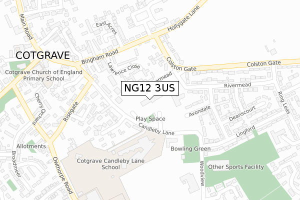
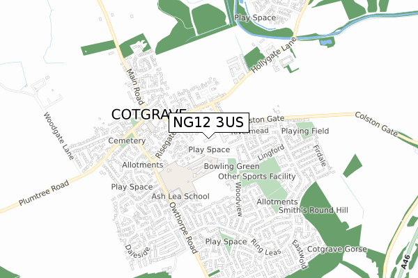
NG12 3US is located in the Cotgrave electoral ward, within the local authority district of Rushcliffe and the English Parliamentary constituency of Rushcliffe. The Sub Integrated Care Board (ICB) Location is NHS Nottingham and Nottinghamshire ICB - 52R and the police force is Nottinghamshire. This postcode has been in use since June 2018.


GetTheData
Source: OS Open Zoomstack (Ordnance Survey)
Licence: Open Government Licence (requires attribution)
Attribution: Contains OS data © Crown copyright and database right 2024
Source: Open Postcode Geo
Licence: Open Government Licence (requires attribution)
Attribution: Contains OS data © Crown copyright and database right 2024; Contains Royal Mail data © Royal Mail copyright and database right 2024; Source: Office for National Statistics licensed under the Open Government Licence v.3.0
| Easting | 464841 |
| Northing | 335231 |
| Latitude | 52.910626 |
| Longitude | -1.037264 |
GetTheData
Source: Open Postcode Geo
Licence: Open Government Licence
| Country | England |
| Postcode District | NG12 |
| ➜ NG12 open data dashboard ➜ See where NG12 is on a map ➜ Where is Cotgrave? | |
GetTheData
Source: Land Registry Price Paid Data
Licence: Open Government Licence
| Ward | Cotgrave |
| Constituency | Rushcliffe |
GetTheData
Source: ONS Postcode Database
Licence: Open Government Licence
| January 2024 | Violence and sexual offences | On or near Cartbridge | 457m |
| September 2023 | Other theft | On or near Parking Area | 57m |
| August 2023 | Violence and sexual offences | On or near Cartbridge | 457m |
| ➜ Get more crime data in our Crime section | |||
GetTheData
Source: data.police.uk
Licence: Open Government Licence
| Candleby Lane | Cotgrave | 121m |
| Candleby Lane | Cotgrave | 123m |
| East Acres (Bingham Road) | Cotgrave | 189m |
| East Acres (Bingham Road) | Cotgrave | 199m |
| Welfare P & R (Woodview) | Cotgrave | 274m |
| Radcliffe (Notts) Station | 4.2km |
GetTheData
Source: NaPTAN
Licence: Open Government Licence
GetTheData
Source: ONS Postcode Database
Licence: Open Government Licence


➜ Get more ratings from the Food Standards Agency
GetTheData
Source: Food Standards Agency
Licence: FSA terms & conditions
| Last Collection | |||
|---|---|---|---|
| Location | Mon-Fri | Sat | Distance |
| The Precinct | 17:30 | 10:00 | 93m |
| Rivermead | 17:30 | 11:00 | 296m |
| Owthorpe Road | 17:30 | 10:00 | 358m |
GetTheData
Source: Dracos
Licence: Creative Commons Attribution-ShareAlike
| Facility | Distance |
|---|---|
| Candleby Lane School Candleby Lane, Cotgrave, Nottingham Grass Pitches, Artificial Grass Pitch | 157m |
| Cotgrave Welfare Club Woodview, Cotgrave, Nottingham Grass Pitches | 299m |
| Cotgrave Leisure Centre Woodview, Cotgrave, Nottingham Sports Hall, Swimming Pool, Health and Fitness Gym, Grass Pitches, Studio | 305m |
GetTheData
Source: Active Places
Licence: Open Government Licence
| School | Phase of Education | Distance |
|---|---|---|
| Cotgrave Candleby Lane School Candleby Lane, Cotgrave, Nottingham, NG12 3JG | Primary | 125m |
| Ash Lea School Owthorpe Road, Cotgrave, NG12 3PA | Not applicable | 379m |
| Cotgrave Church of England Primary School The Cross, Cotgrave, Nottingham, NG12 3HS | Primary | 394m |
GetTheData
Source: Edubase
Licence: Open Government Licence
The below table lists the International Territorial Level (ITL) codes (formerly Nomenclature of Territorial Units for Statistics (NUTS) codes) and Local Administrative Units (LAU) codes for NG12 3US:
| ITL 1 Code | Name |
|---|---|
| TLF | East Midlands (England) |
| ITL 2 Code | Name |
| TLF1 | Derbyshire and Nottinghamshire |
| ITL 3 Code | Name |
| TLF16 | South Nottinghamshire |
| LAU 1 Code | Name |
| E07000176 | Rushcliffe |
GetTheData
Source: ONS Postcode Directory
Licence: Open Government Licence
The below table lists the Census Output Area (OA), Lower Layer Super Output Area (LSOA), and Middle Layer Super Output Area (MSOA) for NG12 3US:
| Code | Name | |
|---|---|---|
| OA | E00144557 | |
| LSOA | E01028370 | Rushcliffe 009E |
| MSOA | E02005914 | Rushcliffe 009 |
GetTheData
Source: ONS Postcode Directory
Licence: Open Government Licence
| NG12 3LF | Lawrence Close | 106m |
| NG12 3FY | Candleby Lane | 119m |
| NG12 3JG | Candleby Lane | 134m |
| NG12 3JH | Candleby Close | 176m |
| NG12 3JR | Bingham Road | 182m |
| NG12 3JX | Colston Gate | 184m |
| NG12 3LR | Avondale | 206m |
| NG12 3JU | Chapel Lane | 213m |
| NG12 3LN | Risegate Gardens | 216m |
| NG12 3LA | Woodview | 219m |
GetTheData
Source: Open Postcode Geo; Land Registry Price Paid Data
Licence: Open Government Licence