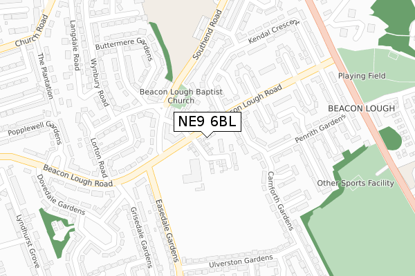
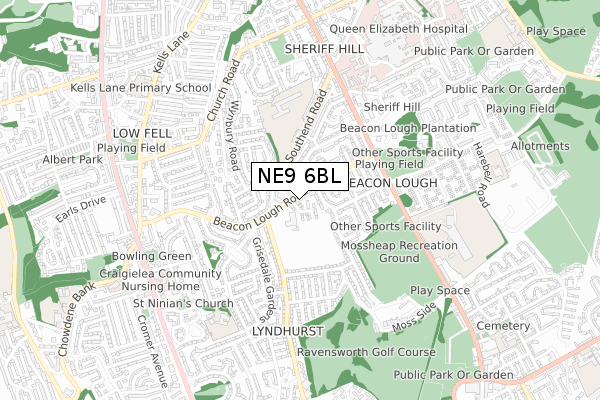
NE9 6BL is located in the High Fell electoral ward, within the metropolitan district of Gateshead and the English Parliamentary constituency of Gateshead. The Sub Integrated Care Board (ICB) Location is NHS North East and North Cumbria ICB - 13T and the police force is Northumbria. This postcode has been in use since January 2020.


GetTheData
Source: OS Open Zoomstack (Ordnance Survey)
Licence: Open Government Licence (requires attribution)
Attribution: Contains OS data © Crown copyright and database right 2024
Source: Open Postcode Geo
Licence: Open Government Licence (requires attribution)
Attribution: Contains OS data © Crown copyright and database right 2024; Contains Royal Mail data © Royal Mail copyright and database right 2024; Source: Office for National Statistics licensed under the Open Government Licence v.3.0
| Easting | 426575 |
| Northing | 559819 |
| Latitude | 54.932354 |
| Longitude | -1.586812 |
GetTheData
Source: Open Postcode Geo
Licence: Open Government Licence
| Country | England |
| Postcode District | NE9 |
| ➜ NE9 open data dashboard ➜ See where NE9 is on a map ➜ Where is Gateshead? | |
GetTheData
Source: Land Registry Price Paid Data
Licence: Open Government Licence
| Ward | High Fell |
| Constituency | Gateshead |
GetTheData
Source: ONS Postcode Database
Licence: Open Government Licence
8, PATTERDALE PLACE, GATESHEAD, NE9 6BL 2020 2 SEP £184,950 |
7, PATTERDALE PLACE, GATESHEAD, NE9 6BL 2020 14 FEB £189,950 |
GetTheData
Source: HM Land Registry Price Paid Data
Licence: Contains HM Land Registry data © Crown copyright and database right 2024. This data is licensed under the Open Government Licence v3.0.
| December 2023 | Public order | On or near Borrowdale Gardens | 382m |
| November 2023 | Criminal damage and arson | On or near Borrowdale Gardens | 382m |
| October 2023 | Violence and sexual offences | On or near Borrowdale Gardens | 382m |
| ➜ Get more crime data in our Crime section | |||
GetTheData
Source: data.police.uk
Licence: Open Government Licence
| Beacon Lough Road-carnforth Gardens (Beacon Lough Road) | Beacon Lough | 29m |
| Beacon Lough Road-kendal Crescent (Beacon Lough Road) | Beacon Lough | 105m |
| Whinlatter Gardens | Beacon Lough | 146m |
| Easedale Gardens - Beacon Lough Road (Eastdale Gardens) | Beacon Lough | 175m |
| Whinlatter Gardens | Beacon Lough | 182m |
| Heworth Station | 2.9km |
| Dunston Station | 4.1km |
| Newcastle Station | 4.5km |
GetTheData
Source: NaPTAN
Licence: Open Government Licence
GetTheData
Source: ONS Postcode Database
Licence: Open Government Licence


➜ Get more ratings from the Food Standards Agency
GetTheData
Source: Food Standards Agency
Licence: FSA terms & conditions
| Last Collection | |||
|---|---|---|---|
| Location | Mon-Fri | Sat | Distance |
| Whinlatter Gardens | 17:30 | 11:30 | 231m |
| Beacon Lough Road | 17:30 | 12:00 | 341m |
| Church Road | 16:00 | 11:15 | 538m |
GetTheData
Source: Dracos
Licence: Creative Commons Attribution-ShareAlike
| Facility | Distance |
|---|---|
| Lyndhurst Centre (Closed) Beacon Lough Road, Gateshead Health and Fitness Gym, Artificial Grass Pitch, Grass Pitches | 105m |
| Gateshead Cleveland Hall Community Association Beacon Lough Road, Gateshead Grass Pitches, Artificial Grass Pitch, Sports Hall, Studio | 134m |
| Moss Heaps Playing Fields West View, Wrekenton, Gateshead Grass Pitches | 529m |
GetTheData
Source: Active Places
Licence: Open Government Licence
| School | Phase of Education | Distance |
|---|---|---|
| Glynwood Community Primary School Glynwood Gardens, Gateshead, NE9 5SY | Primary | 438m |
| The Cedars Academy Ivy Lane, Low Fell, Gateshead, NE9 6QD | Not applicable | 588m |
| Kells Lane Primary School Kells Lane, Low Fell, Gateshead, NE9 5HX | Primary | 789m |
GetTheData
Source: Edubase
Licence: Open Government Licence
The below table lists the International Territorial Level (ITL) codes (formerly Nomenclature of Territorial Units for Statistics (NUTS) codes) and Local Administrative Units (LAU) codes for NE9 6BL:
| ITL 1 Code | Name |
|---|---|
| TLC | North East (England) |
| ITL 2 Code | Name |
| TLC2 | Northumberland, and Tyne and Wear |
| ITL 3 Code | Name |
| TLC22 | Tyneside |
| LAU 1 Code | Name |
| E08000037 | Gateshead |
GetTheData
Source: ONS Postcode Directory
Licence: Open Government Licence
The below table lists the Census Output Area (OA), Lower Layer Super Output Area (LSOA), and Middle Layer Super Output Area (MSOA) for NE9 6BL:
| Code | Name | |
|---|---|---|
| OA | E00041670 | |
| LSOA | E01008221 | Gateshead 021C |
| MSOA | E02001702 | Gateshead 021 |
GetTheData
Source: ONS Postcode Directory
Licence: Open Government Licence
| NE9 6YW | Carlisle Place | 87m |
| NE9 6YE | Carnforth Gardens | 106m |
| NE9 6YX | Bowness Place | 129m |
| NE9 6XU | Southend Road | 139m |
| NE9 6XS | Southend Road | 143m |
| NE9 6YD | Kendal Crescent | 144m |
| NE9 6TA | Beacon Lough Road | 149m |
| NE9 6YY | Millom Place | 183m |
| NE9 6YS | Beacon Lough Road | 185m |
| NE9 6TN | Loweswater Road | 186m |
GetTheData
Source: Open Postcode Geo; Land Registry Price Paid Data
Licence: Open Government Licence