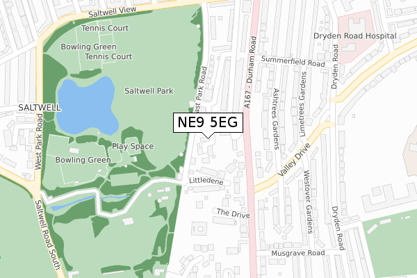
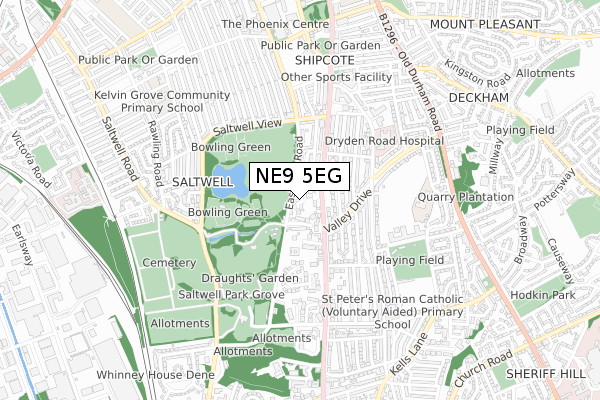
NE9 5EG is located in the Saltwell electoral ward, within the metropolitan district of Gateshead and the English Parliamentary constituency of Gateshead. The Sub Integrated Care Board (ICB) Location is NHS North East and North Cumbria ICB - 13T and the police force is Northumbria. This postcode has been in use since December 2017.


GetTheData
Source: OS Open Zoomstack (Ordnance Survey)
Licence: Open Government Licence (requires attribution)
Attribution: Contains OS data © Crown copyright and database right 2024
Source: Open Postcode Geo
Licence: Open Government Licence (requires attribution)
Attribution: Contains OS data © Crown copyright and database right 2024; Contains Royal Mail data © Royal Mail copyright and database right 2024; Source: Office for National Statistics licensed under the Open Government Licence v.3.0
| Easting | 425647 |
| Northing | 561171 |
| Latitude | 54.944551 |
| Longitude | -1.601174 |
GetTheData
Source: Open Postcode Geo
Licence: Open Government Licence
| Country | England |
| Postcode District | NE9 |
| ➜ NE9 open data dashboard ➜ See where NE9 is on a map ➜ Where is Gateshead? | |
GetTheData
Source: Land Registry Price Paid Data
Licence: Open Government Licence
| Ward | Saltwell |
| Constituency | Gateshead |
GetTheData
Source: ONS Postcode Database
Licence: Open Government Licence
7, SALTWELL GARDENS, GATESHEAD, NE9 5EG 2018 25 OCT £379,950 |
4, SALTWELL GARDENS, GATESHEAD, NE9 5EG 2018 21 SEP £359,950 |
2, SALTWELL GARDENS, GATESHEAD, NE9 5EG 2018 19 JUN £374,950 |
8, SALTWELL GARDENS, GATESHEAD, NE9 5EG 2018 20 APR £382,950 |
11, SALTWELL GARDENS, GATESHEAD, NE9 5EG 2018 20 APR £404,950 |
5, SALTWELL GARDENS, GATESHEAD, NE9 5EG 2018 11 APR £399,950 |
6, SALTWELL GARDENS, GATESHEAD, NE9 5EG 2018 29 MAR £417,950 |
10, SALTWELL GARDENS, GATESHEAD, NE9 5EG 2018 29 MAR £407,950 |
9, SALTWELL GARDENS, GATESHEAD, NE9 5EG 2018 28 MAR £414,950 |
1, SALTWELL GARDENS, GATESHEAD, NE9 5EG 2017 15 DEC £365,702 |
GetTheData
Source: HM Land Registry Price Paid Data
Licence: Contains HM Land Registry data © Crown copyright and database right 2024. This data is licensed under the Open Government Licence v3.0.
| August 2023 | Other crime | On or near The Drive | 191m |
| August 2023 | Other theft | On or near The Drive | 191m |
| December 2022 | Other crime | On or near The Drive | 191m |
| ➜ Get more crime data in our Crime section | |||
GetTheData
Source: data.police.uk
Licence: Open Government Licence
| Durham Road-valley View (Durham Road) | Low Fell | 82m |
| Durham Road-valley View (Durham Road) | Low Fell | 102m |
| Dryden Road-valley Drive (Dryden Road) | Low Fell | 292m |
| Durham Road Saltwell Park (Durham Road) | Saltwell | 294m |
| Dryden Road-valley Drive (Dryden Road) | Low Fell | 309m |
| Gateshead Stadium (Tyne And Wear Metro Station) (St James Road) | Gateshead Stadium | 1,699m |
| Dunston Station | 2.7km |
| Newcastle Station | 2.8km |
| Heworth Station | 3km |
GetTheData
Source: NaPTAN
Licence: Open Government Licence
➜ Broadband speed and availability dashboard for NE9 5EG
| Percentage of properties with Next Generation Access | 100.0% |
| Percentage of properties with Superfast Broadband | 100.0% |
| Percentage of properties with Ultrafast Broadband | 100.0% |
| Percentage of properties with Full Fibre Broadband | 100.0% |
Superfast Broadband is between 30Mbps and 300Mbps
Ultrafast Broadband is > 300Mbps
| Median download speed | 83.3Mbps |
| Average download speed | 88.3Mbps |
| Maximum download speed | 200.00Mbps |
| Median upload speed | 10.0Mbps |
| Average upload speed | 8.3Mbps |
| Maximum upload speed | 13.77Mbps |
| Percentage of properties unable to receive 2Mbps | 0.0% |
| Percentage of properties unable to receive 5Mbps | 0.0% |
| Percentage of properties unable to receive 10Mbps | 0.0% |
| Percentage of properties unable to receive 30Mbps | 0.0% |
➜ Broadband speed and availability dashboard for NE9 5EG
GetTheData
Source: Ofcom
Licence: Ofcom Terms of Use (requires attribution)
GetTheData
Source: ONS Postcode Database
Licence: Open Government Licence


➜ Get more ratings from the Food Standards Agency
GetTheData
Source: Food Standards Agency
Licence: FSA terms & conditions
| Last Collection | |||
|---|---|---|---|
| Location | Mon-Fri | Sat | Distance |
| Musgrave Road | 16:00 | 11:15 | 303m |
| Dryden Road | 16:15 | 11:15 | 306m |
| Lindum Road | 17:30 | 11:15 | 380m |
GetTheData
Source: Dracos
Licence: Creative Commons Attribution-ShareAlike
| Facility | Distance |
|---|---|
| Saltwell Park Saltwell View, Gateshead Outdoor Tennis Courts | 340m |
| Gateshead Fell Cricket Club Eastwood Gardens, Low Fell, Gateshead Grass Pitches | 450m |
| Gateshead Rugby Club Eastwood Gardens, Low Fell, Gateshead Grass Pitches | 525m |
GetTheData
Source: Active Places
Licence: Open Government Licence
| School | Phase of Education | Distance |
|---|---|---|
| Dryden School Shotley Gardens, Low Fell, Gateshead, NE9 5UR | Not applicable | 417m |
| St Peter's Catholic Primary School, Low Fell Dryden Road, Low Fell, Gateshead, NE9 5TU | Primary | 486m |
| Gibside School Shipcote Lane, Gateshead, NE8 4DE | Not applicable | 575m |
GetTheData
Source: Edubase
Licence: Open Government Licence
The below table lists the International Territorial Level (ITL) codes (formerly Nomenclature of Territorial Units for Statistics (NUTS) codes) and Local Administrative Units (LAU) codes for NE9 5EG:
| ITL 1 Code | Name |
|---|---|
| TLC | North East (England) |
| ITL 2 Code | Name |
| TLC2 | Northumberland, and Tyne and Wear |
| ITL 3 Code | Name |
| TLC22 | Tyneside |
| LAU 1 Code | Name |
| E08000037 | Gateshead |
GetTheData
Source: ONS Postcode Directory
Licence: Open Government Licence
The below table lists the Census Output Area (OA), Lower Layer Super Output Area (LSOA), and Middle Layer Super Output Area (MSOA) for NE9 5EG:
| Code | Name | |
|---|---|---|
| OA | E00041860 | |
| LSOA | E01008255 | Gateshead 010E |
| MSOA | E02001691 | Gateshead 010 |
GetTheData
Source: ONS Postcode Directory
Licence: Open Government Licence
| NE9 5AX | East Park Road | 28m |
| NE9 5AF | Littledene | 84m |
| NE9 5AE | Durham Road | 88m |
| NE9 5BJ | Ashtrees Gardens | 147m |
| NE9 5EN | Park View Avenue | 179m |
| NE9 5BH | Ashtrees Gardens | 187m |
| NE9 5AD | Durham Road | 190m |
| NE9 5BL | The Drive | 196m |
| NE9 5BE | Limetrees Gardens | 226m |
| NE9 5DE | Valley Drive | 232m |
GetTheData
Source: Open Postcode Geo; Land Registry Price Paid Data
Licence: Open Government Licence