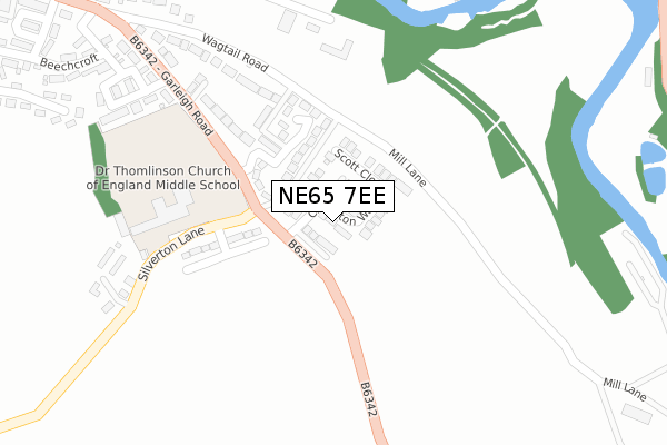
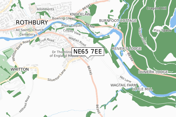
NE65 7EE is located in the Rothbury electoral ward, within the unitary authority of Northumberland and the English Parliamentary constituency of Berwick-upon-Tweed. The Sub Integrated Care Board (ICB) Location is NHS North East and North Cumbria ICB - 00L and the police force is Northumbria. This postcode has been in use since January 2018.


GetTheData
Source: OS Open Zoomstack (Ordnance Survey)
Licence: Open Government Licence (requires attribution)
Attribution: Contains OS data © Crown copyright and database right 2024
Source: Open Postcode Geo
Licence: Open Government Licence (requires attribution)
Attribution: Contains OS data © Crown copyright and database right 2024; Contains Royal Mail data © Royal Mail copyright and database right 2024; Source: Office for National Statistics licensed under the Open Government Licence v.3.0
| Easting | 406620 |
| Northing | 601281 |
| Latitude | 55.305584 |
| Longitude | -1.897279 |
GetTheData
Source: Open Postcode Geo
Licence: Open Government Licence
| Country | England |
| Postcode District | NE65 |
| ➜ NE65 open data dashboard ➜ See where NE65 is on a map ➜ Where is Rothbury? | |
GetTheData
Source: Land Registry Price Paid Data
Licence: Open Government Licence
| Ward | Rothbury |
| Constituency | Berwick-upon-tweed |
GetTheData
Source: ONS Postcode Database
Licence: Open Government Licence
2022 16 DEC £375,000 |
2022 17 NOV £495,000 |
2022 21 OCT £425,000 |
2022 6 SEP £350,000 |
2022 1 SEP £397,500 |
2022 25 MAR £360,000 |
2022 8 MAR £405,000 |
2022 26 JAN £390,000 |
2021 30 JUL £370,000 |
18, CHARLETON WAY, ROTHBURY, MORPETH, NE65 7EE 2020 18 DEC £401,950 |
GetTheData
Source: HM Land Registry Price Paid Data
Licence: Contains HM Land Registry data © Crown copyright and database right 2024. This data is licensed under the Open Government Licence v3.0.
| June 2022 | Violence and sexual offences | On or near Wagtail Road | 289m |
| June 2022 | Violence and sexual offences | On or near Wagtail Road | 289m |
| May 2022 | Violence and sexual offences | On or near Tollgate Crescent | 378m |
| ➜ Get more crime data in our Crime section | |||
GetTheData
Source: data.police.uk
Licence: Open Government Licence
| Thomlinson's Middle School (Silverton Lane) | Rothbury | 224m |
| Garleigh Road | Rothbury | 400m |
| Garleigh Road | Rothbury | 425m |
| Reivers Well Gate (B6344) | Cragside | 550m |
| Reivers Well Gate (B6344) | Cragside | 561m |
GetTheData
Source: NaPTAN
Licence: Open Government Licence
| Percentage of properties with Next Generation Access | 100.0% |
| Percentage of properties with Superfast Broadband | 100.0% |
| Percentage of properties with Ultrafast Broadband | 100.0% |
| Percentage of properties with Full Fibre Broadband | 100.0% |
Superfast Broadband is between 30Mbps and 300Mbps
Ultrafast Broadband is > 300Mbps
| Percentage of properties unable to receive 2Mbps | 0.0% |
| Percentage of properties unable to receive 5Mbps | 0.0% |
| Percentage of properties unable to receive 10Mbps | 0.0% |
| Percentage of properties unable to receive 30Mbps | 0.0% |
GetTheData
Source: Ofcom
Licence: Ofcom Terms of Use (requires attribution)
GetTheData
Source: ONS Postcode Database
Licence: Open Government Licence


➜ Get more ratings from the Food Standards Agency
GetTheData
Source: Food Standards Agency
Licence: FSA terms & conditions
| Last Collection | |||
|---|---|---|---|
| Location | Mon-Fri | Sat | Distance |
| Garleigh Road | 16:45 | 08:30 | 267m |
| The Coquet Vale Hotel | 16:45 | 09:00 | 516m |
| Cragside | 16:45 | 08:30 | 647m |
GetTheData
Source: Dracos
Licence: Creative Commons Attribution-ShareAlike
| Facility | Distance |
|---|---|
| Dr Thomlinson Church Of England Middle School Silverton Lane, Rothbury, Morpeth Sports Hall, Grass Pitches, Outdoor Tennis Courts | 263m |
| Rothbury Pool & Gym Silverton Lane, Rothbury, Morpeth Swimming Pool, Health and Fitness Gym | 339m |
| Rothbury Fc Armstrong Park, Rothbury, Morpeth Grass Pitches | 529m |
GetTheData
Source: Active Places
Licence: Open Government Licence
| School | Phase of Education | Distance |
|---|---|---|
| Dr Thomlinson Church of England Middle School Silverton Lane, Rothbury, Morpeth, NE65 7RJ | Middle deemed secondary | 339m |
| Rothbury First School Addycombe, Rothbury, Morpeth, NE65 7PG | Primary | 1.1km |
| Thropton Village First School Thropton, Morpeth, NE65 7JD | Primary | 3.6km |
GetTheData
Source: Edubase
Licence: Open Government Licence
The below table lists the International Territorial Level (ITL) codes (formerly Nomenclature of Territorial Units for Statistics (NUTS) codes) and Local Administrative Units (LAU) codes for NE65 7EE:
| ITL 1 Code | Name |
|---|---|
| TLC | North East (England) |
| ITL 2 Code | Name |
| TLC2 | Northumberland, and Tyne and Wear |
| ITL 3 Code | Name |
| TLC21 | Northumberland |
| LAU 1 Code | Name |
| E06000057 | Northumberland |
GetTheData
Source: ONS Postcode Directory
Licence: Open Government Licence
The below table lists the Census Output Area (OA), Lower Layer Super Output Area (LSOA), and Middle Layer Super Output Area (MSOA) for NE65 7EE:
| Code | Name | |
|---|---|---|
| OA | E00139288 | |
| LSOA | E01027373 | Northumberland 007D |
| MSOA | E02005705 | Northumberland 007 |
GetTheData
Source: ONS Postcode Directory
Licence: Open Government Licence
| NE65 7JU | Lordenshaw Drive | 122m |
| NE65 7PH | Wagtail Lane | 169m |
| NE65 7RG | Garleigh Road | 252m |
| NE65 7RF | Mount Healey Villas | 276m |
| NE65 7PQ | Wagtail Road | 295m |
| NE65 7RD | Tollgate Road | 338m |
| NE65 7RJ | Silverton Lane | 343m |
| NE65 7RE | Tollgate Crescent | 360m |
| NE65 7XH | 371m | |
| NE65 7RB | Garleigh Road | 372m |
GetTheData
Source: Open Postcode Geo; Land Registry Price Paid Data
Licence: Open Government Licence