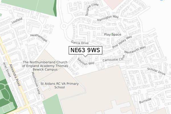
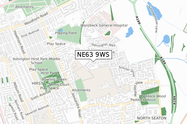
NE63 9WS is located in the Seaton with Newbiggin West electoral ward, within the unitary authority of Northumberland and the English Parliamentary constituency of Wansbeck. The Sub Integrated Care Board (ICB) Location is NHS North East and North Cumbria ICB - 00L and the police force is Northumbria. This postcode has been in use since October 2018.


GetTheData
Source: OS Open Zoomstack (Ordnance Survey)
Licence: Open Government Licence (requires attribution)
Attribution: Contains OS data © Crown copyright and database right 2024
Source: Open Postcode Geo
Licence: Open Government Licence (requires attribution)
Attribution: Contains OS data © Crown copyright and database right 2024; Contains Royal Mail data © Royal Mail copyright and database right 2024; Source: Office for National Statistics licensed under the Open Government Licence v.3.0
| Easting | 428935 |
| Northing | 587332 |
| Latitude | 55.179447 |
| Longitude | -1.547205 |
GetTheData
Source: Open Postcode Geo
Licence: Open Government Licence
| Country | England |
| Postcode District | NE63 |
| ➜ NE63 open data dashboard ➜ See where NE63 is on a map ➜ Where is Ashington? | |
GetTheData
Source: Land Registry Price Paid Data
Licence: Open Government Licence
| Ward | Seaton With Newbiggin West |
| Constituency | Wansbeck |
GetTheData
Source: ONS Postcode Database
Licence: Open Government Licence
2022 31 MAY £280,000 |
20, SAUNTON WAY, ASHINGTON, NE63 9WS 2021 9 JUL £239,950 |
22, SAUNTON WAY, ASHINGTON, NE63 9WS 2021 28 MAY £218,950 |
4, SAUNTON WAY, ASHINGTON, NE63 9WS 2021 9 APR £236,950 |
26, SAUNTON WAY, ASHINGTON, NE63 9WS 2021 26 MAR £225,950 |
18, SAUNTON WAY, ASHINGTON, NE63 9WS 2021 26 FEB £239,950 |
24, SAUNTON WAY, ASHINGTON, NE63 9WS 2021 23 FEB £239,950 |
14, SAUNTON WAY, ASHINGTON, NE63 9WS 2020 22 DEC £225,950 |
16, SAUNTON WAY, ASHINGTON, NE63 9WS 2020 16 DEC £219,950 |
2, SAUNTON WAY, ASHINGTON, NE63 9WS 2020 13 NOV £224,950 |
GetTheData
Source: HM Land Registry Price Paid Data
Licence: Contains HM Land Registry data © Crown copyright and database right 2024. This data is licensed under the Open Government Licence v3.0.
| October 2023 | Anti-social behaviour | On or near Scoular Drive | 423m |
| June 2022 | Anti-social behaviour | On or near Carnoustie Close | 137m |
| June 2022 | Violence and sexual offences | On or near Slaley Drive | 139m |
| ➜ Get more crime data in our Crime section | |||
GetTheData
Source: data.police.uk
Licence: Open Government Licence
| St Benedict's Middle School (Moorhouse Lane) | Hirst | 323m |
| Moorhouse Lane (Alexandra Road) | Hirst | 413m |
| Moorhouse Lane (Alexandra Road) | Hirst | 426m |
| Tosson Place (Alexandra Road) | Hirst | 496m |
| Tosson Place (Alexandra Road) | Hirst | 514m |
GetTheData
Source: NaPTAN
Licence: Open Government Licence
| Percentage of properties with Next Generation Access | 100.0% |
| Percentage of properties with Superfast Broadband | 100.0% |
| Percentage of properties with Ultrafast Broadband | 0.0% |
| Percentage of properties with Full Fibre Broadband | 0.0% |
Superfast Broadband is between 30Mbps and 300Mbps
Ultrafast Broadband is > 300Mbps
| Percentage of properties unable to receive 2Mbps | 0.0% |
| Percentage of properties unable to receive 5Mbps | 0.0% |
| Percentage of properties unable to receive 10Mbps | 0.0% |
| Percentage of properties unable to receive 30Mbps | 0.0% |
GetTheData
Source: Ofcom
Licence: Ofcom Terms of Use (requires attribution)
GetTheData
Source: ONS Postcode Database
Licence: Open Government Licence


➜ Get more ratings from the Food Standards Agency
GetTheData
Source: Food Standards Agency
Licence: FSA terms & conditions
| Last Collection | |||
|---|---|---|---|
| Location | Mon-Fri | Sat | Distance |
| Moorhouse Estate | 17:00 | 11:45 | 437m |
| Alexandra Road | 17:00 | 11:45 | 456m |
| Manley View | 17:30 | 12:00 | 628m |
GetTheData
Source: Dracos
Licence: Creative Commons Attribution-ShareAlike
| Facility | Distance |
|---|---|
| St Benedicts Rc Middle School (Closed) Moorhouse Lane, Ashington Sports Hall, Grass Pitches | 298m |
| Northumberland Church Of England Academy (Josephine Butler Campus) Academy Road, Ashington Sports Hall, Studio, Grass Pitches, Artificial Grass Pitch | 320m |
| Hirst High School (Closed) Lichfield Close, Ashington Grass Pitches | 380m |
GetTheData
Source: Active Places
Licence: Open Government Licence
| School | Phase of Education | Distance |
|---|---|---|
| NCEA Thomas Bewick C of E Primary School Moorhouse Lane, Ashington, NE63 9LP | Primary | 279m |
| St Aidan's Catholic Primary School, Ashington Moorhouse Lane, Ashington, NE63 9LR | Primary | 302m |
| NCEA Castle School Academy Road, Ashington, NE63 9FZ | Not applicable | 331m |
GetTheData
Source: Edubase
Licence: Open Government Licence
The below table lists the International Territorial Level (ITL) codes (formerly Nomenclature of Territorial Units for Statistics (NUTS) codes) and Local Administrative Units (LAU) codes for NE63 9WS:
| ITL 1 Code | Name |
|---|---|
| TLC | North East (England) |
| ITL 2 Code | Name |
| TLC2 | Northumberland, and Tyne and Wear |
| ITL 3 Code | Name |
| TLC21 | Northumberland |
| LAU 1 Code | Name |
| E06000057 | Northumberland |
GetTheData
Source: ONS Postcode Directory
Licence: Open Government Licence
The below table lists the Census Output Area (OA), Lower Layer Super Output Area (LSOA), and Middle Layer Super Output Area (MSOA) for NE63 9WS:
| Code | Name | |
|---|---|---|
| OA | E00176342 | |
| LSOA | E01027549 | Northumberland 013E |
| MSOA | E02005736 | Northumberland 013 |
GetTheData
Source: ONS Postcode Directory
Licence: Open Government Licence
| NE63 9HF | Garcia Drive | 128m |
| NE63 9GB | Carnoustie Close | 136m |
| NE63 9JU | Montgomerie Court | 173m |
| NE63 9GT | Sunningdale Road | 195m |
| NE63 9FS | Ryder Walk | 197m |
| NE63 9GX | Slaley Drive | 198m |
| NE63 9WG | Maidstone Gardens | 248m |
| NE63 9JP | Harrington Way | 254m |
| NE63 9GL | Pine Valley Way | 255m |
| NE63 9GN | Oakmont Rise | 258m |
GetTheData
Source: Open Postcode Geo; Land Registry Price Paid Data
Licence: Open Government Licence