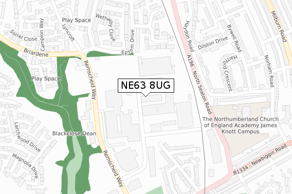
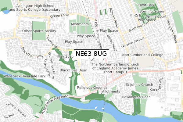
NE63 8UG is located in the Haydon electoral ward, within the unitary authority of Northumberland and the English Parliamentary constituency of Wansbeck. The Sub Integrated Care Board (ICB) Location is NHS North East and North Cumbria ICB - 00L and the police force is Northumbria. This postcode has been in use since January 2018.


GetTheData
Source: OS Open Zoomstack (Ordnance Survey)
Licence: Open Government Licence (requires attribution)
Attribution: Contains OS data © Crown copyright and database right 2024
Source: Open Postcode Geo
Licence: Open Government Licence (requires attribution)
Attribution: Contains OS data © Crown copyright and database right 2024; Contains Royal Mail data © Royal Mail copyright and database right 2024; Source: Office for National Statistics licensed under the Open Government Licence v.3.0
| Easting | 427569 |
| Northing | 586499 |
| Latitude | 55.172040 |
| Longitude | -1.568735 |
GetTheData
Source: Open Postcode Geo
Licence: Open Government Licence
| Country | England |
| Postcode District | NE63 |
| ➜ NE63 open data dashboard ➜ See where NE63 is on a map ➜ Where is Ashington? | |
GetTheData
Source: Land Registry Price Paid Data
Licence: Open Government Licence
| Ward | Haydon |
| Constituency | Wansbeck |
GetTheData
Source: ONS Postcode Database
Licence: Open Government Licence
| January 2024 | Burglary | On or near Orpine Court | 340m |
| January 2024 | Violence and sexual offences | On or near Rothley Avenue | 394m |
| January 2024 | Violence and sexual offences | On or near Rothley Avenue | 394m |
| ➜ Get more crime data in our Crime section | |||
GetTheData
Source: data.police.uk
Licence: Open Government Licence
| Haydon Road (North Seaton Road) | Elephant | 169m |
| Haydon Road (North Seaton Road) | Elephant | 202m |
| S E N E T Enterprise Centre (North Seaton Road) | Ashington | 239m |
| Remscheid Way | Jubilee Industrial Estate | 304m |
| Remscheid Way | Jubilee Industrial Estate | 305m |
| Pegswood Station | 4.9km |
GetTheData
Source: NaPTAN
Licence: Open Government Licence
GetTheData
Source: ONS Postcode Database
Licence: Open Government Licence


➜ Get more ratings from the Food Standards Agency
GetTheData
Source: Food Standards Agency
Licence: FSA terms & conditions
| Last Collection | |||
|---|---|---|---|
| Location | Mon-Fri | Sat | Distance |
| Bywell Road | 16:45 | 11:45 | 348m |
| Newbiggin Road | 16:00 | 11:00 | 431m |
| Seaton Hirst Post Office | 16:45 | 11:30 | 591m |
GetTheData
Source: Dracos
Licence: Creative Commons Attribution-ShareAlike
| Facility | Distance |
|---|---|
| Shape House (Closed) Milburn Road, Ashington Health and Fitness Gym | 531m |
| New Form (Closed) Milburn Road, Ashington Studio, Health and Fitness Gym | 537m |
| Northumberland College (Ashington Campus) College Road, Ashington Sports Hall, Health and Fitness Gym, Grass Pitches | 733m |
GetTheData
Source: Active Places
Licence: Open Government Licence
| School | Phase of Education | Distance |
|---|---|---|
| NCEA James Knott CofE Primary School Norham Road, Ashington, NE63 0LF | Primary | 367m |
| Ashington Academy Green Lane, Ashington, NE63 8DH | Secondary | 935m |
| Central Primary School Milburn Road, Ashington, NE63 0AX | Primary | 953m |
GetTheData
Source: Edubase
Licence: Open Government Licence
The below table lists the International Territorial Level (ITL) codes (formerly Nomenclature of Territorial Units for Statistics (NUTS) codes) and Local Administrative Units (LAU) codes for NE63 8UG:
| ITL 1 Code | Name |
|---|---|
| TLC | North East (England) |
| ITL 2 Code | Name |
| TLC2 | Northumberland, and Tyne and Wear |
| ITL 3 Code | Name |
| TLC21 | Northumberland |
| LAU 1 Code | Name |
| E06000057 | Northumberland |
GetTheData
Source: ONS Postcode Directory
Licence: Open Government Licence
The below table lists the Census Output Area (OA), Lower Layer Super Output Area (LSOA), and Middle Layer Super Output Area (MSOA) for NE63 8UG:
| Code | Name | |
|---|---|---|
| OA | E00140154 | |
| LSOA | E01027538 | Northumberland 014C |
| MSOA | E02005738 | Northumberland 014 |
GetTheData
Source: ONS Postcode Directory
Licence: Open Government Licence
| NE63 8NR | Ascot Grove | 183m |
| NE63 8NJ | Wetherby Close | 211m |
| NE63 0JU | Haydon Road | 222m |
| NE63 8NA | Epsom Drive | 229m |
| NE63 0JT | Haydon Road | 266m |
| NE63 8NP | Goodwood Court | 269m |
| NE63 0LH | Dilston Drive | 275m |
| NE63 8TA | Jubilee Estate | 277m |
| NE63 0LD | Hartford Crescent | 301m |
| NE63 0JS | North Seaton Road | 303m |
GetTheData
Source: Open Postcode Geo; Land Registry Price Paid Data
Licence: Open Government Licence