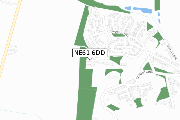
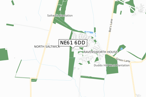
NE61 6DD is located in the Ponteland East and Stannington electoral ward, within the unitary authority of Northumberland and the English Parliamentary constituency of Hexham. The Sub Integrated Care Board (ICB) Location is NHS North East and North Cumbria ICB - 00L and the police force is Northumbria. This postcode has been in use since September 2017.


GetTheData
Source: OS Open Zoomstack (Ordnance Survey)
Licence: Open Government Licence (requires attribution)
Attribution: Contains OS data © Crown copyright and database right 2024
Source: Open Postcode Geo
Licence: Open Government Licence (requires attribution)
Attribution: Contains OS data © Crown copyright and database right 2024; Contains Royal Mail data © Royal Mail copyright and database right 2024; Source: Office for National Statistics licensed under the Open Government Licence v.3.0
| Easting | 417930 |
| Northing | 581187 |
| Latitude | 55.124748 |
| Longitude | -1.720393 |
GetTheData
Source: Open Postcode Geo
Licence: Open Government Licence
| Country | England |
| Postcode District | NE61 |
| ➜ NE61 open data dashboard ➜ See where NE61 is on a map | |
GetTheData
Source: Land Registry Price Paid Data
Licence: Open Government Licence
| Ward | Ponteland East And Stannington |
| Constituency | Hexham |
GetTheData
Source: ONS Postcode Database
Licence: Open Government Licence
| June 2022 | Other theft | On or near Sports/Recreation Area | 443m |
| June 2022 | Anti-social behaviour | On or near Sports/Recreation Area | 443m |
| March 2022 | Violence and sexual offences | On or near Sports/Recreation Area | 443m |
| ➜ Get more crime data in our Crime section | |||
GetTheData
Source: data.police.uk
Licence: Open Government Licence
| Bus Terminus (St Mary's Lane) | St Mary's | 365m |
| Lodge Gates (Street) | St Mary's | 569m |
| Lodge Gates (Street) | St Mary's | 574m |
| Duddo Hill (Green Lane) | St Mary's | 1,347m |
| Duddo Hill (Green Lane) | St Mary's | 1,353m |
| Morpeth Station | 4.8km |
GetTheData
Source: NaPTAN
Licence: Open Government Licence
| Percentage of properties with Next Generation Access | 100.0% |
| Percentage of properties with Superfast Broadband | 100.0% |
| Percentage of properties with Ultrafast Broadband | 100.0% |
| Percentage of properties with Full Fibre Broadband | 100.0% |
Superfast Broadband is between 30Mbps and 300Mbps
Ultrafast Broadband is > 300Mbps
| Percentage of properties unable to receive 2Mbps | 0.0% |
| Percentage of properties unable to receive 5Mbps | 0.0% |
| Percentage of properties unable to receive 10Mbps | 0.0% |
| Percentage of properties unable to receive 30Mbps | 0.0% |
GetTheData
Source: Ofcom
Licence: Ofcom Terms of Use (requires attribution)
GetTheData
Source: ONS Postcode Database
Licence: Open Government Licence


➜ Get more ratings from the Food Standards Agency
GetTheData
Source: Food Standards Agency
Licence: FSA terms & conditions
| Last Collection | |||
|---|---|---|---|
| Location | Mon-Fri | Sat | Distance |
| West Duddo Post Office | 16:00 | 09:15 | 423m |
| Wellhill | 16:00 | 09:15 | 1,118m |
| Tranwell Woods | 16:00 | 09:15 | 1,326m |
GetTheData
Source: Dracos
Licence: Creative Commons Attribution-ShareAlike
| Facility | Distance |
|---|---|
| N1 Golf Centre Ponteland Road, Morpeth Golf | 1.7km |
| Craik Park Morpeth Athletics, Grass Pitches, Artificial Grass Pitch | 3.5km |
| Morpeth Common High House Road, Morpeth Grass Pitches | 3.5km |
GetTheData
Source: Active Places
Licence: Open Government Licence
| School | Phase of Education | Distance |
|---|---|---|
| Stannington First School Church Road, Stannington, Morpeth, NE61 6HJ | Primary | 3.5km |
| Kyloe House Care of: Northumberland County Council, County Hall, Morpeth, NE61 2EF | Not applicable | 3.9km |
| Morpeth First School Loansdean, Morpeth, NE61 2AP | Primary | 4km |
GetTheData
Source: Edubase
Licence: Open Government Licence
The below table lists the International Territorial Level (ITL) codes (formerly Nomenclature of Territorial Units for Statistics (NUTS) codes) and Local Administrative Units (LAU) codes for NE61 6DD:
| ITL 1 Code | Name |
|---|---|
| TLC | North East (England) |
| ITL 2 Code | Name |
| TLC2 | Northumberland, and Tyne and Wear |
| ITL 3 Code | Name |
| TLC21 | Northumberland |
| LAU 1 Code | Name |
| E06000057 | Northumberland |
GetTheData
Source: ONS Postcode Directory
Licence: Open Government Licence
The below table lists the Census Output Area (OA), Lower Layer Super Output Area (LSOA), and Middle Layer Super Output Area (MSOA) for NE61 6DD:
| Code | Name | |
|---|---|---|
| OA | E00139819 | |
| LSOA | E01027473 | Northumberland 015D |
| MSOA | E02005722 | Northumberland 015 |
GetTheData
Source: ONS Postcode Directory
Licence: Open Government Licence
| NE61 6DA | Bowmont Walk | 108m |
| NE61 6DB | Beamish Way | 134m |
| NE61 6BY | Rowan Drive | 228m |
| NE61 6BP | Eden Walk | 274m |
| NE61 6BL | St Mary Lane | 274m |
| NE61 6BN | Cheviot Way | 276m |
| NE61 6BU | Woodland Grove | 337m |
| NE61 6AT | The Villas | 418m |
| NE61 6BG | 431m | |
| NE61 6BX | Blencathra Court | 491m |
GetTheData
Source: Open Postcode Geo; Land Registry Price Paid Data
Licence: Open Government Licence