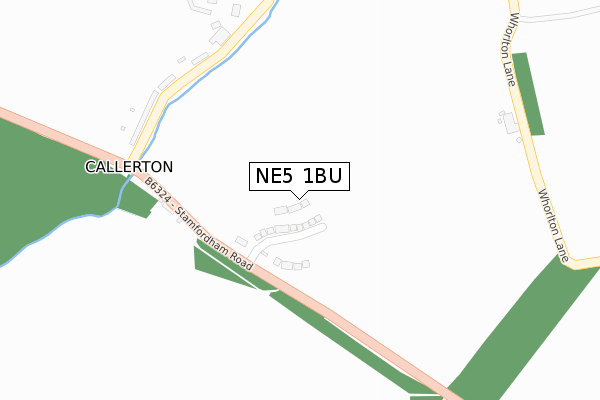
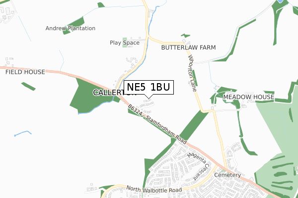
NE5 1BU is located in the Callerton & Throckley electoral ward, within the metropolitan district of Newcastle upon Tyne and the English Parliamentary constituency of Newcastle upon Tyne North. The Sub Integrated Care Board (ICB) Location is NHS North East and North Cumbria ICB - 13T and the police force is Northumbria. This postcode has been in use since December 2019.


GetTheData
Source: OS Open Zoomstack (Ordnance Survey)
Licence: Open Government Licence (requires attribution)
Attribution: Contains OS data © Crown copyright and database right 2024
Source: Open Postcode Geo
Licence: Open Government Licence (requires attribution)
Attribution: Contains OS data © Crown copyright and database right 2024; Contains Royal Mail data © Royal Mail copyright and database right 2024; Source: Office for National Statistics licensed under the Open Government Licence v.3.0
| Easting | 417967 |
| Northing | 568511 |
| Latitude | 55.010842 |
| Longitude | -1.720608 |
GetTheData
Source: Open Postcode Geo
Licence: Open Government Licence
| Country | England |
| Postcode District | NE5 |
| ➜ NE5 open data dashboard ➜ See where NE5 is on a map ➜ Where is Callerton? | |
GetTheData
Source: Land Registry Price Paid Data
Licence: Open Government Licence
| Ward | Callerton & Throckley |
| Constituency | Newcastle Upon Tyne North |
GetTheData
Source: ONS Postcode Database
Licence: Open Government Licence
2022 30 AUG £286,500 |
102, WATSON ROAD, CALLERTON, NEWCASTLE UPON TYNE, NE5 1BU 2021 29 OCT £349,995 |
104, WATSON ROAD, CALLERTON, NEWCASTLE UPON TYNE, NE5 1BU 2021 22 OCT £386,995 |
106, WATSON ROAD, CALLERTON, NEWCASTLE UPON TYNE, NE5 1BU 2020 19 OCT £324,950 |
118, WATSON ROAD, CALLERTON, NEWCASTLE UPON TYNE, NE5 1BU 2020 30 JUN £289,950 |
114, WATSON ROAD, CALLERTON, NEWCASTLE UPON TYNE, NE5 1BU 2020 26 JUN £249,950 |
116, WATSON ROAD, CALLERTON, NEWCASTLE UPON TYNE, NE5 1BU 2020 26 JUN £319,950 |
112, WATSON ROAD, CALLERTON, NEWCASTLE UPON TYNE, NE5 1BU 2020 28 FEB £299,950 |
2019 20 DEC £249,950 |
GetTheData
Source: HM Land Registry Price Paid Data
Licence: Contains HM Land Registry data © Crown copyright and database right 2024. This data is licensed under the Open Government Licence v3.0.
| April 2022 | Anti-social behaviour | On or near Whorlton Lane | 384m |
| March 2022 | Anti-social behaviour | On or near Whorlton Lane | 384m |
| February 2022 | Anti-social behaviour | On or near Whorlton Lane | 384m |
| ➜ Get more crime data in our Crime section | |||
GetTheData
Source: data.police.uk
Licence: Open Government Licence
| Callerton (Stamfordham Road) | North Walbottle | 324m |
| Callerton (Stamfordham Road) | North Walbottle | 343m |
| Stamfordham Road-magenta Crescent (Stamfordham Road) | Westerhope | 678m |
| North Walbottle Rd-whorlton Tce (North Walbottle Road) | North Walbottle | 767m |
| North Walbottle Rd-claverdon St (North Walbottle Road) | North Walbottle | 767m |
| Newcastle Airport Metro | 2.9km |
GetTheData
Source: NaPTAN
Licence: Open Government Licence
GetTheData
Source: ONS Postcode Database
Licence: Open Government Licence


➜ Get more ratings from the Food Standards Agency
GetTheData
Source: Food Standards Agency
Licence: FSA terms & conditions
| Last Collection | |||
|---|---|---|---|
| Location | Mon-Fri | Sat | Distance |
| Marquis Avenue | 16:00 | 10:45 | 674m |
| Grosvenor Way | 16:00 | 11:00 | 1,450m |
| Kenton Grange | 17:30 | 12:00 | 1,587m |
GetTheData
Source: Dracos
Licence: Creative Commons Attribution-ShareAlike
| Facility | Distance |
|---|---|
| Westerhope Golf Club Whorlton Grange, Newcastle Upon Tyne Golf | 1.3km |
| Chapel Park Middle School (Closed) Granville Drive, Chapel Park, Newcastle Upon Tyne Grass Pitches | 1.4km |
| Westerhope Community Centre Hillhead Road, Newcastle Upon Tyne Grass Pitches, Sports Hall | 1.4km |
GetTheData
Source: Active Places
Licence: Open Government Licence
| School | Phase of Education | Distance |
|---|---|---|
| Milecastle Primary School Hillhead Parkway, Chapel House, Newcastle-upon-Tyne, NE5 1LH | Primary | 1.5km |
| Westerhope Primary School Hillhead Road, Westerhope, Newcastle-upon-Tyne, NE5 1NE | Primary | 1.6km |
| Simonside Primary School Bedeburn Road, Westerhope, Newcastle-upon-Tyne, NE5 4LG | Primary | 1.7km |
GetTheData
Source: Edubase
Licence: Open Government Licence
The below table lists the International Territorial Level (ITL) codes (formerly Nomenclature of Territorial Units for Statistics (NUTS) codes) and Local Administrative Units (LAU) codes for NE5 1BU:
| ITL 1 Code | Name |
|---|---|
| TLC | North East (England) |
| ITL 2 Code | Name |
| TLC2 | Northumberland, and Tyne and Wear |
| ITL 3 Code | Name |
| TLC22 | Tyneside |
| LAU 1 Code | Name |
| E08000021 | Newcastle upon Tyne |
GetTheData
Source: ONS Postcode Directory
Licence: Open Government Licence
The below table lists the Census Output Area (OA), Lower Layer Super Output Area (LSOA), and Middle Layer Super Output Area (MSOA) for NE5 1BU:
| Code | Name | |
|---|---|---|
| OA | E00042911 | |
| LSOA | E01008458 | Newcastle upon Tyne 004D |
| MSOA | E02001711 | Newcastle upon Tyne 004 |
GetTheData
Source: ONS Postcode Directory
Licence: Open Government Licence
| NE5 1NY | Burns Close | 331m |
| NE5 1PA | Morton Crescent | 348m |
| NE5 1PB | Severs Terrace | 350m |
| NE5 1YW | Mandarin Close | 419m |
| NE5 1YG | Marquis Avenue | 502m |
| NE5 1NR | Short Row | 515m |
| NE5 1YP | Mandarin Close | 523m |
| NE5 1YR | Magenta Crescent | 526m |
| NE5 1NQ | Armstrong Street | 528m |
| NE5 1YJ | Magenta Crescent | 544m |
GetTheData
Source: Open Postcode Geo; Land Registry Price Paid Data
Licence: Open Government Licence