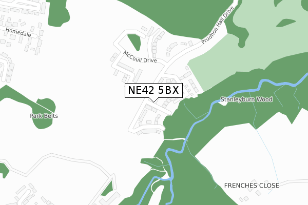
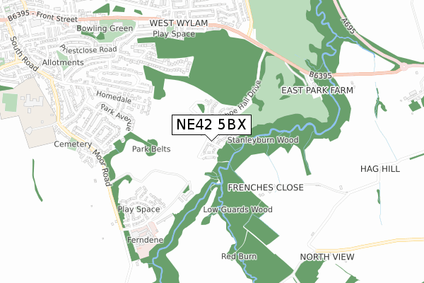
NE42 5BX is located in the Prudhoe South electoral ward, within the unitary authority of Northumberland and the English Parliamentary constituency of Hexham. The Sub Integrated Care Board (ICB) Location is NHS North East and North Cumbria ICB - 00L and the police force is Northumbria. This postcode has been in use since July 2018.


GetTheData
Source: OS Open Zoomstack (Ordnance Survey)
Licence: Open Government Licence (requires attribution)
Attribution: Contains OS data © Crown copyright and database right 2024
Source: Open Postcode Geo
Licence: Open Government Licence (requires attribution)
Attribution: Contains OS data © Crown copyright and database right 2024; Contains Royal Mail data © Royal Mail copyright and database right 2024; Source: Office for National Statistics licensed under the Open Government Licence v.3.0
| Easting | 410712 |
| Northing | 562247 |
| Latitude | 54.954761 |
| Longitude | -1.834278 |
GetTheData
Source: Open Postcode Geo
Licence: Open Government Licence
| Country | England |
| Postcode District | NE42 |
| ➜ NE42 open data dashboard ➜ See where NE42 is on a map ➜ Where is Prudhoe? | |
GetTheData
Source: Land Registry Price Paid Data
Licence: Open Government Licence
| Ward | Prudhoe South |
| Constituency | Hexham |
GetTheData
Source: ONS Postcode Database
Licence: Open Government Licence
2023 15 MAR £297,500 |
2021 25 JUN £349,000 |
3, NIGHTINGALE CLOSE, COTTIER GRANGE, PRUDHOE, NE42 5BX 2019 21 FEB £284,950 |
2018 28 SEP £240,000 |
5, NIGHTINGALE CLOSE, COTTIER GRANGE, PRUDHOE, NE42 5BX 2018 6 SEP £314,950 |
7, NIGHTINGALE CLOSE, COTTIER GRANGE, PRUDHOE, NE42 5BX 2018 20 JUL £317,450 |
2, NIGHTINGALE CLOSE, COTTIER GRANGE, PRUDHOE, NE42 5BX 2018 20 JUL £175,960 |
2018 19 JUL £317,450 |
4, NIGHTINGALE CLOSE, COTTIER GRANGE, PRUDHOE, NE42 5BX 2018 13 JUL £175,960 |
GetTheData
Source: HM Land Registry Price Paid Data
Licence: Contains HM Land Registry data © Crown copyright and database right 2024. This data is licensed under the Open Government Licence v3.0.
| May 2022 | Public order | On or near Valley View | 440m |
| May 2022 | Anti-social behaviour | On or near Valley View | 440m |
| May 2022 | Anti-social behaviour | On or near Valley View | 440m |
| ➜ Get more crime data in our Crime section | |||
GetTheData
Source: data.police.uk
Licence: Open Government Licence
| Main Gate (B6395) | Prudhoe Hospital | 623m |
| Main Gate (B6395) | Prudhoe Hospital | 640m |
| Priestclose Cottages (B6395) | West Wylam | 687m |
| Priestclose Cottages (B6395) | West Wylam | 698m |
| Stonyflat Bank | West Wylam | 761m |
| Prudhoe Station | 2.3km |
| Wylam Station | 2.6km |
GetTheData
Source: NaPTAN
Licence: Open Government Licence
| Percentage of properties with Next Generation Access | 100.0% |
| Percentage of properties with Superfast Broadband | 100.0% |
| Percentage of properties with Ultrafast Broadband | 100.0% |
| Percentage of properties with Full Fibre Broadband | 100.0% |
Superfast Broadband is between 30Mbps and 300Mbps
Ultrafast Broadband is > 300Mbps
| Percentage of properties unable to receive 2Mbps | 0.0% |
| Percentage of properties unable to receive 5Mbps | 0.0% |
| Percentage of properties unable to receive 10Mbps | 0.0% |
| Percentage of properties unable to receive 30Mbps | 0.0% |
GetTheData
Source: Ofcom
Licence: Ofcom Terms of Use (requires attribution)
GetTheData
Source: ONS Postcode Database
Licence: Open Government Licence

➜ Get more ratings from the Food Standards Agency
GetTheData
Source: Food Standards Agency
Licence: FSA terms & conditions
| Last Collection | |||
|---|---|---|---|
| Location | Mon-Fri | Sat | Distance |
| Park Lane | 16:00 | 12:00 | 768m |
| Redwell Road | 16:00 | 11:45 | 777m |
| Coldwell Road | 16:15 | 11:45 | 866m |
GetTheData
Source: Dracos
Licence: Creative Commons Attribution-ShareAlike
| Facility | Distance |
|---|---|
| Prudhoe Golf Club Eastwood Park, Prudhoe Golf | 870m |
| Prudhoe Waterworld Front Street, Prudhoe Swimming Pool, Health and Fitness Gym, Studio | 888m |
| Eastwoods Park Eastwoods Road, Prudhoe Grass Pitches | 1km |
GetTheData
Source: Active Places
Licence: Open Government Licence
| School | Phase of Education | Distance |
|---|---|---|
| Prudhoe Community High School Moor Road, Prudhoe, NE42 5LJ | Secondary | 1.1km |
| Adderlane Academy Broomhill Road, Adderlane Academy, Prudhoe, NE42 5HX | Primary | 1.2km |
| St Matthew's Catholic Primary School, Prudhoe Highfield Lane, Prudhoe, NE42 6EY | Primary | 1.5km |
GetTheData
Source: Edubase
Licence: Open Government Licence
The below table lists the International Territorial Level (ITL) codes (formerly Nomenclature of Territorial Units for Statistics (NUTS) codes) and Local Administrative Units (LAU) codes for NE42 5BX:
| ITL 1 Code | Name |
|---|---|
| TLC | North East (England) |
| ITL 2 Code | Name |
| TLC2 | Northumberland, and Tyne and Wear |
| ITL 3 Code | Name |
| TLC21 | Northumberland |
| LAU 1 Code | Name |
| E06000057 | Northumberland |
GetTheData
Source: ONS Postcode Directory
Licence: Open Government Licence
The below table lists the Census Output Area (OA), Lower Layer Super Output Area (LSOA), and Middle Layer Super Output Area (MSOA) for NE42 5BX:
| Code | Name | |
|---|---|---|
| OA | E00139969 | |
| LSOA | E01027499 | Northumberland 038C |
| MSOA | E02005731 | Northumberland 038 |
GetTheData
Source: ONS Postcode Directory
Licence: Open Government Licence
| NE42 5NN | 416m | |
| NE42 5BL | Valley View | 417m |
| NE42 5PH | Woodside | 462m |
| NE42 5PJ | Redburn Close | 511m |
| NE42 5BB | Park Avenue | 514m |
| NE42 5PN | Beechwood Drive | 576m |
| NE42 5LR | Moorlands | 607m |
| NE42 5BJ | Paddock Wood | 610m |
| NE42 5AX | Cheviot View | 611m |
| NE42 5PL | Fern Close | 620m |
GetTheData
Source: Open Postcode Geo; Land Registry Price Paid Data
Licence: Open Government Licence