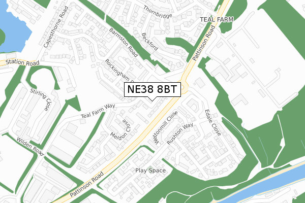
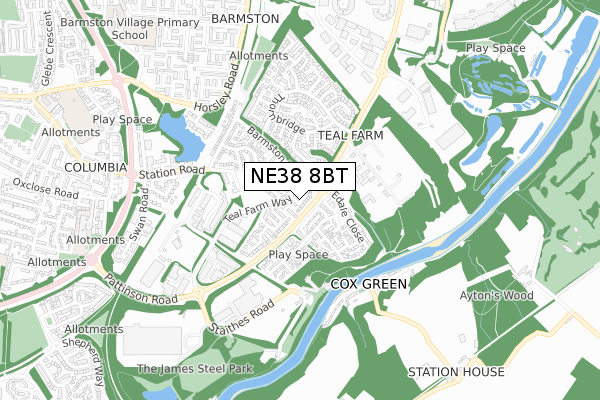
NE38 8BT is located in the Washington East electoral ward, within the metropolitan district of Sunderland and the English Parliamentary constituency of Washington and Sunderland West. The Sub Integrated Care Board (ICB) Location is NHS North East and North Cumbria ICB - 00P and the police force is Northumbria. This postcode has been in use since June 2019.


GetTheData
Source: OS Open Zoomstack (Ordnance Survey)
Licence: Open Government Licence (requires attribution)
Attribution: Contains OS data © Crown copyright and database right 2024
Source: Open Postcode Geo
Licence: Open Government Licence (requires attribution)
Attribution: Contains OS data © Crown copyright and database right 2024; Contains Royal Mail data © Royal Mail copyright and database right 2024; Source: Office for National Statistics licensed under the Open Government Licence v.3.0
| Easting | 432412 |
| Northing | 555622 |
| Latitude | 54.894297 |
| Longitude | -1.496195 |
GetTheData
Source: Open Postcode Geo
Licence: Open Government Licence
| Country | England |
| Postcode District | NE38 |
| ➜ NE38 open data dashboard ➜ See where NE38 is on a map ➜ Where is Washington? | |
GetTheData
Source: Land Registry Price Paid Data
Licence: Open Government Licence
| Ward | Washington East |
| Constituency | Washington And Sunderland West |
GetTheData
Source: ONS Postcode Database
Licence: Open Government Licence
5, WILLIAM FORSTER CLOSE, WASHINGTON, NE38 8BT 2020 18 SEP £241,995 |
4, WILLIAM FORSTER CLOSE, WASHINGTON, NE38 8BT 2020 24 JUL £221,995 |
6, WILLIAM FORSTER CLOSE, WASHINGTON, NE38 8BT 2020 3 JUL £267,995 |
6, WILLIAM FORSTER CLOSE, WASHINGTON, NE38 8BT 2020 3 JUL £267,995 |
7, WILLIAM FORSTER CLOSE, WASHINGTON, NE38 8BT 2020 29 MAY £284,995 |
10, WILLIAM FORSTER CLOSE, WASHINGTON, NE38 8BT 2019 19 DEC £279,995 |
10, WILLIAM FORSTER CLOSE, WASHINGTON, NE38 8BT 2019 19 DEC £279,995 |
11, WILLIAM FORSTER CLOSE, WASHINGTON, NE38 8BT 2019 29 NOV £239,995 |
11, WILLIAM FORSTER CLOSE, WASHINGTON, NE38 8BT 2019 29 NOV £239,995 |
24, WILLIAM FORSTER CLOSE, WASHINGTON, NE38 8BT 2019 29 NOV £254,995 |
GetTheData
Source: HM Land Registry Price Paid Data
Licence: Contains HM Land Registry data © Crown copyright and database right 2024. This data is licensed under the Open Government Licence v3.0.
| June 2022 | Anti-social behaviour | On or near Ferry Terminal | 380m |
| June 2022 | Violence and sexual offences | On or near Ferry Terminal | 380m |
| June 2022 | Anti-social behaviour | On or near Parking Area | 398m |
| ➜ Get more crime data in our Crime section | |||
GetTheData
Source: data.police.uk
Licence: Open Government Licence
| Teal Farm (Pattinson Road) | Barnes Park | 67m |
| Teal Farm (Pattinson Road) | Barmston | 141m |
| Teal Farm (Pattinson Road) | Barmston | 280m |
| Pattinson Road-sewage Works (Pattinson Road) | Barmston | 400m |
| Barmston Court | Columbia | 646m |
GetTheData
Source: NaPTAN
Licence: Open Government Licence
| Percentage of properties with Next Generation Access | 40.0% |
| Percentage of properties with Superfast Broadband | 40.0% |
| Percentage of properties with Ultrafast Broadband | 35.0% |
| Percentage of properties with Full Fibre Broadband | 35.0% |
Superfast Broadband is between 30Mbps and 300Mbps
Ultrafast Broadband is > 300Mbps
| Percentage of properties unable to receive 2Mbps | 0.0% |
| Percentage of properties unable to receive 5Mbps | 0.0% |
| Percentage of properties unable to receive 10Mbps | 5.0% |
| Percentage of properties unable to receive 30Mbps | 5.0% |
GetTheData
Source: Ofcom
Licence: Ofcom Terms of Use (requires attribution)
GetTheData
Source: ONS Postcode Database
Licence: Open Government Licence


➜ Get more ratings from the Food Standards Agency
GetTheData
Source: Food Standards Agency
Licence: FSA terms & conditions
| Last Collection | |||
|---|---|---|---|
| Location | Mon-Fri | Sat | Distance |
| Pattinson Road | 16:30 | 10:30 | 341m |
| Horsley Road | 17:00 | 10:30 | 750m |
| Washington Station Post Office | 17:30 | 10:30 | 811m |
GetTheData
Source: Dracos
Licence: Creative Commons Attribution-ShareAlike
| Facility | Distance |
|---|---|
| Barmston Village Primary School Barmston Centre, Washington Grass Pitches | 1.1km |
| John F Kennedy Primary School Station Road, Station Road, Washington Grass Pitches | 1.1km |
| Wearside Golf Club Coxgreen, Sunderland Golf | 1.1km |
GetTheData
Source: Active Places
Licence: Open Government Licence
| School | Phase of Education | Distance |
|---|---|---|
| Columbia Grange School Oxclose Road, Washington, NE38 7NY | Not applicable | 907m |
| Barmston Village Primary School Barmston Centre, Washington, NE38 8JA | Primary | 1.1km |
| John F Kennedy Primary School Station Road, Columbia, Washington, NE38 7AR | Primary | 1.1km |
GetTheData
Source: Edubase
Licence: Open Government Licence
The below table lists the International Territorial Level (ITL) codes (formerly Nomenclature of Territorial Units for Statistics (NUTS) codes) and Local Administrative Units (LAU) codes for NE38 8BT:
| ITL 1 Code | Name |
|---|---|
| TLC | North East (England) |
| ITL 2 Code | Name |
| TLC2 | Northumberland, and Tyne and Wear |
| ITL 3 Code | Name |
| TLC23 | Sunderland |
| LAU 1 Code | Name |
| E08000024 | Sunderland |
GetTheData
Source: ONS Postcode Directory
Licence: Open Government Licence
The below table lists the Census Output Area (OA), Lower Layer Super Output Area (LSOA), and Middle Layer Super Output Area (MSOA) for NE38 8BT:
| Code | Name | |
|---|---|---|
| OA | E00170198 | |
| LSOA | E01008850 | Sunderland 017D |
| MSOA | E02001807 | Sunderland 017 |
GetTheData
Source: ONS Postcode Directory
Licence: Open Government Licence
| NE38 8BG | Teal Farm Way | 76m |
| NE38 8FP | Wettonmill Close | 91m |
| NE38 8BS | Belton Close | 128m |
| NE38 8FL | Meldon Close | 130m |
| NE38 8BF | Rockingham Drive | 142m |
| NE38 8FF | Rushton Way | 143m |
| NE38 8BL | Belvoir Close | 168m |
| NE38 8FE | Bretton Close | 191m |
| NE38 8TP | Beckford | 192m |
| NE38 8FN | Dryslwyn Road | 194m |
GetTheData
Source: Open Postcode Geo; Land Registry Price Paid Data
Licence: Open Government Licence