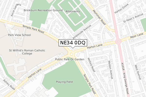
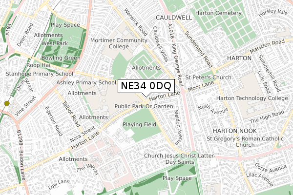
NE34 0DQ is located in the West Park electoral ward, within the metropolitan district of South Tyneside and the English Parliamentary constituency of South Shields. The Sub Integrated Care Board (ICB) Location is NHS North East and North Cumbria ICB - 00N and the police force is Northumbria. This postcode has been in use since August 2018.


GetTheData
Source: OS Open Zoomstack (Ordnance Survey)
Licence: Open Government Licence (requires attribution)
Attribution: Contains OS data © Crown copyright and database right 2024
Source: Open Postcode Geo
Licence: Open Government Licence (requires attribution)
Attribution: Contains OS data © Crown copyright and database right 2024; Contains Royal Mail data © Royal Mail copyright and database right 2024; Source: Office for National Statistics licensed under the Open Government Licence v.3.0
| Easting | 437029 |
| Northing | 564799 |
| Latitude | 54.976440 |
| Longitude | -1.423035 |
GetTheData
Source: Open Postcode Geo
Licence: Open Government Licence
| Country | England |
| Postcode District | NE34 |
| ➜ NE34 open data dashboard ➜ See where NE34 is on a map ➜ Where is South Shields? | |
GetTheData
Source: Land Registry Price Paid Data
Licence: Open Government Licence
| Ward | West Park |
| Constituency | South Shields |
GetTheData
Source: ONS Postcode Database
Licence: Open Government Licence
| January 2024 | Violence and sexual offences | On or near Temple Park Road | 56m |
| December 2023 | Public order | On or near Temple Park Road | 56m |
| December 2023 | Vehicle crime | On or near Cauldwell Villas | 459m |
| ➜ Get more crime data in our Crime section | |||
GetTheData
Source: data.police.uk
Licence: Open Government Licence
| Harton Lane-temple Park Road (Harton Lane) | Harton Moor | 57m |
| Temple Park Road-harton Lane (Temple Park Road) | Harton Moor | 63m |
| Temple Park Road-harton Lane (Temple Park Road) | Harton Moor | 73m |
| Harton Lane-temple Park Road (Harton Lane) | Harton Moor | 108m |
| Harton Lane-school (Harton Lane) | Harton Moor | 235m |
| Tyne Dock (Tyne And Wear Metro Station) (Napier Street) | Tyne Dock | 1,195m |
| Chichester (Tyne And Wear Metro Station) (Laygate) | Chichester | 1,246m |
| Brockley Whins Station | 3.1km |
| East Boldon Station | 3.3km |
GetTheData
Source: NaPTAN
Licence: Open Government Licence
| Percentage of properties with Next Generation Access | 100.0% |
| Percentage of properties with Superfast Broadband | 100.0% |
| Percentage of properties with Ultrafast Broadband | 100.0% |
| Percentage of properties with Full Fibre Broadband | 100.0% |
Superfast Broadband is between 30Mbps and 300Mbps
Ultrafast Broadband is > 300Mbps
| Percentage of properties unable to receive 2Mbps | 0.0% |
| Percentage of properties unable to receive 5Mbps | 0.0% |
| Percentage of properties unable to receive 10Mbps | 0.0% |
| Percentage of properties unable to receive 30Mbps | 0.0% |
GetTheData
Source: Ofcom
Licence: Ofcom Terms of Use (requires attribution)
GetTheData
Source: ONS Postcode Database
Licence: Open Government Licence


➜ Get more ratings from the Food Standards Agency
GetTheData
Source: Food Standards Agency
Licence: FSA terms & conditions
| Last Collection | |||
|---|---|---|---|
| Location | Mon-Fri | Sat | Distance |
| Temple Park Road | 17:00 | 09:30 | 212m |
| Moor Lane | 16:15 | 09:30 | 294m |
| Temple Park Road | 16:45 | 09:30 | 367m |
GetTheData
Source: Dracos
Licence: Creative Commons Attribution-ShareAlike
| Facility | Distance |
|---|---|
| Brinkburn Cio Mcanany Avenue, South Shields Swimming Pool, Grass Pitches, Sports Hall, Health and Fitness Gym | 377m |
| South Shields Community School (Closed) Off Harton Lane, South Shields Athletics, Swimming Pool, Sports Hall, Health and Fitness Gym, Grass Pitches, Studio | 379m |
| Brinkburn Recreation Ground Mortimer Road, South Shields Grass Pitches | 394m |
GetTheData
Source: Active Places
Licence: Open Government Licence
| School | Phase of Education | Distance |
|---|---|---|
| Park View School Temple Park Road, South Shields, NE34 0QA | Not applicable | 400m |
| St Wilfrid's RC College Temple Park Road, South Shields, NE34 0QA | Secondary | 419m |
| Mortimer Primary School Mortimer Road, South Shields, NE34 0RW | Primary | 481m |
GetTheData
Source: Edubase
Licence: Open Government Licence
The below table lists the International Territorial Level (ITL) codes (formerly Nomenclature of Territorial Units for Statistics (NUTS) codes) and Local Administrative Units (LAU) codes for NE34 0DQ:
| ITL 1 Code | Name |
|---|---|
| TLC | North East (England) |
| ITL 2 Code | Name |
| TLC2 | Northumberland, and Tyne and Wear |
| ITL 3 Code | Name |
| TLC22 | Tyneside |
| LAU 1 Code | Name |
| E08000023 | South Tyneside |
GetTheData
Source: ONS Postcode Directory
Licence: Open Government Licence
The below table lists the Census Output Area (OA), Lower Layer Super Output Area (LSOA), and Middle Layer Super Output Area (MSOA) for NE34 0DQ:
| Code | Name | |
|---|---|---|
| OA | E00044079 | |
| LSOA | E01008680 | South Tyneside 005B |
| MSOA | E02001772 | South Tyneside 005 |
GetTheData
Source: ONS Postcode Directory
Licence: Open Government Licence
| NE34 0EB | Rydal Gardens | 79m |
| NE34 0EE | Harton Lane | 85m |
| NE34 0EA | Ambleside Avenue | 97m |
| NE34 0DZ | Grasmere Gardens | 142m |
| NE34 0PR | Temple Park Road | 153m |
| NE34 0EG | Harton Lane | 166m |
| NE34 0EN | Temple Park Road | 172m |
| NE34 0PP | Harton Lane | 174m |
| NE34 0PS | Ullswater Gardens | 193m |
| NE34 0DW | Buttermere Gardens | 198m |
GetTheData
Source: Open Postcode Geo; Land Registry Price Paid Data
Licence: Open Government Licence