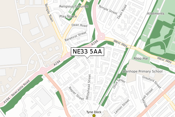
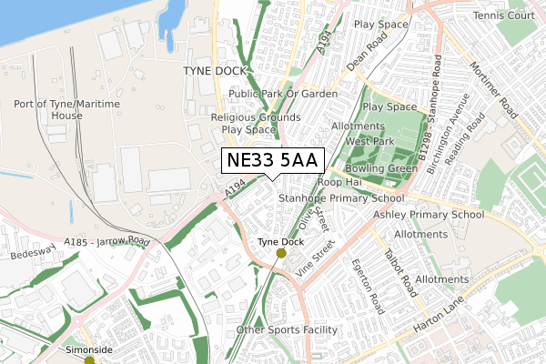
NE33 5AA is located in the Simonside and Rekendyke electoral ward, within the metropolitan district of South Tyneside and the English Parliamentary constituency of South Shields. The Sub Integrated Care Board (ICB) Location is NHS North East and North Cumbria ICB - 00N and the police force is Northumbria. This postcode has been in use since October 2017.


GetTheData
Source: OS Open Zoomstack (Ordnance Survey)
Licence: Open Government Licence (requires attribution)
Attribution: Contains OS data © Crown copyright and database right 2024
Source: Open Postcode Geo
Licence: Open Government Licence (requires attribution)
Attribution: Contains OS data © Crown copyright and database right 2024; Contains Royal Mail data © Royal Mail copyright and database right 2024; Source: Office for National Statistics licensed under the Open Government Licence v.3.0
| Easting | 435801 |
| Northing | 565076 |
| Latitude | 54.979018 |
| Longitude | -1.442185 |
GetTheData
Source: Open Postcode Geo
Licence: Open Government Licence
| Country | England |
| Postcode District | NE33 |
| ➜ NE33 open data dashboard ➜ See where NE33 is on a map ➜ Where is South Shields? | |
GetTheData
Source: Land Registry Price Paid Data
Licence: Open Government Licence
| Ward | Simonside And Rekendyke |
| Constituency | South Shields |
GetTheData
Source: ONS Postcode Database
Licence: Open Government Licence
| January 2024 | Drugs | On or near Vine Street | 397m |
| January 2024 | Other theft | On or near Vine Street | 397m |
| January 2024 | Public order | On or near Vine Street | 397m |
| ➜ Get more crime data in our Crime section | |||
GetTheData
Source: data.police.uk
Licence: Open Government Licence
| Slake Terrace | Tyne Dock | 155m |
| Slake Terrace | Tyne Dock | 209m |
| Temple Town-south Eldon Street (Temple Town) | Tyne Dock | 210m |
| Dean Road-dean Terrace (Dean Road) | Tyne Dock | 214m |
| Temple Town-south Eldon Street (Temple Town) | Tyne Dock | 226m |
| Tyne Dock (Tyne And Wear Metro Station) (Napier Street) | Tyne Dock | 318m |
| Chichester (Tyne And Wear Metro Station) (Laygate) | Chichester | 1,056m |
| Simonside (Tyne And Wear Metro Station) (Not Specified) | Simonside | 1,162m |
| Bede (Tyne And Wear Metro Station) (Monksway) | Bede | 1,556m |
| Brockley Whins Station | 2.5km |
| East Boldon Station | 3.9km |
GetTheData
Source: NaPTAN
Licence: Open Government Licence
| Percentage of properties with Next Generation Access | 0.0% |
| Percentage of properties with Superfast Broadband | 0.0% |
| Percentage of properties with Ultrafast Broadband | 0.0% |
| Percentage of properties with Full Fibre Broadband | 0.0% |
Superfast Broadband is between 30Mbps and 300Mbps
Ultrafast Broadband is > 300Mbps
| Median download speed | 8.0Mbps |
| Average download speed | 7.8Mbps |
| Maximum download speed | 10.88Mbps |
| Median upload speed | 0.9Mbps |
| Average upload speed | 0.9Mbps |
| Maximum upload speed | 1.14Mbps |
| Percentage of properties unable to receive 2Mbps | 0.0% |
| Percentage of properties unable to receive 5Mbps | 0.0% |
| Percentage of properties unable to receive 10Mbps | 38.7% |
| Percentage of properties unable to receive 30Mbps | 100.0% |
GetTheData
Source: Ofcom
Licence: Ofcom Terms of Use (requires attribution)
GetTheData
Source: ONS Postcode Database
Licence: Open Government Licence


➜ Get more ratings from the Food Standards Agency
GetTheData
Source: Food Standards Agency
Licence: FSA terms & conditions
| Last Collection | |||
|---|---|---|---|
| Location | Mon-Fri | Sat | Distance |
| Hudson Street | 16:00 | 11:30 | 255m |
| The Deans Post Office | 16:00 | 11:30 | 316m |
| Stanhope Road | 16:15 | 09:30 | 479m |
GetTheData
Source: Dracos
Licence: Creative Commons Attribution-ShareAlike
| Facility | Distance |
|---|---|
| Stanhope Primary School Gresford Street, South Shields Swimming Pool, Sports Hall | 379m |
| West Park (South Shields) West Park Road, South Shields Outdoor Tennis Courts | 653m |
| St Wilfrids Rc College Temple Park Road, South Shields Grass Pitches, Sports Hall | 927m |
GetTheData
Source: Active Places
Licence: Open Government Licence
| School | Phase of Education | Distance |
|---|---|---|
| Stanhope Primary School Gresford Street, South Shields, NE33 4SZ | Primary | 312m |
| SS Peter and Paul Catholic Primary School, South Shields Olive Street, South Shields, NE33 4RH | Primary | 459m |
| Ashley Academy Temple Park Road, South Shields, NE34 0QA | Primary | 694m |
GetTheData
Source: Edubase
Licence: Open Government Licence
The below table lists the International Territorial Level (ITL) codes (formerly Nomenclature of Territorial Units for Statistics (NUTS) codes) and Local Administrative Units (LAU) codes for NE33 5AA:
| ITL 1 Code | Name |
|---|---|
| TLC | North East (England) |
| ITL 2 Code | Name |
| TLC2 | Northumberland, and Tyne and Wear |
| ITL 3 Code | Name |
| TLC22 | Tyneside |
| LAU 1 Code | Name |
| E08000023 | South Tyneside |
GetTheData
Source: ONS Postcode Directory
Licence: Open Government Licence
The below table lists the Census Output Area (OA), Lower Layer Super Output Area (LSOA), and Middle Layer Super Output Area (MSOA) for NE33 5AA:
| Code | Name | |
|---|---|---|
| OA | E00044015 | |
| LSOA | E01008671 | South Tyneside 012C |
| MSOA | E02001779 | South Tyneside 012 |
GetTheData
Source: ONS Postcode Directory
Licence: Open Government Licence
| NE33 4SH | Waverdale Way | 90m |
| NE33 5LX | Greathead Street | 102m |
| NE33 5LY | Barehirst Street | 134m |
| NE33 5LU | Corney Street | 136m |
| NE33 5LZ | Whitehead Street | 137m |
| NE33 5NH | Whitfield Villas | 140m |
| NE33 4SN | Woodside Way | 142m |
| NE33 4SL | Waverdale Way | 161m |
| NE33 4SJ | Waverdale Way | 178m |
| NE33 5SX | South Eldon Street | 184m |
GetTheData
Source: Open Postcode Geo; Land Registry Price Paid Data
Licence: Open Government Licence