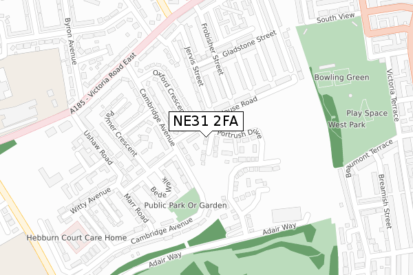
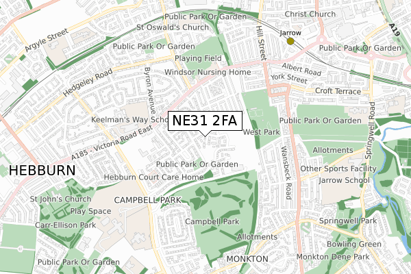
NE31 2FA is located in the Monkton electoral ward, within the metropolitan district of South Tyneside and the English Parliamentary constituency of Jarrow. The Sub Integrated Care Board (ICB) Location is NHS North East and North Cumbria ICB - 00N and the police force is Northumbria. This postcode has been in use since June 2019.


GetTheData
Source: OS Open Zoomstack (Ordnance Survey)
Licence: Open Government Licence (requires attribution)
Attribution: Contains OS data © Crown copyright and database right 2024
Source: Open Postcode Geo
Licence: Open Government Licence (requires attribution)
Attribution: Contains OS data © Crown copyright and database right 2024; Contains Royal Mail data © Royal Mail copyright and database right 2024; Source: Office for National Statistics licensed under the Open Government Licence v.3.0
| Easting | 432064 |
| Northing | 564548 |
| Latitude | 54.974527 |
| Longitude | -1.500628 |
GetTheData
Source: Open Postcode Geo
Licence: Open Government Licence
| Country | England |
| Postcode District | NE31 |
| ➜ NE31 open data dashboard ➜ See where NE31 is on a map ➜ Where is Hebburn? | |
GetTheData
Source: Land Registry Price Paid Data
Licence: Open Government Licence
| Ward | Monkton |
| Constituency | Jarrow |
GetTheData
Source: ONS Postcode Database
Licence: Open Government Licence
71, PORTRUSH DRIVE, HEBBURN, NE31 2FA 2021 19 NOV £246,995 |
69, PORTRUSH DRIVE, HEBBURN, NE31 2FA 2021 19 NOV £246,995 |
63, PORTRUSH DRIVE, HEBBURN, NE31 2FA 2021 24 JUN £235,495 |
57, PORTRUSH DRIVE, HEBBURN, NE31 2FA 2021 19 FEB £235,495 |
25, PORTRUSH DRIVE, HEBBURN, NE31 2FA 2020 25 SEP £246,995 |
31, PORTRUSH DRIVE, HEBBURN, NE31 2FA 2020 18 SEP £223,995 |
23, PORTRUSH DRIVE, HEBBURN, NE31 2FA 2020 28 AUG £227,995 |
33, PORTRUSH DRIVE, HEBBURN, NE31 2FA 2020 21 AUG £224,995 |
29, PORTRUSH DRIVE, HEBBURN, NE31 2FA 2020 31 JUL £217,995 |
27, PORTRUSH DRIVE, HEBBURN, NE31 2FA 2020 26 JUN £249,995 |
GetTheData
Source: HM Land Registry Price Paid Data
Licence: Contains HM Land Registry data © Crown copyright and database right 2024. This data is licensed under the Open Government Licence v3.0.
| January 2024 | Violence and sexual offences | On or near Windsor Crescent | 465m |
| January 2024 | Criminal damage and arson | On or near Windsor Crescent | 465m |
| January 2024 | Public order | On or near Windsor Crescent | 465m |
| ➜ Get more crime data in our Crime section | |||
GetTheData
Source: data.police.uk
Licence: Open Government Licence
| Victoria Road-jervis Street (Victoria Road) | Hebburn | 308m |
| Victoria Road East-jubilee Court (Victoria Road East) | Hebburn | 347m |
| Victoria Road East-byron Avenue (Victoria Road East) | Hebburn | 354m |
| Victoria Road West - Ushaw Road (Victoria Road East) | Hebburn | 427m |
| Bede Burn Road-social Club (Bede Burn Road) | Jarrow | 453m |
| Jarrow (Tyne And Wear Metro Station) (Grant Street) | Jarrow | 710m |
| Hebburn (Tyne And Wear Metro Station) (Prince Consort Road) | Hebburn | 1,277m |
| Brockley Whins Station | 3km |
| Heworth Station | 4.4km |
GetTheData
Source: NaPTAN
Licence: Open Government Licence
| Percentage of properties with Next Generation Access | 100.0% |
| Percentage of properties with Superfast Broadband | 100.0% |
| Percentage of properties with Ultrafast Broadband | 0.0% |
| Percentage of properties with Full Fibre Broadband | 0.0% |
Superfast Broadband is between 30Mbps and 300Mbps
Ultrafast Broadband is > 300Mbps
| Percentage of properties unable to receive 2Mbps | 0.0% |
| Percentage of properties unable to receive 5Mbps | 0.0% |
| Percentage of properties unable to receive 10Mbps | 0.0% |
| Percentage of properties unable to receive 30Mbps | 0.0% |
GetTheData
Source: Ofcom
Licence: Ofcom Terms of Use (requires attribution)
GetTheData
Source: ONS Postcode Database
Licence: Open Government Licence


➜ Get more ratings from the Food Standards Agency
GetTheData
Source: Food Standards Agency
Licence: FSA terms & conditions
| Last Collection | |||
|---|---|---|---|
| Location | Mon-Fri | Sat | Distance |
| Linden Road | 17:30 | 11:30 | 250m |
| Victoria Road East | 16:15 | 10:30 | 302m |
| Cambridge Avenue | 16:15 | 10:30 | 303m |
GetTheData
Source: Dracos
Licence: Creative Commons Attribution-ShareAlike
| Facility | Distance |
|---|---|
| Hebburn Swimming Pool (Closed) Campbell Park Road, Hebburn Swimming Pool, Health and Fitness Gym | 486m |
| Keelman's Way School Campbell Park Road, Hebburn Grass Pitches | 518m |
| The Clock Playing Field Victoria Road East, Hebburn Grass Pitches | 533m |
GetTheData
Source: Active Places
Licence: Open Government Licence
| School | Phase of Education | Distance |
|---|---|---|
| Keelman's Way School Campbell Park Road, Hebburn, NE31 1QY | Not applicable | 518m |
| The Sue Hedley Nursery School Campbell Park Road, Hebburn, NE31 1QY | Nursery | 612m |
| St Oswald's CofE Aided Primary School St Oswald's Road, Hebburn, NE31 1HT | Primary | 662m |
GetTheData
Source: Edubase
Licence: Open Government Licence
The below table lists the International Territorial Level (ITL) codes (formerly Nomenclature of Territorial Units for Statistics (NUTS) codes) and Local Administrative Units (LAU) codes for NE31 2FA:
| ITL 1 Code | Name |
|---|---|
| TLC | North East (England) |
| ITL 2 Code | Name |
| TLC2 | Northumberland, and Tyne and Wear |
| ITL 3 Code | Name |
| TLC22 | Tyneside |
| LAU 1 Code | Name |
| E08000023 | South Tyneside |
GetTheData
Source: ONS Postcode Directory
Licence: Open Government Licence
The below table lists the Census Output Area (OA), Lower Layer Super Output Area (LSOA), and Middle Layer Super Output Area (MSOA) for NE31 2FA:
| Code | Name | |
|---|---|---|
| OA | E00043944 | |
| LSOA | E01008655 | South Tyneside 009E |
| MSOA | E02001776 | South Tyneside 009 |
GetTheData
Source: ONS Postcode Directory
Licence: Open Government Licence
| NE31 2XF | Red House Road | 60m |
| NE31 2XS | Red House Road | 89m |
| NE31 2XE | Frobisher Street | 115m |
| NE31 2XR | Jervis Street | 129m |
| NE31 2XH | Howe Street | 134m |
| NE31 2XG | Red House Road | 135m |
| NE31 2RZ | Cambridge Avenue | 176m |
| NE31 2XU | Cambridge Avenue | 177m |
| NE31 2XT | Oxford Crescent | 182m |
| NE31 2XX | Cambridge Avenue | 188m |
GetTheData
Source: Open Postcode Geo; Land Registry Price Paid Data
Licence: Open Government Licence