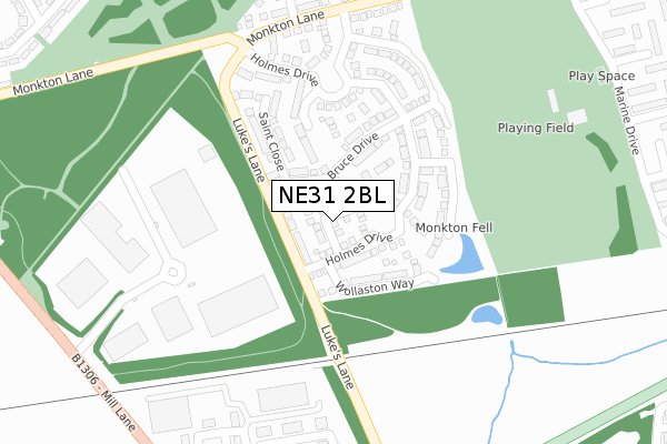
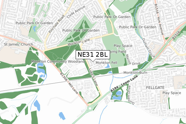
NE31 2BL is located in the Hebburn South electoral ward, within the metropolitan district of South Tyneside and the English Parliamentary constituency of Jarrow. The Sub Integrated Care Board (ICB) Location is NHS North East and North Cumbria ICB - 00N and the police force is Northumbria. This postcode has been in use since May 2018.


GetTheData
Source: OS Open Zoomstack (Ordnance Survey)
Licence: Open Government Licence (requires attribution)
Attribution: Contains OS data © Crown copyright and database right 2024
Source: Open Postcode Geo
Licence: Open Government Licence (requires attribution)
Attribution: Contains OS data © Crown copyright and database right 2024; Contains Royal Mail data © Royal Mail copyright and database right 2024; Source: Office for National Statistics licensed under the Open Government Licence v.3.0
| Easting | 431776 |
| Northing | 562677 |
| Latitude | 54.957733 |
| Longitude | -1.505334 |
GetTheData
Source: Open Postcode Geo
Licence: Open Government Licence
| Country | England |
| Postcode District | NE31 |
| ➜ NE31 open data dashboard ➜ See where NE31 is on a map ➜ Where is Hebburn? | |
GetTheData
Source: Land Registry Price Paid Data
Licence: Open Government Licence
| Ward | Hebburn South |
| Constituency | Jarrow |
GetTheData
Source: ONS Postcode Database
Licence: Open Government Licence
2022 14 APR £339,000 |
4, GRESFORD CLOSE, HEBBURN, NE31 2BL 2019 6 DEC £259,995 |
15, GRESFORD CLOSE, HEBBURN, NE31 2BL 2019 29 NOV £234,995 |
18, GRESFORD CLOSE, HEBBURN, NE31 2BL 2019 29 NOV £312,995 |
14, GRESFORD CLOSE, HEBBURN, NE31 2BL 2019 25 OCT £224,995 |
1, GRESFORD CLOSE, HEBBURN, NE31 2BL 2019 21 FEB £265,995 |
7, GRESFORD CLOSE, HEBBURN, NE31 2BL 2018 14 DEC £284,995 |
2018 14 DEC £251,745 |
3, GRESFORD CLOSE, HEBBURN, NE31 2BL 2018 30 NOV £294,995 |
12, GRESFORD CLOSE, HEBBURN, NE31 2BL 2018 2 NOV £263,995 |
GetTheData
Source: HM Land Registry Price Paid Data
Licence: Contains HM Land Registry data © Crown copyright and database right 2024. This data is licensed under the Open Government Licence v3.0.
| June 2022 | Violence and sexual offences | On or near Sports/Recreation Area | 280m |
| June 2022 | Public order | On or near Sports/Recreation Area | 280m |
| June 2022 | Anti-social behaviour | On or near Sports/Recreation Area | 280m |
| ➜ Get more crime data in our Crime section | |||
GetTheData
Source: data.police.uk
Licence: Open Government Licence
| Monkton Business Park (Unknown) | Hebburn | 300m |
| Monkton Business Park South (Koppers Way) | Hebburn | 376m |
| Leam Lane-lakeside (Leam Lane) | Fellgate | 491m |
| Marine Drive-hastings Club (Marine Drive) | Hebburn | 498m |
| Campbell Park Road | Hebburn | 504m |
| Fellgate (Tyne And Wear Metro Station) (Leam Lane) | Fellgate | 1,254m |
| Brockley Whins Station | 2.8km |
| Heworth Station | 3.3km |
GetTheData
Source: NaPTAN
Licence: Open Government Licence
| Percentage of properties with Next Generation Access | 93.3% |
| Percentage of properties with Superfast Broadband | 93.3% |
| Percentage of properties with Ultrafast Broadband | 0.0% |
| Percentage of properties with Full Fibre Broadband | 0.0% |
Superfast Broadband is between 30Mbps and 300Mbps
Ultrafast Broadband is > 300Mbps
| Percentage of properties unable to receive 2Mbps | 0.0% |
| Percentage of properties unable to receive 5Mbps | 0.0% |
| Percentage of properties unable to receive 10Mbps | 6.7% |
| Percentage of properties unable to receive 30Mbps | 6.7% |
GetTheData
Source: Ofcom
Licence: Ofcom Terms of Use (requires attribution)
GetTheData
Source: ONS Postcode Database
Licence: Open Government Licence


➜ Get more ratings from the Food Standards Agency
GetTheData
Source: Food Standards Agency
Licence: FSA terms & conditions
| Last Collection | |||
|---|---|---|---|
| Location | Mon-Fri | Sat | Distance |
| Brighton Parade | 16:00 | 10:00 | 547m |
| Bath Square | 17:00 | 10:30 | 626m |
| Finchale Road Post Office | 18:15 | 12:15 | 726m |
GetTheData
Source: Dracos
Licence: Creative Commons Attribution-ShareAlike
| Facility | Distance |
|---|---|
| Luke Lane Playing Fields Lukes Lane Estate, Hebburn Grass Pitches | 325m |
| St Matthews Rc Primary School Alnwick Grove, Jarrow Swimming Pool, Grass Pitches | 835m |
| Monkton Stadium Dene Terrace, Jarrow Sports Hall, Athletics, Health and Fitness Gym, Grass Pitches, Artificial Grass Pitch | 1.1km |
GetTheData
Source: Active Places
Licence: Open Government Licence
| School | Phase of Education | Distance |
|---|---|---|
| St Matthew's Catholic Primary School, Jarrow Alnwick Grove, Jarrow, NE32 5YT | Primary | 790m |
| St James' Catholic Primary School, Hebburn Solway Road, HEBBURN, NE31 2BP | Primary | 987m |
| Fellgate Primary School Oxford Way, Durham Drive, Fellgate Estate, Jarrow, NE32 4XA | Primary | 1.1km |
GetTheData
Source: Edubase
Licence: Open Government Licence
The below table lists the International Territorial Level (ITL) codes (formerly Nomenclature of Territorial Units for Statistics (NUTS) codes) and Local Administrative Units (LAU) codes for NE31 2BL:
| ITL 1 Code | Name |
|---|---|
| TLC | North East (England) |
| ITL 2 Code | Name |
| TLC2 | Northumberland, and Tyne and Wear |
| ITL 3 Code | Name |
| TLC22 | Tyneside |
| LAU 1 Code | Name |
| E08000023 | South Tyneside |
GetTheData
Source: ONS Postcode Directory
Licence: Open Government Licence
The below table lists the Census Output Area (OA), Lower Layer Super Output Area (LSOA), and Middle Layer Super Output Area (MSOA) for NE31 2BL:
| Code | Name | |
|---|---|---|
| OA | E00043887 | |
| LSOA | E01008645 | South Tyneside 015C |
| MSOA | E02001782 | South Tyneside 015 |
GetTheData
Source: ONS Postcode Directory
Licence: Open Government Licence
| NE31 2JZ | Monkton Business Park North | 307m |
| NE31 2GD | Monkton Lane | 310m |
| NE31 2ES | Koppers Way | 349m |
| NE31 2GF | Ebba Point | 374m |
| NE31 2GE | St Aidans Walk | 437m |
| NE31 2GB | Bedeswell Close | 439m |
| NE31 2GA | Benedict Lane | 504m |
| NE31 2AP | Penzance Parade | 511m |
| NE31 2JG | Hexham Avenue | 516m |
| NE31 2GG | Kellsway | 522m |
GetTheData
Source: Open Postcode Geo; Land Registry Price Paid Data
Licence: Open Government Licence