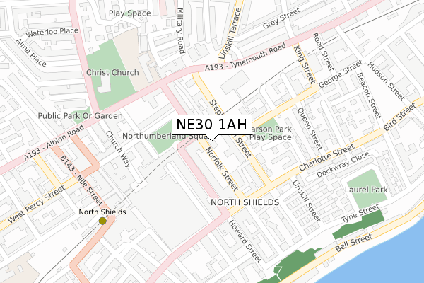
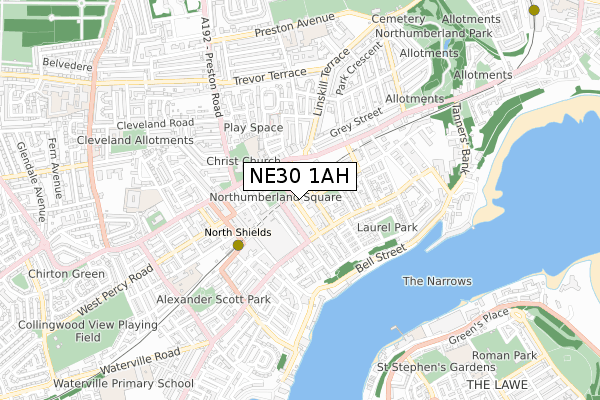
NE30 1AH is located in the Tynemouth electoral ward, within the metropolitan district of North Tyneside and the English Parliamentary constituency of Tynemouth. The Sub Integrated Care Board (ICB) Location is NHS North East and North Cumbria ICB - 99C and the police force is Northumbria. This postcode has been in use since January 2018.


GetTheData
Source: OS Open Zoomstack (Ordnance Survey)
Licence: Open Government Licence (requires attribution)
Attribution: Contains OS data © Crown copyright and database right 2025
Source: Open Postcode Geo
Licence: Open Government Licence (requires attribution)
Attribution: Contains OS data © Crown copyright and database right 2025; Contains Royal Mail data © Royal Mail copyright and database right 2025; Source: Office for National Statistics licensed under the Open Government Licence v.3.0
| Easting | 435646 |
| Northing | 568543 |
| Latitude | 55.010183 |
| Longitude | -1.444176 |
GetTheData
Source: Open Postcode Geo
Licence: Open Government Licence
| Country | England |
| Postcode District | NE30 |
➜ See where NE30 is on a map ➜ Where is Tynemouth? | |
GetTheData
Source: Land Registry Price Paid Data
Licence: Open Government Licence
| Ward | Tynemouth |
| Constituency | Tynemouth |
GetTheData
Source: ONS Postcode Database
Licence: Open Government Licence
| Howard Street | North Shields | 79m |
| Northumberland Square | North Shields | 113m |
| Northumberland Square | North Shields | 134m |
| Saville Street | North Shields | 162m |
| Tynemouth Road-linskill Terrace (Tynemouth Road) | North Shields | 180m |
| North Shields (Tyne And Wear Metro Station) (Railway Terrace) | North Shields | 355m |
| Tynemouth (Tyne And Wear Metro Station) (Station Terrace) | Tynemouth | 1,261m |
| South Shields (Tyne And Wear Metro Station) (Smithy Street) | South Shields | 1,499m |
| Meadow Well (Tyne And Wear Metro Station) (Ripley Avenue) | Meadow Well | 1,650m |
GetTheData
Source: NaPTAN
Licence: Open Government Licence
| Percentage of properties with Next Generation Access | 100.0% |
| Percentage of properties with Superfast Broadband | 100.0% |
| Percentage of properties with Ultrafast Broadband | 0.0% |
| Percentage of properties with Full Fibre Broadband | 0.0% |
Superfast Broadband is between 30Mbps and 300Mbps
Ultrafast Broadband is > 300Mbps
| Median download speed | 23.9Mbps |
| Average download speed | 41.3Mbps |
| Maximum download speed | 80.00Mbps |
| Median upload speed | 1.3Mbps |
| Average upload speed | 7.3Mbps |
| Maximum upload speed | 20.00Mbps |
| Percentage of properties unable to receive 2Mbps | 0.0% |
| Percentage of properties unable to receive 5Mbps | 0.0% |
| Percentage of properties unable to receive 10Mbps | 0.0% |
| Percentage of properties unable to receive 30Mbps | 0.0% |
GetTheData
Source: Ofcom
Licence: Ofcom Terms of Use (requires attribution)
GetTheData
Source: ONS Postcode Database
Licence: Open Government Licence


➜ Get more ratings from the Food Standards Agency
GetTheData
Source: Food Standards Agency
Licence: FSA terms & conditions
| Last Collection | |||
|---|---|---|---|
| Location | Mon-Fri | Sat | Distance |
| Northumberland Square | 18:30 | 12:15 | 167m |
| Saville Street | 18:30 | 11:45 | 209m |
| Co-op Post Office | 18:30 | 12:30 | 262m |
GetTheData
Source: Dracos
Licence: Creative Commons Attribution-ShareAlike
The below table lists the International Territorial Level (ITL) codes (formerly Nomenclature of Territorial Units for Statistics (NUTS) codes) and Local Administrative Units (LAU) codes for NE30 1AH:
| ITL 1 Code | Name |
|---|---|
| TLC | North East (England) |
| ITL 2 Code | Name |
| TLC2 | Northumberland, and Tyne and Wear |
| ITL 3 Code | Name |
| TLC22 | Tyneside |
| LAU 1 Code | Name |
| E08000022 | North Tyneside |
GetTheData
Source: ONS Postcode Directory
Licence: Open Government Licence
The below table lists the Census Output Area (OA), Lower Layer Super Output Area (LSOA), and Middle Layer Super Output Area (MSOA) for NE30 1AH:
| Code | Name | |
|---|---|---|
| OA | E00043272 | |
| LSOA | E01008524 | North Tyneside 022B |
| MSOA | E02001759 | North Tyneside 022 |
GetTheData
Source: ONS Postcode Directory
Licence: Open Government Licence
| NE30 1BA | Norfolk Street | 28m |
| NE30 1PW | Northumberland Square | 60m |
| NE30 1AF | Howard Street | 82m |
| NE30 1ER | Stephenson Street | 115m |
| NE30 1QD | Northumberland Square | 129m |
| NE30 1PT | Upper Norfolk Street | 144m |
| NE30 1AR | Howard Street | 153m |
| NE30 1PU | Back Albion Road | 160m |
| NE30 2RH | Howard Terrace | 166m |
| NE30 1NS | Saville Street | 174m |
GetTheData
Source: Open Postcode Geo; Land Registry Price Paid Data
Licence: Open Government Licence