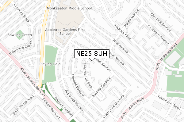
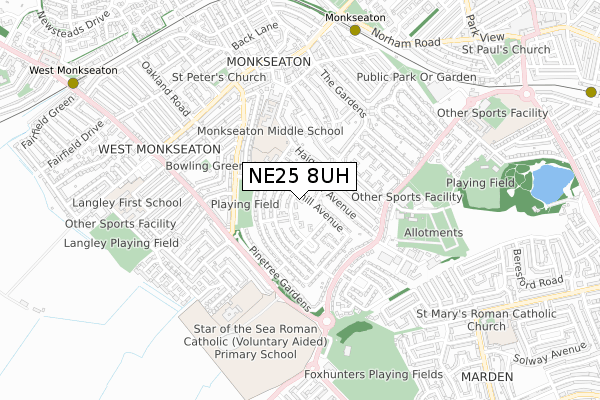
NE25 8UH is located in the Monkseaton South electoral ward, within the metropolitan district of North Tyneside and the English Parliamentary constituency of Tynemouth. The Sub Integrated Care Board (ICB) Location is NHS North East and North Cumbria ICB - 99C and the police force is Northumbria. This postcode has been in use since July 2019.


GetTheData
Source: OS Open Zoomstack (Ordnance Survey)
Licence: Open Government Licence (requires attribution)
Attribution: Contains OS data © Crown copyright and database right 2024
Source: Open Postcode Geo
Licence: Open Government Licence (requires attribution)
Attribution: Contains OS data © Crown copyright and database right 2024; Contains Royal Mail data © Royal Mail copyright and database right 2024; Source: Office for National Statistics licensed under the Open Government Licence v.3.0
| Easting | 434488 |
| Northing | 571393 |
| Latitude | 55.035873 |
| Longitude | -1.461940 |
GetTheData
Source: Open Postcode Geo
Licence: Open Government Licence
| Country | England |
| Postcode District | NE25 |
| ➜ NE25 open data dashboard ➜ See where NE25 is on a map ➜ Where is Whitley Bay? | |
GetTheData
Source: Land Registry Price Paid Data
Licence: Open Government Licence
| Ward | Monkseaton South |
| Constituency | Tynemouth |
GetTheData
Source: ONS Postcode Database
Licence: Open Government Licence
| November 2023 | Criminal damage and arson | On or near Parking Area | 409m |
| November 2023 | Violence and sexual offences | On or near Parking Area | 409m |
| November 2023 | Public order | On or near Parking Area | 409m |
| ➜ Get more crime data in our Crime section | |||
GetTheData
Source: data.police.uk
Licence: Open Government Licence
| Hillheads Estate (Churchill Avenue) | Monkseaton | 101m |
| Hillheads Estate (Churchill Avenue) | Monkseaton | 101m |
| Bromley Avenue-seatonville Road (Bromley Avenue) | Monkseaton | 287m |
| Bromley Avenue-seatonville Road (Bromley Avenue) | Monkseaton | 292m |
| Shields Road | Monkseaton | 320m |
| Monkseaton (Tyne And Wear Metro Station) (Front Street) | Monkseaton | 756m |
| West Monkseaton (Tyne And Wear Metro Station) (Earsdon Road) | West Monkseaton | 1,111m |
| Whitley Bay (Tyne And Wear Metro Station) (Station Road) | Whitley Bay | 1,307m |
GetTheData
Source: NaPTAN
Licence: Open Government Licence
| Percentage of properties with Next Generation Access | 0.0% |
| Percentage of properties with Superfast Broadband | 0.0% |
| Percentage of properties with Ultrafast Broadband | 0.0% |
| Percentage of properties with Full Fibre Broadband | 0.0% |
Superfast Broadband is between 30Mbps and 300Mbps
Ultrafast Broadband is > 300Mbps
| Percentage of properties unable to receive 2Mbps | 0.0% |
| Percentage of properties unable to receive 5Mbps | 0.0% |
| Percentage of properties unable to receive 10Mbps | 0.0% |
| Percentage of properties unable to receive 30Mbps | 0.0% |
GetTheData
Source: Ofcom
Licence: Ofcom Terms of Use (requires attribution)
GetTheData
Source: ONS Postcode Database
Licence: Open Government Licence


➜ Get more ratings from the Food Standards Agency
GetTheData
Source: Food Standards Agency
Licence: FSA terms & conditions
| Last Collection | |||
|---|---|---|---|
| Location | Mon-Fri | Sat | Distance |
| Front Street | 16:00 | 12:00 | 397m |
| South Parade | 17:30 | 11:45 | 711m |
| Newsteads Drive | 17:45 | 11:00 | 771m |
GetTheData
Source: Dracos
Licence: Creative Commons Attribution-ShareAlike
| Facility | Distance |
|---|---|
| Monkseaton Middle School Vernon Drive, Whitley Bay Grass Pitches | 377m |
| Whitley Bay Ice Rink Hillheads Road, Whitley Bay Ice Rinks, Studio | 441m |
| Crawford Park Seatonville Road, West Monkseaton, Whitley Bay Outdoor Tennis Courts | 446m |
GetTheData
Source: Active Places
Licence: Open Government Licence
| School | Phase of Education | Distance |
|---|---|---|
| Appletree Gardens First School Appletree Gardens, Monkseaton, Whitley Bay, NE25 8XS | Primary | 187m |
| Monkseaton Middle School Vernon Drive, Monkseaton, Whitley Bay, NE25 8JW | Middle deemed secondary | 332m |
| Star of the Sea Catholic Primary School, Whitley Bay Seatonville Road, Whitley Bay, NE25 9EG | Primary | 359m |
GetTheData
Source: Edubase
Licence: Open Government Licence
The below table lists the International Territorial Level (ITL) codes (formerly Nomenclature of Territorial Units for Statistics (NUTS) codes) and Local Administrative Units (LAU) codes for NE25 8UH:
| ITL 1 Code | Name |
|---|---|
| TLC | North East (England) |
| ITL 2 Code | Name |
| TLC2 | Northumberland, and Tyne and Wear |
| ITL 3 Code | Name |
| TLC22 | Tyneside |
| LAU 1 Code | Name |
| E08000022 | North Tyneside |
GetTheData
Source: ONS Postcode Directory
Licence: Open Government Licence
The below table lists the Census Output Area (OA), Lower Layer Super Output Area (LSOA), and Middle Layer Super Output Area (MSOA) for NE25 8UH:
| Code | Name | |
|---|---|---|
| OA | E00043441 | |
| LSOA | E01008555 | North Tyneside 009D |
| MSOA | E02001746 | North Tyneside 009 |
GetTheData
Source: ONS Postcode Directory
Licence: Open Government Licence
| NE25 8XL | Cedartree Gardens | 48m |
| NE25 8XP | Churchill Avenue | 75m |
| NE25 8JF | Maple Avenue | 84m |
| NE25 8JB | Roker Avenue | 102m |
| NE25 8XF | Oaktree Gardens | 113m |
| NE25 8XR | Elmtree Gardens | 115m |
| NE25 8XN | Cedartree Gardens | 142m |
| NE25 8XT | Appletree Gardens | 155m |
| NE25 8XS | Appletree Gardens | 161m |
| NE25 8XH | Baytree Gardens | 165m |
GetTheData
Source: Open Postcode Geo; Land Registry Price Paid Data
Licence: Open Government Licence