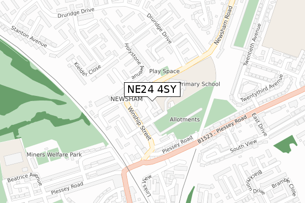
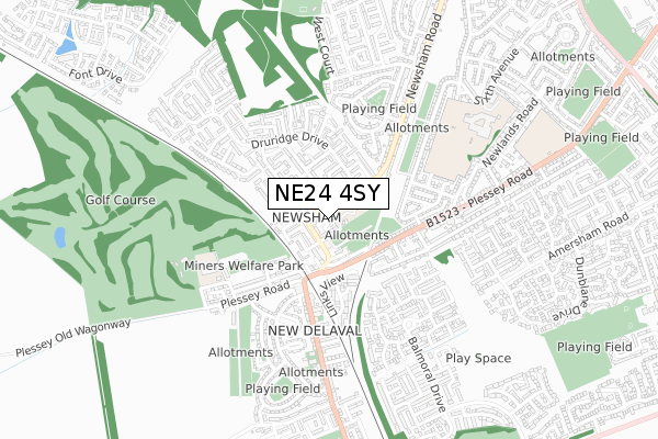
NE24 4SY is located in the Newsham electoral ward, within the unitary authority of Northumberland and the English Parliamentary constituency of Blyth Valley. The Sub Integrated Care Board (ICB) Location is NHS North East and North Cumbria ICB - 00L and the police force is Northumbria. This postcode has been in use since April 2018.


GetTheData
Source: OS Open Zoomstack (Ordnance Survey)
Licence: Open Government Licence (requires attribution)
Attribution: Contains OS data © Crown copyright and database right 2024
Source: Open Postcode Geo
Licence: Open Government Licence (requires attribution)
Attribution: Contains OS data © Crown copyright and database right 2024; Contains Royal Mail data © Royal Mail copyright and database right 2024; Source: Office for National Statistics licensed under the Open Government Licence v.3.0
| Easting | 430102 |
| Northing | 580022 |
| Latitude | 55.113694 |
| Longitude | -1.529654 |
GetTheData
Source: Open Postcode Geo
Licence: Open Government Licence
| Country | England |
| Postcode District | NE24 |
| ➜ NE24 open data dashboard ➜ See where NE24 is on a map ➜ Where is Blyth? | |
GetTheData
Source: Land Registry Price Paid Data
Licence: Open Government Licence
| Ward | Newsham |
| Constituency | Blyth Valley |
GetTheData
Source: ONS Postcode Database
Licence: Open Government Licence
| January 2024 | Anti-social behaviour | On or near Elliott Street | 145m |
| January 2024 | Criminal damage and arson | On or near Elliott Street | 145m |
| January 2024 | Criminal damage and arson | On or near Elliott Street | 145m |
| ➜ Get more crime data in our Crime section | |||
GetTheData
Source: data.police.uk
Licence: Open Government Licence
| Wharton Street | Newsham | 46m |
| Wharton Street | Newsham | 58m |
| Embleton Drive (Druridge Drive) | Newsham Farm | 176m |
| Embleton Drive (Druridge Drive) | Newsham Farm | 187m |
| Black Diamond (Plessey Road) | Newsham | 208m |
| Cramlington Station | 5.3km |
GetTheData
Source: NaPTAN
Licence: Open Government Licence
➜ Broadband speed and availability dashboard for NE24 4SY
| Percentage of properties with Next Generation Access | 100.0% |
| Percentage of properties with Superfast Broadband | 100.0% |
| Percentage of properties with Ultrafast Broadband | 0.0% |
| Percentage of properties with Full Fibre Broadband | 0.0% |
Superfast Broadband is between 30Mbps and 300Mbps
Ultrafast Broadband is > 300Mbps
| Median download speed | 40.0Mbps |
| Average download speed | 29.9Mbps |
| Maximum download speed | 63.74Mbps |
| Median upload speed | 10.0Mbps |
| Average upload speed | 8.2Mbps |
| Maximum upload speed | 19.53Mbps |
| Percentage of properties unable to receive 2Mbps | 0.0% |
| Percentage of properties unable to receive 5Mbps | 0.0% |
| Percentage of properties unable to receive 10Mbps | 0.0% |
| Percentage of properties unable to receive 30Mbps | 0.0% |
➜ Broadband speed and availability dashboard for NE24 4SY
GetTheData
Source: Ofcom
Licence: Ofcom Terms of Use (requires attribution)
GetTheData
Source: ONS Postcode Database
Licence: Open Government Licence


➜ Get more ratings from the Food Standards Agency
GetTheData
Source: Food Standards Agency
Licence: FSA terms & conditions
| Last Collection | |||
|---|---|---|---|
| Location | Mon-Fri | Sat | Distance |
| Plessey Road | 16:15 | 10:45 | 184m |
| Newsham Post Office | 16:15 | 10:45 | 271m |
| Twentieth Avenue | 16:30 | 10:45 | 335m |
GetTheData
Source: Dracos
Licence: Creative Commons Attribution-ShareAlike
| Facility | Distance |
|---|---|
| Newsham Primary School Warwick Street, Blyth Grass Pitches | 96m |
| New Delaval And Newsham Miners Welfare Park Delaval Gardens, Blyth Grass Pitches, Outdoor Tennis Courts | 436m |
| New Delaval Primary School Blyth Grass Pitches | 496m |
GetTheData
Source: Active Places
Licence: Open Government Licence
| School | Phase of Education | Distance |
|---|---|---|
| Newsham Primary School Warwick Street, Blyth, NE24 4NX | Primary | 45m |
| New Delaval Primary School Delaval Gardens, New Delaval, Blyth, NE24 4DA | Primary | 529m |
| Bede Academy Sixth Avenue, Blyth, NE24 2SY | All-through | 734m |
GetTheData
Source: Edubase
Licence: Open Government Licence
The below table lists the International Territorial Level (ITL) codes (formerly Nomenclature of Territorial Units for Statistics (NUTS) codes) and Local Administrative Units (LAU) codes for NE24 4SY:
| ITL 1 Code | Name |
|---|---|
| TLC | North East (England) |
| ITL 2 Code | Name |
| TLC2 | Northumberland, and Tyne and Wear |
| ITL 3 Code | Name |
| TLC21 | Northumberland |
| LAU 1 Code | Name |
| E06000057 | Northumberland |
GetTheData
Source: ONS Postcode Directory
Licence: Open Government Licence
The below table lists the Census Output Area (OA), Lower Layer Super Output Area (LSOA), and Middle Layer Super Output Area (MSOA) for NE24 4SY:
| Code | Name | |
|---|---|---|
| OA | E00139590 | |
| LSOA | E01027427 | Northumberland 025C |
| MSOA | E02005712 | Northumberland 025 |
GetTheData
Source: ONS Postcode Directory
Licence: Open Government Licence
| NE24 4NB | Brockwell Court | 61m |
| NE24 4PU | Wharton Street | 78m |
| NE24 4NH | Winship Street | 87m |
| NE24 4NT | Elliott Street | 111m |
| NE24 4NR | Elliott Street | 134m |
| NE24 4QZ | Holystone Avenue | 144m |
| NE24 4QD | Holystone Avenue | 149m |
| NE24 4QB | Holystone Avenue | 149m |
| NE24 4DD | Carrside Mews | 152m |
| NE24 4QE | Amble Close | 167m |
GetTheData
Source: Open Postcode Geo; Land Registry Price Paid Data
Licence: Open Government Licence