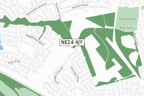
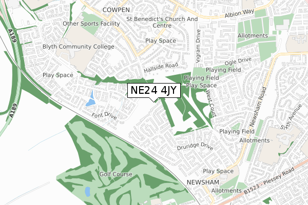
NE24 4JY is located in the Kitty Brewster electoral ward, within the unitary authority of Northumberland and the English Parliamentary constituency of Blyth Valley. The Sub Integrated Care Board (ICB) Location is NHS North East and North Cumbria ICB - 00L and the police force is Northumbria. This postcode has been in use since January 2018.


GetTheData
Source: OS Open Zoomstack (Ordnance Survey)
Licence: Open Government Licence (requires attribution)
Attribution: Contains OS data © Crown copyright and database right 2024
Source: Open Postcode Geo
Licence: Open Government Licence (requires attribution)
Attribution: Contains OS data © Crown copyright and database right 2024; Contains Royal Mail data © Royal Mail copyright and database right 2024; Source: Office for National Statistics licensed under the Open Government Licence v.3.0
| Easting | 429585 |
| Northing | 580700 |
| Latitude | 55.119817 |
| Longitude | -1.537688 |
GetTheData
Source: Open Postcode Geo
Licence: Open Government Licence
| Country | England |
| Postcode District | NE24 |
| ➜ NE24 open data dashboard ➜ See where NE24 is on a map ➜ Where is Blyth? | |
GetTheData
Source: Land Registry Price Paid Data
Licence: Open Government Licence
| Ward | Kitty Brewster |
| Constituency | Blyth Valley |
GetTheData
Source: ONS Postcode Database
Licence: Open Government Licence
12, HALIDON WALK, BLYTH, NE24 4JY 2022 21 DEC £202,950 |
2, HALIDON WALK, BLYTH, NE24 4JY 2022 30 NOV £189,950 |
27, HALIDON WALK, BLYTH, NE24 4JY 2022 8 JUL £214,950 |
20, HALIDON WALK, BLYTH, NE24 4JY 2022 30 JUN £176,950 |
18, HALIDON WALK, BLYTH, NE24 4JY 2022 30 JUN £201,950 |
15, HALIDON WALK, BLYTH, NE24 4JY 2022 30 JUN £216,950 |
16, HALIDON WALK, BLYTH, NE24 4JY 2022 30 JUN £216,950 |
17, HALIDON WALK, BLYTH, NE24 4JY 2022 30 JUN £176,950 |
19, HALIDON WALK, BLYTH, NE24 4JY 2022 27 JUN £211,950 |
26, HALIDON WALK, BLYTH, NE24 4JY 2022 27 JUN £215,950 |
GetTheData
Source: HM Land Registry Price Paid Data
Licence: Contains HM Land Registry data © Crown copyright and database right 2024. This data is licensed under the Open Government Licence v3.0.
| January 2024 | Anti-social behaviour | On or near Castledale Avenue | 268m |
| January 2024 | Anti-social behaviour | On or near Castledale Avenue | 268m |
| January 2024 | Anti-social behaviour | On or near Castledale Avenue | 268m |
| ➜ Get more crime data in our Crime section | |||
GetTheData
Source: data.police.uk
Licence: Open Government Licence
| St Mary's Drive (Druridge Crescent) | Newsham Farm | 168m |
| Druridge Crescent | Newsham Farm | 233m |
| Walsham Close (Druridge Crescent) | Newsham Farm | 284m |
| Tynedale Drive South End (Tynedale Drive) | Cowpen | 419m |
| Percy Arms (Brierley Road) | Cowpen | 468m |
| Cramlington Station | 5.3km |
GetTheData
Source: NaPTAN
Licence: Open Government Licence
GetTheData
Source: ONS Postcode Database
Licence: Open Government Licence


➜ Get more ratings from the Food Standards Agency
GetTheData
Source: Food Standards Agency
Licence: FSA terms & conditions
| Last Collection | |||
|---|---|---|---|
| Location | Mon-Fri | Sat | Distance |
| Newsham Farm Post Office | 17:30 | 11:00 | 477m |
| Brierly Road | 16:15 | 11:45 | 496m |
| Swaledale Avenue | 16:15 | 11:45 | 518m |
GetTheData
Source: Dracos
Licence: Creative Commons Attribution-ShareAlike
| Facility | Distance |
|---|---|
| Isabella Pavilion Ogle Drive, Blyth Grass Pitches | 477m |
| The Blyth Academy Chase Farm Drive, Blyth Sports Hall, Grass Pitches, Studio, Artificial Grass Pitch | 763m |
| Blyth Golf Club New Delaval & Newsham, Blyth Golf | 831m |
GetTheData
Source: Active Places
Licence: Open Government Licence
| School | Phase of Education | Distance |
|---|---|---|
| The Blyth Academy Chase Farm Drive, Blyth, NE24 4JP | Secondary | 772m |
| Newsham Primary School Warwick Street, Blyth, NE24 4NX | Primary | 856m |
| New Delaval Primary School Delaval Gardens, New Delaval, Blyth, NE24 4DA | Primary | 907m |
GetTheData
Source: Edubase
Licence: Open Government Licence
The below table lists the International Territorial Level (ITL) codes (formerly Nomenclature of Territorial Units for Statistics (NUTS) codes) and Local Administrative Units (LAU) codes for NE24 4JY:
| ITL 1 Code | Name |
|---|---|
| TLC | North East (England) |
| ITL 2 Code | Name |
| TLC2 | Northumberland, and Tyne and Wear |
| ITL 3 Code | Name |
| TLC21 | Northumberland |
| LAU 1 Code | Name |
| E06000057 | Northumberland |
GetTheData
Source: ONS Postcode Directory
Licence: Open Government Licence
The below table lists the Census Output Area (OA), Lower Layer Super Output Area (LSOA), and Middle Layer Super Output Area (MSOA) for NE24 4JY:
| Code | Name | |
|---|---|---|
| OA | E00139571 | |
| LSOA | E01027425 | Northumberland 025A |
| MSOA | E02005712 | Northumberland 025 |
GetTheData
Source: ONS Postcode Directory
Licence: Open Government Licence
| NE24 4QT | Rothbury Avenue | 68m |
| NE24 4QS | Druridge Drive | 162m |
| NE24 4SD | Druridge Crescent | 177m |
| NE24 4QU | St Marys Drive | 183m |
| NE24 4PJ | Druridge Drive | 205m |
| NE24 4LU | Tynedale Drive | 226m |
| NE24 4GB | Barmoor Row | 234m |
| NE24 4EL | Castledale Avenue | 246m |
| NE24 4RB | Walsham Close | 249m |
| NE24 4LX | Tynedale Drive | 250m |
GetTheData
Source: Open Postcode Geo; Land Registry Price Paid Data
Licence: Open Government Licence